 |
|
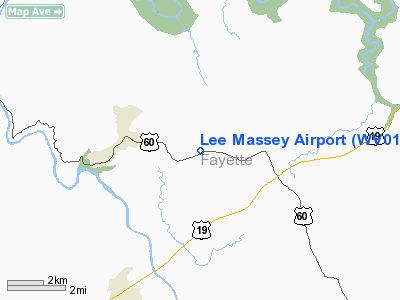
Location & QuickFacts
| FAA Information Effective: | 2008-09-25 |
| Airport Identifier: | WV01 |
| Airport Status: | Operational |
| Longitude/Latitude: | 081-03-13.3650W/38-07-45.3940N
-81.053713/38.129276 (Estimated) |
| Elevation: | 1665 ft / 507.49 m (Surveyed) |
| Land: | 0 acres |
| From nearest city: | 2 nautical miles E of Ansted, WV |
| Location: | Fayette County, WV |
| Magnetic Variation: | 06W (1985) |
Owner & Manager
| Ownership: | Privately owned |
| Owner: | G. Lee Massey |
| Address: | Po Box 7
Victor, WV 25938 |
| Phone number: | 304-658-4948 |
| Manager: | G. Lee Massey |
| Address: | Po Box 7
Victor, WV 25938 |
| Phone number: | 304-658-4948 |
Airport Operations and Facilities
| Airport Use: | Private |
| Wind indicator: | No |
| Segmented Circle: | No |
| Control Tower: | No |
| Landing fee charge: | No |
| Sectional chart: | Cincinnati |
| Region: | AEA - Eastern |
| Boundary ARTCC: | ZID - Indianapolis |
| Tie-in FSS: | EKN - Elkins |
| FSS on Airport: | No |
| FSS Toll Free: | 1-800-WX-BRIEF |
Airport Services
| Airframe Repair: | NONE |
| Power Plant Repair: | NONE |
Runway Information
Runway 07/25
| Dimension: | 1300 x 150 ft / 396.2 x 45.7 m |
| Surface: | TURF-DIRT, |
| |
Runway 07 |
Runway 25 |
| Traffic Pattern: | Left | Left |
|
Runway 16/34
| Dimension: | 1500 x 200 ft / 457.2 x 61.0 m |
| Surface: | TURF, |
| |
Runway 16 |
Runway 34 |
| Traffic Pattern: | Left | Left |
|
Radio Navigation Aids
| ID |
Type |
Name |
Ch |
Freq |
Var |
Dist |
| IJZ | NDB | Nicholas | | 272.00 | 05W | 6.9 nm |
| LW | NDB | Bushi | | 346.00 | 06W | 34.7 nm |
| JTM | NDB | Braxton | | 234.00 | 06W | 38.4 nm |
| GTC | NDB | Guyandot | | 293.00 | 03W | 45.6 nm |
| RNL | VOR | Rainelle | | 116.60 | 04W | 14.9 nm |
| LWB | VOR/DME | Greenbrier | 107Y | 116.05 | 08W | 35.2 nm |
| BKW | VORTAC | Beckley | 124X | 117.70 | 06W | 21.2 nm |
| HVQ | VORTAC | Charleston | 121X | 117.40 | 03W | 36.3 nm |
| BLF | VORTAC | Bluefield | 037X | 110.00 | 03W | 49.9 nm |
| CRW | VOT | Charleston Kanawha | | 108.80 | | 29.4 nm |
Remarks
- IN EXISTENCE PRIOR TO 1959.
Images and information placed above are from
http://www.airport-data.com/airport/WV01/
We thank them for the data!
| General Info
|
| Country |
United States
|
| State |
WEST VIRGINIA
|
| FAA ID |
WV01
|
| Latitude |
38-07-45.394N
|
| Longitude |
081-03-13.365W
|
| Elevation |
1665 feet
|
| Near City |
ANSTED
|
We don't guarantee the information is fresh and accurate. The data may
be wrong or outdated.
For more up-to-date information please refer to other sources.
|
|


