 |
|
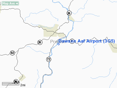
Location & QuickFacts
| FAA Information Effective: | 2008-09-25 |
| Airport Identifier: | 3G5 |
| Airport Status: | Operational |
| Longitude/Latitude: | 079-39-59.1980W/39-27-00.3260N
-79.666444/39.450091 (Estimated) |
| Elevation: | 1265 ft / 385.57 m (Estimated) |
| Land: | 0 acres |
| From nearest city: | 0 nautical miles of Camp Dawson (kingwood), WV |
| Location: | Preston County, WV |
| Magnetic Variation: | 07W (1985) |
Owner & Manager
| Ownership: | Army owned |
| Owner: | Us Army Atca-aso |
| Address: | Cameron Station
Alexandria, VA 22314 |
| Address: |
|
Airport Operations and Facilities
| Airport Use: | Private |
| Segmented Circle: | No |
| Control Tower: | No |
| Lighting Schedule: | RDO-CTL
ACTVT LIRL RY 05/23, NSTD VASI RYS 05 & 23 & REILS RYS 05 & 23 - CTAF. |
| Sectional chart: | Cincinnati |
| Region: | AEA - Eastern |
| Boundary ARTCC: | ZOB - Cleveland |
| Tie-in FSS: | EKN - Elkins |
| FSS on Airport: | No |
| FSS Toll Free: | 1-800-WX-BRIEF |
| NOTAMs Facility: | (NOTAM-d service avaliable) |
Airport Communications
Airport Services
| Fuel available: | 100LL
ALSO J8. |
Runway Information
Runway 05/23
| Dimension: | 4500 x 50 ft / 1371.6 x 15.2 m |
| Surface: | ASPH, |
| Edge Lights: | Low |
| |
Runway 05 |
Runway 23 |
| Traffic Pattern: | Left | Left |
| Displaced threshold: | 650.00 ft | 350.00 ft |
| VASI: | nonstandard system
NON STD VASI LEFT SIDE APCH RWY 05. | nonstandard system
NON STD VASI LEFT SIDE APCH RWY 23. |
| Runway End Identifier: | Yes | Yes |
|
Radio Navigation Aids
| ID |
Type |
Name |
Ch |
Freq |
Var |
Dist |
| VV | NDB | Camor | | 299.00 | 08W | 26.3 nm |
| RQY | NDB | Randolph County | | 284.00 | 07W | 34.6 nm |
| CBE | NDB | Cumberland | | 317.00 | 07W | 44.2 nm |
| PNU | NDB | Washington County | | 255.00 | 08W | 47.6 nm |
| CKB | VOR/DME | Clarksburg | 073X | 112.60 | 04W | 30.4 nm |
| GRV | VOR/DME | Grantsville | 070X | 112.30 | 06W | 30.6 nm |
| ESL | VOR/DME | Kessel | 045X | 110.80 | 06W | 34.2 nm |
| MGW | VORTAC | Morgantown | 053X | 111.60 | 05W | 11.0 nm |
| IHD | VORTAC | Indian Head | 019X | 108.20 | 06W | 34.6 nm |
| EKN | VORTAC | Elkins | 089X | 114.20 | 07W | 38.0 nm |
Remarks
- MOUNTAIN CLOSE ON ALL SIDES OF APT.
- APT CLSD TO ALL FIXED WING ACFT OVER 12,500LBS.
- PLINES 2 NM NE & NW.
- PPR FROM ADJUTANT GENERAL WV NG FOR CIVIL OPS.
- OPEN DAYLIGHT HRS.
Images and information placed above are from
http://www.airport-data.com/airport/3G5/
We thank them for the data!
| General Info
|
| Country |
United States
|
| State |
WEST VIRGINIA
|
| FAA ID |
3G5
|
| Latitude |
39-27-00.326N
|
| Longitude |
079-39-59.198W
|
| Elevation |
1265 feet
|
| Near City |
CAMP DAWSON (KINGWOOD)
|
We don't guarantee the information is fresh and accurate. The data may
be wrong or outdated.
For more up-to-date information please refer to other sources.
|
|


