 |
|
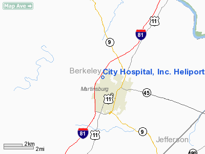
City Hospital, Inc. Heliport |
Location & QuickFacts
| FAA Information Effective: | 2008-09-25 |
| Airport Identifier: | WV48 |
| Airport Status: | Operational |
| Longitude/Latitude: | 077-58-47.9940W/39-28-36.3540N
-77.979998/39.476765 (Estimated) |
| Elevation: | 548 ft / 167.03 m (Estimated) |
| Land: | 33 acres |
| From nearest city: | 0 nautical miles NW of Martinsburg, WV |
| Location: | Berkeley County, WV |
| Magnetic Variation: | 09W (1985) |
Owner & Manager
| Ownership: | Privately owned |
| Owner: | City Hospital Inc |
| Address: | Po Box 1418
Martinsburg, WV 25401 |
| Phone number: | 304-264-1000 |
| Manager: | Administration |
| Address: | Po Box 1418
Martinsburg, WV 25401 |
| Phone number: | 304-264-1000
EXT 1243. |
Airport Operations and Facilities
| Airport Use: | Private
MEDICAL USE. |
| Wind indicator: | Yes |
| Segmented Circle: | No |
| Control Tower: | No |
| Lighting Schedule: | PHONE REQ
FOR PERIMETER & FLOOD LGTS CALL 304-264-1000 EXT 1203 SECURITY. |
| Landing fee charge: | No |
| Sectional chart: | Washington |
| Region: | AEA - Eastern |
| Boundary ARTCC: | ZDC - Washington |
| Tie-in FSS: | EKN - Elkins |
| FSS on Airport: | No |
| FSS Toll Free: | 1-800-WX-BRIEF |
Runway Information
Helipad H1
| Dimension: | 64 x 64 ft / 19.5 x 19.5 m |
| Surface: | ASPH, |
| |
Runway H1 |
Runway |
| Traffic Pattern: | Left | Left |
|
Radio Navigation Aids
| ID |
Type |
Name |
Ch |
Freq |
Var |
Dist |
| TZ | NDB | Cogan | | 364.00 | 10W | 23.8 nm |
| GDX | NDB | Goodwin Lake | | 227.00 | 08W | 32.2 nm |
| CBE | NDB | Cumberland | | 317.00 | 07W | 37.0 nm |
| GAI | NDB | Gaithersburg | | 385.00 | 09W | 42.1 nm |
| HGR | VOR | Hagerstown | | 109.80 | 07W | 14.5 nm |
| FDK | VOR | Frederick | | 109.00 | 08W | 28.3 nm |
| ESL | VOR/DME | Kessel | 045X | 110.80 | 06W | 49.3 nm |
| MRB | VORTAC | Martinsburg | 058X | 112.10 | 07W | 8.2 nm |
| THS | VORTAC | St Thomas | 097X | 115.00 | 07W | 27.5 nm |
| LDN | VORTAC | Linden | 090X | 114.30 | 06W | 38.9 nm |
| AML | VORTAC | Armel | 082X | 113.50 | 08W | 40.4 nm |
| EMI | VORTAC | Westminster | 126X | 117.90 | 08W | 46.5 nm |
Remarks
Images and information placed above are from
http://www.airport-data.com/airport/WV48/
We thank them for the data!
| General Info
|
| Country |
United States
|
| State |
WEST VIRGINIA
|
| FAA ID |
WV48
|
| Latitude |
39-28-36.354N
|
| Longitude |
077-58-47.994W
|
| Elevation |
548 feet
|
| Near City |
MARTINSBURG
|
We don't guarantee the information is fresh and accurate. The data may
be wrong or outdated.
For more up-to-date information please refer to other sources.
|
|


