 |
|
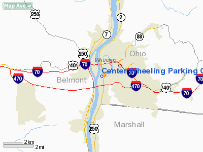
Center Wheeling Parking Garage Heliport |
Location & QuickFacts
| FAA Information Effective: | 2008-09-25 |
| Airport Identifier: | WV49 |
| Airport Status: | Operational |
| Longitude/Latitude: | 080-43-22.2940W/40-03-36.2610N
-80.722859/40.060072 (Estimated) |
| Elevation: | 730 ft / 222.50 m (Estimated) |
| Land: | 0 acres |
| From nearest city: | 0 nautical miles SW of Wheeling, WV |
| Location: | Ohio County, WV |
| Magnetic Variation: | 07W (1985) |
Owner & Manager
| Ownership: | Privately owned |
| Owner: | Ohio Valley Medical Cntr Inc |
| Address: | 2000 Eoff Street
Wheeling, WV 26003 |
| Phone number: | 304-234-0123 |
| Manager: | Ned Greeneltch |
| Address: | 2000 Eoff Street
Wheeling, WV 26003 |
| Phone number: | 304-234-0123 |
Airport Operations and Facilities
| Airport Use: | Private
MEDICAL USE. |
| Wind indicator: | Yes |
| Segmented Circle: | No |
| Control Tower: | No |
| Lighting Schedule: | PHONE REQ
FOR FLOOD LGTS CALL 304-234-0123. |
| Beacon Color: | Clear-Green-Yellow (heliport) |
| Landing fee charge: | No |
| Sectional chart: | Cincinnati |
| Region: | AEA - Eastern |
| Boundary ARTCC: | ZOB - Cleveland |
| Tie-in FSS: | EKN - Elkins |
| FSS on Airport: | No |
| FSS Toll Free: | 1-800-WX-BRIEF |
Runway Information
Helipad H1
| Dimension: | 60 x 60 ft / 18.3 x 18.3 m |
| Surface: | CONC, |
| |
Runway H1 |
Runway |
| Traffic Pattern: | Left | Left |
|
Radio Navigation Aids
| ID |
Type |
Name |
Ch |
Freq |
Var |
Dist |
| CFX | NDB | Cadiz | | 239.00 | 07W | 17.0 nm |
| PNU | NDB | Washington County | | 255.00 | 08W | 26.3 nm |
| TSO | NDB | Tolson | | 395.00 | 07W | 34.3 nm |
| VV | NDB | Camor | | 299.00 | 08W | 46.3 nm |
| MKP | NDB | Mc Keesport | | 287.00 | 07W | 46.7 nm |
| AIR | VOR/DME | Bellaire | 118X | 117.10 | 07W | 5.1 nm |
| HLG | VOR/DME | Wheeling | 059X | 112.20 | 07W | 13.9 nm |
| AGC | VOR/DME | Allegheny | 037X | 110.00 | 09W | 34.0 nm |
| CTW | VOR/DME | Newcomerstown | 055X | 111.80 | 07W | 36.1 nm |
| MMJ | VORTAC | Montour | 057X | 112.00 | 08W | 35.4 nm |
| JPU | VORTAC | Parkersburg | 023X | 108.60 | 03W | 47.9 nm |
Remarks
- PRVDD LAMP POLES ON E & W SIDE OF HELIPORT ARE REMOVED; INGRESS/EGRESS RTE CHGD TO 350 DEGREES; ADVISE THOSE WHO UTILIZE HELIPORT TO OPERATE TO MINIMIZE NOISE & WHEN GROUND LEVEL HELIPAD IS CLSD THIS OFFICE IS NOTIFIED.
Images and information placed above are from
http://www.airport-data.com/airport/WV49/
We thank them for the data!
| General Info
|
| Country |
United States
|
| State |
WEST VIRGINIA
|
| FAA ID |
WV49
|
| Latitude |
40-03-36.261N
|
| Longitude |
080-43-22.294W
|
| Elevation |
730 feet
|
| Near City |
WHEELING
|
We don't guarantee the information is fresh and accurate. The data may
be wrong or outdated.
For more up-to-date information please refer to other sources.
|
|


