 |
|
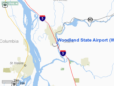
Location & QuickFacts
| FAA Information Effective: | 2008-09-25 |
| Airport Identifier: | W27 |
| Airport Status: | Operational |
| Longitude/Latitude: | 122-44-14.1880W/45-53-55.7460N
-122.737274/45.898818 (Estimated) |
| Elevation: | 29 ft / 8.84 m (Estimated) |
| Land: | 0 acres |
| From nearest city: | 1 nautical miles SE of Woodland, WA |
| Location: | Cowlitz County, WA |
| Magnetic Variation: | 20E (1985) |
Owner & Manager
| Ownership: | Publicly owned |
| Owner: | Wash State Aviation Div |
| Address: | 3704 172nd Street Ne, Suite K2, P.o. Box 3367
Arlington, WA 98108-6336 |
| Phone number: | 360-651-6300 |
| Manager: | Wash State Aviation Div |
| Address: | 3704 172nd Street Ne, Suite K2, P.o. Box 3367
Arlington, WA 98108-6336 |
| Phone number: | 800-552-0666 |
Airport Operations and Facilities
| Airport Use: | Open to public |
| Wind indicator: | Yes |
| Segmented Circle: | No |
| Control Tower: | No |
| Lighting Schedule: | DUSK-DAWN |
| Landing fee charge: | No |
| Sectional chart: | Seattle |
| Region: | ANM - Northwest Mountain |
| Boundary ARTCC: | ZSE - Seattle |
| Tie-in FSS: | SEA - Seattle |
| FSS on Airport: | No |
| FSS Toll Free: | 1-800-WX-BRIEF |
| NOTAMs Facility: | SEA (NOTAM-d service avaliable) |
Airport Communications
Airport Services
| Airframe Repair: | NONE |
| Power Plant Repair: | NONE |
| Bottled Oxygen: | NONE |
| Bulk Oxygen: | NONE |
Runway Information
Runway 14/32
| Dimension: | 1953 x 25 ft / 595.3 x 7.6 m |
| Surface: | ASPH, Good Condition |
| Edge Lights: | Low |
| |
Runway 14 |
Runway 32 |
| Longitude: | 122-44-19.7610W | 122-44-08.6150W |
| Latitude: | 45-54-04.5670N | 45-53-46.9240N |
| Alignment: | 127 | 127 |
| Traffic Pattern: | Right | Left |
| Markings: | Basic, Good Condition | Basic, Good Condition |
| Displaced threshold: | 290.00 ft | 0.00 ft |
| Obstruction: | 40 ft pole, 245.0 ft from runway, 114 ft right of centerline, 1:1 slope to clear
20:1 SLOPE TO DSPLCD THR.
15' HGRS 200' FM CTRLN 69' RT AND 79' LT. | 4 ft brush, 200.0 ft from runway, 18 ft right of centerline
+4' BRUSH BOTH SIDES OF RWY IN PRIMARY SFC. |
|
Radio Navigation Aids
| ID |
Type |
Name |
Ch |
Freq |
Var |
Dist |
| LSO | NDB | Kelso | | 256.00 | 21E | 17.1 nm |
| PND | NDB | Banks | | 356.00 | 21E | 20.7 nm |
| LBH | NDB | Laker | | 332.00 | 20E | 24.4 nm |
| TDO | NDB | Toledo | | 219.00 | 20E | 34.9 nm |
| PEN | NDB | Karpen | | 201.00 | 20E | 38.3 nm |
| CBU | TACAN | Columbia | 029X | | 20E | 19.4 nm |
| PDX | VOR/DME | Portland | 055X | 111.80 | 20E | 19.1 nm |
| UBG | VOR/DME | Newberg | 121X | 117.40 | 21E | 34.3 nm |
| BTG | VORTAC | Battle Ground | 113X | 116.60 | 21E | 10.9 nm |
| PDX | VOT | Portland Intl | | 111.00 | | 19.0 nm |
| HIO | VOT | Portland-hillsboro | | 115.20 | | 23.3 nm |
Remarks
- PLINE & BLDGS IN APCH TO RY 14.
- 12 FT DIKE NW END.
- WATCH FOR PEDESTRIANS; VEHICLES & ANIMALS ON RWY.
- CTC WA STATE DIV OF AERONAUTICS 360-651-6300 OR 800-552-0666 WA AREA FOR FAC INFO PRIOR TO USE.
- 2 +6 NAVIGATIONAL BUOYS MARKING SOUTH SIDE OF COMMERCIAL WATERLANE, LGTD WITH BLINKING DIM RED LGTS. BLINK AT APPROXIMATELY 2 SECOND INTERVALS, EXTREMELY DIFFICULT TO SEE.
- EXTREME TURBULENCE POSSIBLE WHEN WINDS FROM THE EAST.
- GRVL TWY MKD WITH BLUE REFLECTORS.
Images and information placed above are from
http://www.airport-data.com/airport/W27/
We thank them for the data!
| General Info
|
| Country |
United States
|
| State |
WASHINGTON
|
| FAA ID |
W27
|
| Latitude |
45-53-54.412N
|
| Longitude |
122-44-14.367W
|
| Elevation |
24 feet
|
| Near City |
WOODLAND
|
We don't guarantee the information is fresh and accurate. The data may
be wrong or outdated.
For more up-to-date information please refer to other sources.
|
|


