 |
|
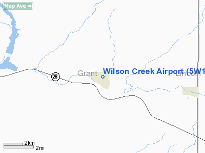
Location & QuickFacts
| FAA Information Effective: | 2008-09-25 |
| Airport Identifier: | 5W1 |
| Airport Status: | Operational |
| Longitude/Latitude: | 119-06-54.0580W/47-25-29.5220N
-119.115016/47.424867 (Estimated) |
| Elevation: | 1440 ft / 438.91 m (Estimated) |
| Land: | 25 acres |
| From nearest city: | 1 nautical miles E of Wilson Creek, WA |
| Location: | Grant County, WA |
| Magnetic Variation: | 20E (1985) |
Owner & Manager
| Ownership: | Publicly owned |
| Owner: | Town Of Wilson Creek
LEASED TO GRANT CO PORT DIST NR 6. |
| Address: | Town Hall
Wilson Creek, WA 98860 |
| Phone number: | 509-345-2531
TOWN HALL HOURS: 12:30 PM TO 3:30 PM, THE 1ST TO THE 10TH OF EVERY MONTH. |
| Manager: | Gary Ribail |
| Address: | Town Of Wilson Creek
Wilson Creek, WA 98860 |
| Phone number: | 509-770-7130 |
Airport Operations and Facilities
| Airport Use: | Open to public |
| Wind indicator: | Yes |
| Segmented Circle: | No |
| Control Tower: | No |
| Landing fee charge: | No |
| Sectional chart: | Seattle |
| Region: | ANM - Northwest Mountain |
| Boundary ARTCC: | ZSE - Seattle |
| Tie-in FSS: | SEA - Seattle |
| FSS on Airport: | No |
| FSS Toll Free: | 1-800-WX-BRIEF |
| NOTAMs Facility: | SEA (NOTAM-d service avaliable) |
Airport Communications
Airport Services
| Airframe Repair: | NONE |
| Power Plant Repair: | NONE |
| Bottled Oxygen: | NONE |
| Bulk Oxygen: | NONE |
Runway Information
Runway 10/28
| Dimension: | 3074 x 50 ft / 937.0 x 15.2 m |
| Surface: | ASPH, Fair Condition |
| |
Runway 10 |
Runway 28 |
| Traffic Pattern: | Left | Left |
| Markings: | Basic, Good Condition | Basic, Good Condition |
|
Radio Navigation Aids
| ID |
Type |
Name |
Ch |
Freq |
Var |
Dist |
| EAT | FAN MARKER | Malaga | | | 21E | 41.8 nm |
| MW | NDB | Pelly | | 408.00 | 18E | 19.7 nm |
| MWH | VOR/DME | Moses Lake | 097X | 115.00 | 18E | 15.3 nm |
| EAT | VOR/DME | Wenatchee | 047X | 111.00 | 19E | 44.6 nm |
| EPH | VORTAC | Ephrata | 073X | 112.60 | 21E | 12.9 nm |
Remarks
- ESTABD PRIOR TO 15 MAY 1959.
Images and information placed above are from
http://www.airport-data.com/airport/5W1/
We thank them for the data!
| General Info
|
| Country |
United States
|
| State |
WASHINGTON
|
| FAA ID |
5W1
|
| Latitude |
47-25-29.522N
|
| Longitude |
119-06-54.058W
|
| Elevation |
1440 feet
|
| Near City |
WILSON CREEK
|
We don't guarantee the information is fresh and accurate. The data may
be wrong or outdated.
For more up-to-date information please refer to other sources.
|
|


