 |
|
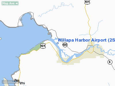
Location & QuickFacts
| FAA Information Effective: | 2008-09-25 |
| Airport Identifier: | 2S9 |
| Airport Status: | Operational |
| Longitude/Latitude: | 123-49-24.1790W/46-41-51.4340N
-123.823383/46.697621 (Estimated) |
| Elevation: | 13 ft / 3.96 m (Estimated) |
| Land: | 147 acres |
| From nearest city: | 2 nautical miles NW of South Bend/raymond/, WA |
| Location: | Pacific County, WA |
| Magnetic Variation: | 20E (1985) |
Owner & Manager
| Ownership: | Publicly owned |
| Owner: | Port Of Willapa Harbor |
| Address: | 1725 Ocean Avenue
Raymond, WA 98577 |
| Phone number: | 360-942-3422 |
| Manager: | Rebecca Chaffee |
| Address: | Port Of Willapa Harbor, 1725 Ocean Avenue
Raymond, WA 98577 |
| Phone number: | 360-942-3422 |
Airport Operations and Facilities
| Airport Use: | Open to public |
| Wind indicator: | Yes |
| Segmented Circle: | No |
| Control Tower: | No |
| Lighting Schedule: | RDO-CTL
ACTVT MIRL RY 11/29 & ROTG BCN - 122.8. |
| Beacon Color: | Clear-Green (lighted land airport) |
| Landing fee charge: | No |
| Sectional chart: | Seattle |
| Region: | ANM - Northwest Mountain |
| Boundary ARTCC: | ZSE - Seattle |
| Tie-in FSS: | SEA - Seattle |
| FSS on Airport: | No |
| FSS Toll Free: | 1-800-WX-BRIEF |
| NOTAMs Facility: | SEA (NOTAM-d service avaliable) |
| Federal Agreements: | 13 |
Airport Communications
Airport Services
| Fuel available: | 100LL
CREDIT CARD FUEL AVBL 24 HRS. |
| Airframe Repair: | NONE |
| Power Plant Repair: | NONE |
| Bottled Oxygen: | NONE |
| Bulk Oxygen: | NONE |
Runway Information
Runway 11/29
| Dimension: | 3005 x 52 ft / 915.9 x 15.8 m
RY IS 52 FT WIDE WITH 22.5 FT ASPH TRTD SHOULDERS. |
| Surface: | ASPH, Good Condition |
| Weight Limit: | Single wheel: 12000 lbs. |
| Edge Lights: | Medium |
| |
Runway 11 |
Runway 29 |
| Longitude: | 123-49-39.4080W | 123-49-08.9520W |
| Latitude: | 46-42-01.9300N | 46-41-40.9380N |
| Traffic Pattern: | Left | Left |
| Markings: | Non-precision instrument, Good Condition | Non-precision instrument, Good Condition |
| Obstruction: | 64 ft trees, 744.0 ft from runway, 8:1 slope to clear | 99 ft trees, 534.0 ft from runway, 100 ft right of centerline, 3:1 slope to clear
+8' TREES FM 0-200' FROM THR;60L |
|
Radio Navigation Aids
| ID |
Type |
Name |
Ch |
Freq |
Var |
Dist |
| AST | FAN MARKER | Fort Stevens | | | 22E | 30.0 nm |
| PEN | NDB | Karpen | | 201.00 | 20E | 34.9 nm |
| TDO | NDB | Toledo | | 219.00 | 20E | 43.7 nm |
| MNC | NDB | Mason County | | 348.00 | 19E | 44.8 nm |
| LSO | NDB | Kelso | | 256.00 | 21E | 49.9 nm |
| AST | VOR/DME | Astoria | 087X | 114.00 | 19E | 32.3 nm |
| HQM | VORTAC | Hoquiam | 124X | 117.70 | 19E | 20.1 nm |
| OLM | VORTAC | Olympia | 081X | 113.40 | 19E | 41.3 nm |
Remarks
- WATCH FOR ELK ON AND INVOF ARPT.
- ESTABD PRIOR TO 5/15/59.
Images and information placed above are from
http://www.airport-data.com/airport/2S9/
We thank them for the data!
| General Info
|
| Country |
United States
|
| State |
WASHINGTON
|
| FAA ID |
2S9
|
| Latitude |
46-41-44.355N
|
| Longitude |
123-49-19.586W
|
| Elevation |
16 feet
|
| Near City |
SOUTH BEND/RAYMOND/
|
We don't guarantee the information is fresh and accurate. The data may
be wrong or outdated.
For more up-to-date information please refer to other sources.
|
|


