 |
|
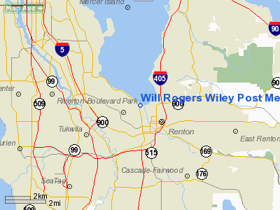
Will Rogers Wiley Post Memorial Seaplane Base Airport |
Location & QuickFacts
| FAA Information Effective: | 2008-09-25 |
| Airport Identifier: | W36 |
| Airport Status: | Operational |
| Longitude/Latitude: | 122-13-09.4400W/47-29-59.3580N
-122.219289/47.499822 (Estimated) |
| Elevation: | 14 ft / 4.27 m (Estimated) |
| Land: | 0 acres |
| From nearest city: | 1 nautical miles N of Renton, WA |
| Location: | King County, WA |
| Magnetic Variation: | 20E (1985) |
Owner & Manager
| Ownership: | Publicly owned |
| Owner: | City Of Renton |
| Address: | 1055 South Grady Way
Renton, WA 98057 |
| Phone number: | 425-430-6400 |
| Manager: | Ryan Zulauf |
| Address: | 616 West Perimeter Road, Unit A
Renton, WA 98057
ARPT MGRS OFFICE IN AIR TRAFFIC CONTROL TOWER ON RENTON MUNICIPAL ARPT. |
| Phone number: | 425-430-7471 |
Airport Operations and Facilities
| Airport Use: | Open to public |
| Wind indicator: | No |
| Segmented Circle: | No |
| Control Tower: | No |
| Landing fee charge: | No |
| Sectional chart: | Seattle |
| Region: | ANM - Northwest Mountain |
| Boundary ARTCC: | ZSE - Seattle |
| Tie-in FSS: | SEA - Seattle |
| FSS on Airport: | No |
| FSS Toll Free: | 1-800-WX-BRIEF |
| NOTAMs Facility: | RNT (NOTAM-d service avaliable) |
Airport Communications
| CTAF: | 124.700 |
| Unicom: | 122.800 |
Airport Services
| Fuel available: | 100LLA A1+ |
| Airframe Repair: | MAJOR |
| Power Plant Repair: | MAJOR |
| Bottled Oxygen: | NONE |
| Bulk Oxygen: | HIGH/LOW |
Runway Information
Runway 12/30
| Dimension: | 5000 x 200 ft / 1524.0 x 61.0 m |
| Surface: | WATER, |
| |
Runway 12 |
Runway 30 |
| Elevation: | 14.00 ft | 14.00 ft |
| Traffic Pattern: | Right | Left |
|
Radio Navigation Aids
| ID |
Type |
Name |
Ch |
Freq |
Var |
Dist |
| RNT | NDB | Renton | | 353.00 | 20E | 0.3 nm |
| ODD | NDB | Dondo | | 224.00 | 19E | 8.9 nm |
| PWT | NDB | Kitsap | | 206.00 | 20E | 21.8 nm |
| CAN | NDB | Carney | | 274.00 | 20E | 25.7 nm |
| GR | NDB | Graye | | 216.00 | 18E | 26.2 nm |
| LAC | NDB | Lacomas | | 328.00 | 18E | 32.6 nm |
| MNC | NDB | Mason County | | 348.00 | 19E | 38.4 nm |
| PAE | VOR/DME | Paine | 043X | 110.60 | 20E | 25.4 nm |
| CVV | VOR/DME | Penn Cove | 119X | 117.20 | 19E | 49.2 nm |
| SEA | VORTAC | Seattle | 115X | 116.80 | 19E | 5.3 nm |
| TCM | VORTAC | Mcchord | 033X | 109.60 | 22E | 23.6 nm |
| OLM | VORTAC | Olympia | 081X | 113.40 | 19E | 42.2 nm |
| BFI | VOT | Boeing Field | | 108.60 | | 3.8 nm |
| SEA | VOT | Seattle-tacoma | | 117.50 | | 4.8 nm |
Remarks
- CTC RENTON TWR WHEN OPERATING; FOR TFC DATA. WHEN TWR NOT OPERATING ANNOUNCE INTENTIONS ON 124.7.
- EXTENSIVE BOATING & PERSONAL WATERCRAFT IN VICINITY.
- FLOCKS OF WATERFOWL INVOF ARPT ON LAKE WASHINGTON - BE ALERT LNDGS/TKOFS.
- WHEN FLYING INBOUND OR OUTBOUND IN THE WEST CHANNEL WATERWAY ABOVE 800 FT AGL CTC BOEING ATCT FREQ 118.3 FOR TRAFFIC ADVISORIES.
- FLIGHT NOTIFICATION SERVICE (ADCUS) AVBL.
Images and information placed above are from
http://www.airport-data.com/airport/W36/
We thank them for the data!
| General Info
|
| Country |
United States
|
| State |
WASHINGTON
|
| FAA ID |
W36
|
| Latitude |
47-29-59.358N
|
| Longitude |
122-13-09.440W
|
| Elevation |
14 feet
|
| Near City |
RENTON
|
We don't guarantee the information is fresh and accurate. The data may
be wrong or outdated.
For more up-to-date information please refer to other sources.
|
|


