|
 |
|
||||
|
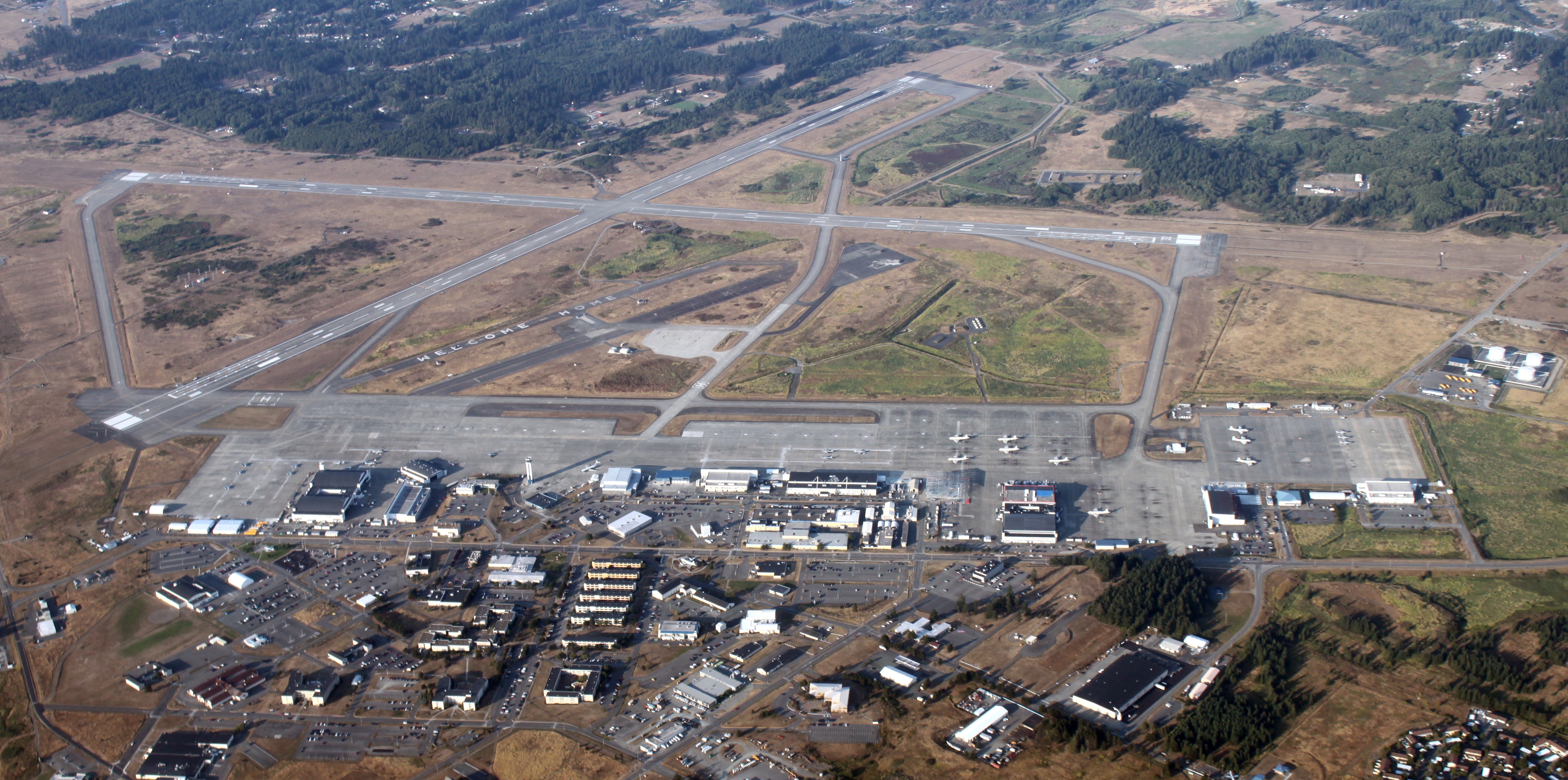
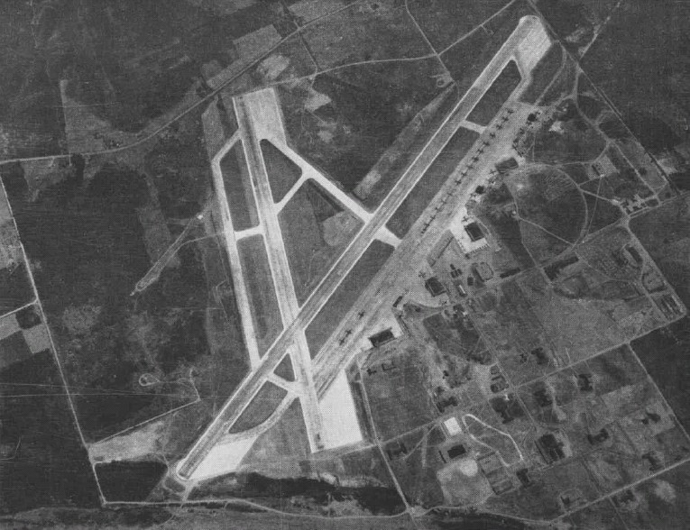
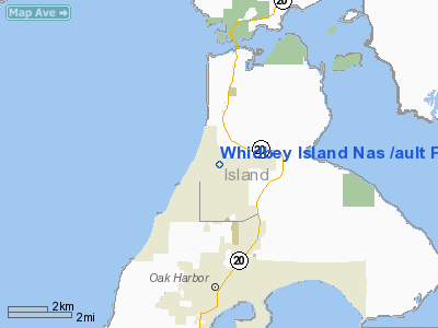
FAA diagram of the runway area Naval Air Station Whidbey Island (NASWI) (IATA: NUW, ICAO: KNUW, FAA LID: NUW) is a naval air station located in two sections around Oak Harbor, Washington, USA. It was commissioned as an active U.S. Navy installation on 21 September 1942. The main portion of the base is called Ault Field in memory of Commander William B. Ault, who was listed 'missing in action' during the Battle of the Coral Sea. Ault Field is located approximately three miles north of Oak Harbor. The other section of the air station is known as the Seaplane Base. Originally home to PBY Catalina flying boats, the air station's main Navy Exchange and DeCA Commissary are located here, as is most of the Navy housing on the island. A lightly utilized satellite airfield, Naval Outlying Landing Field (NOLF) Coupeville, is located on central Whidbey Island at 48°11′24″N 122°37′48″W / 48.19°N 122.63°W, roughly nine miles south of Ault Field. Primarily utilized for Field Carrier Landing Practice (FCLP) by carrier-based jet aircraft, this field has no permanently assigned personnel and falls under the command of the Commanding Officer of NASWI. NASWI currently supports MH-60S Seahawk helicopter, EA-18G Growler, EA-6B Prowler, P-3C Orion, EP-3E ARIES II and C-9 Skytrain aircraft. HistoryOn 17 Jan 1941, almost 11 months before the U.S. entered World War II, the Office of the Chief of Naval Operations asked the Commandant of the 13th Naval District to find a location for the re-arming and refueling of Navy patrol planes operating in defense of Puget Sound, should such defense be necessary. Lake Ozette, Indian Island, Keystone Harbor, Penn Cove and Oak Harbor were considered and later rejected because of mountainous terrain, bluff shore front, inaccessibility, absence of sufficient beaches and lee shores. But within 10 days, the commanding officer of Naval Air Station Seattle recommended the site of Saratoga Passage on the shores of Crescent Harbor and Forbes Point as a base suitable for seaplane takeoffs and landings under instrument conditions. A narrow strip of land tied Oak Harbor to what is now Maylor’s Point Capehart Housing. Dredging, filling, and running water and power lines to the city was under way when at the end of November came the word to find a land plane site. On 8 Dec, three workers started a topographic survey of what would become Ault Field, about four miles to the north. Actual construction of Ault Field started on 1 March 1942. The first plane landed there on 5 Aug, when LT Newton Wakefield, a former civil engineer and airline pilot, who later became the air station's Operations Officer, brought his SNJ single-engine trainer in with little fanfare. Everyone was busy working on the still-incomplete runway.
On 21 Sep 1942, the air station's first Commanding Officer, CAPT Cyril Thomas Simard, read the orders and the watch was set. U.S. Naval Air Station Whidbey Island was duly commissioned. A year later, on 25 Sep 1943, the land plane field was named Ault Field, in memory of CDR William B. Ault, missing in action in the Battle of the Coral Sea. Following the recommendation of the Interdepartmental Air Traffic Control Board, an area 2½ miles southeast of Coupeville was approved as an auxiliary field to serve NAS Seattle. Survey work began in February 1943, and work started in March. Outlying Field (OLF) Coupeville was in use by September. At Ault Field, the earliest squadrons of aircraft were F4F Wildcats, which came aboard in 1942, followed by F6F Hellcats. Later that year, PV-1 Venturas arrived for training. By the end of 1943, all F4Fs were gone, replaced by the F6F Hellcat. In 1944, SBD Dauntless dive-bombers became the predominant aircraft at Ault Field, while at the Seaplane Base, several PBY Catalina and PBM Mariner seaplanes were aboard in the summer of 1944, augmented by a few land-based B-26s that arrived earlier that year to be used in towing targets. After World War II ended, operations slowed at war’s end and it was almost certain that NAS Whidbey Island would be earmarked for decommissioning. Many naval air stations across the United States were closing because they couldn’t meet the requirements of the post-war Naval Aviation; 6,000-foot runways were now the minimum standard and approach paths had to be suitable for radar-controlled approaches in any weather. Taken out of reduced operating status, NAS Whidbey had a new lease on life and expansion and construction accelerated with the Korean conflict. P2V Neptune patrol bombers, which arrived in the late 1940s, would eventually make up six patrol squadrons at NAS Whidbey. Patrol Squadron FIFTY (VP-50) moved from NAS Alameda, California in June 1956, returning seaplanes to NAS Whidbey. Flying the P5M-2 Marlin, patrol squadrons dominated the Seaplane Base until the late 1960s along with the seaplane-tender, USS Salisbury Sound. During the Korean War, patrol plane activity was stepped up again with several Naval Air Reserve units being called up and redesignated as active duty squadrons. By the end of the war, there were six VP (Patrol) squadrons and two Fleet Air Support squadrons based at Whibdey. In 1955, VP-29 returned from deployment to the Pacific and was redesignated as Heavy Attack Squadron TWO (VAH-2), the first heavy attack squadron on the West Coast, the "heavy" designation reflecting its concentration on nuclear weapons delivery. Later that year, it moved to NAS North Island in San Diego in order to transition to the A3D Skywarrior.
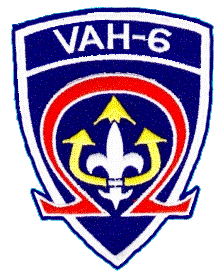
In 1958, the VAH-6 ("Heavy-6") Fleurs, moved from NAS Moffett Field, California, where they had been the Navy's second nuclear attack squadron. As part of CVG-61/CVW-6, the squadron then made several WestPac deployments aboard the USS Ranger (CVA-61) prior to transferring to CVW-8 for operations in the Mediterranean aboard the USS Forrestal (CVA-59). Transferred to NAS Sanford, Florida, VAH-6 was redesignated RVAH-6 in September, 1965, commencing the squadron's transition to the A-5 Vigilante. In early 1965, patrol squadrons began to leave NAS Whidbey; VP-47 transferred to NAS Moffett Field, California and VP-17 to NAS Barbers Point, Hawaii. In July 1969, the patrol community appeared to be reviving with the delivery of the P-3 Orion as a replacement for the venerable P-2 Neptune, but in September 1969, VP-2 and VP-42 were deactivated. On 1 March 1970, VP-1 transferred to NAS Barbers Point, ending seaplane patrol operations by active forces at NAS Whidbey Island. This also brought Fleet Air Wing Four to an end on 1 April 1970, leaving Patrol Squadron SIXTY-NINE (VP-69), a Naval Air Reserve squadron, as the sole remaining maritime patrol squadron at NAS Whidbey. Then in the 1970s and beyond, 16 A-6 squadrons were based at NAS Whidbey Island. Whidbey was now the West Coast training and operations center for these all-weather, medium-attack bomber squadrons. In October 1970, Heavy Attack Squadron 10 (VAH-10) was redesignated Tactical Electronic Warfare Squadron 129 (VAQ-129), the Navy’s first EA-6B squadron and the sole fleet replacement squadron for Navy and Marine Prowler crews. With the exception of a forward deployed EA-6B squadron at NAF Atsugi, Japan and a sole Naval Air Reserve EA-6B squadron (VAQ-209) at Andrews AFB / NAF Washington, Maryland, NAS Whidbey Island supports all of the U.S. Navy’s Prowler squadrons. (In June 2008, VAQ-129 accepted its first EA-18G Growler aircraft. Based on the F/A-18F Super Hornet, the Growler will eventually replace all EA-6B Prowlers in the U.S. Navy's inventory.) In late 1993, with the pending closures of NAS Moffett Field, California and NAS Barbers Point, Hawaii additional P-3C Orion maritime patrol aircraft came aboard NAS Whidbey Island, along with the associated staffs of Commander, Patrol Wings, U.S. Pacific Fleet (COMPATWINGSPAC) and Commander, Patrol Wing TEN (COMPATWING 10). With the closure of NAS Agana, Guam, Fleet Air Reconnaissance Squadron ONE (VQ-1) also arrived at NAS Whidbey Island in 1994 with its EP-3E Aries II aircraft. VQ-1 was placed under the claimancy of COMPATWING 10 and the wing was subsequently redesignated Commander, Patrol and Reconnaissance Wing TEN (COMPATRECONWING 10). With the disestablishment of Reserve Patrol Wing, VP-69 was also placed under COMPATRECONWING 10 claimancy. In 1997 The last Pacific Based A-6E Intruder Squadron VA-196 Decommissioned following a lengthy deployment for WESTPAC 1996. AMSCMC Command Master Chief Sean Miner blew the Final Bosn's whistle and all plank owners from this squadron were reassigned to their new duty station. One member of this squadron, Floyd "Shaky D" Dankert would know fame in a Seattle Based Rock Band "Floyd and the little drummer boys." Present day
In all, there are 19 active duty squadrons and 2 Ready Reserve squadrons currently based at NAS Whidbey Island. The air station also maintains a Search and Rescue Unit, flying two Sikorsky MH-60S Nighthawks. With the addition of the MH-60S, Navy Search and Rescue provides 24 day and night maritime, inland and mountainous rescue support for Department of Defense personnel and the greater Pacific Northwest community. The SAR Unit (360) 257-2681 provides 15 minute alert coverage Monday through Thursday from 0800-0200 or last plane on deck, Friday 0800-2200 or last plane on deck and 30 minute alert coverage at all others times of the year. Additionally, SAR has organic SAR Medical Technicians on all missions it performs. NASWI SAR primarily serves military aircrews, but missions aiding civilians in distress are often approved and executed. Over 50 tenant commands are also located at NAS Whidbey Island, providing training, medical and dental, and other support services, including a Marine Aviation Training Support Group (MATSG) for Whidbey’s staff and student Marine Corps personnel. The base also continues its long-standing role as a center of activity for Naval Air Reserve operations and training in the region. Tenant SquadronsAircraft MaintainedStaffingThe above content comes from Wikipedia and is published under free licenses – click here to read more.
Location & QuickFacts
Owner & Manager
Airport Operations and Facilities
Airport Services
Runway InformationRunway 07/25
Runway 14/32
Radio Navigation Aids
Remarks
Images and information placed above are from We thank them for the data!
We don't guarantee the information is fresh and accurate. The data may
be wrong or outdated.
|
||||||||||||||||||||||||||||||||||||||||||||||||||||||||||||||||||||||||||||||||||||||||||||||||||||||||||||||||||||||||||||||||||||||||||||||||||||||||||||||||||||||||||||||||||||||||||||||||||||||||||||||||||||||||||||||||||||||||||||||||||||||||||||||||||||||||||||||||||||||||||||||||||||||||||||||||||||||||||||||||||||||||||||||||||||||||||||||||||||||||||||||||||||||||||||||||||||||||

 |
|
Copyright 2004-2024 © by Airports-Worldwide.com, Vyshenskoho st. 36, Lviv 79010, Ukraine Legal Disclaimer |