 |
|
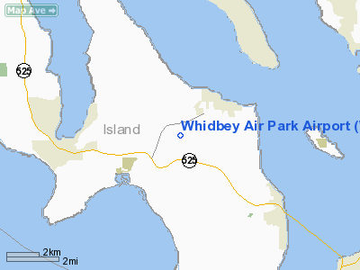
Location & QuickFacts
| FAA Information Effective: | 2008-09-25 |
| Airport Identifier: | W10 |
| Airport Status: | Operational |
| Longitude/Latitude: | 122-26-15.8190W/48-01-03.0441N
-122.437728/48.017512 (Estimated) |
| Elevation: | 271 ft / 82.60 m (Estimated) |
| Land: | 43 acres |
| From nearest city: | 2 nautical miles SW of Langley, WA |
| Location: | Island County, WA |
| Magnetic Variation: | 21E (1985) |
Owner & Manager
| Ownership: | Privately owned |
| Owner: | Whidbey Air Park Llc |
| Address: | Po Box 1075
Langley, WA 98260 |
| Phone number: | 360-321-1537 |
| Manager: | Roy Deaver |
| Address: | Po Box 1075
Langley, WA 98260 |
| Phone number: | 206-322-2003 |
Airport Operations and Facilities
| Airport Use: | Open to public |
| Wind indicator: | Yes |
| Segmented Circle: | No |
| Control Tower: | No |
| Landing fee charge: | No |
| Sectional chart: | Seattle |
| Region: | ANM - Northwest Mountain |
| Boundary ARTCC: | ZSE - Seattle |
| Tie-in FSS: | SEA - Seattle |
| FSS on Airport: | No |
| FSS Toll Free: | 1-800-WX-BRIEF |
| NOTAMs Facility: | SEA (NOTAM-d service avaliable) |
| Federal Agreements: | N |
Airport Communications
Airport Services
| Bottled Oxygen: | NONE |
| Bulk Oxygen: | NONE |
Runway Information
Runway 16/34
| Dimension: | 2470 x 25 ft / 752.9 x 7.6 m |
| Surface: | ASPH, Good Condition |
| |
Runway 16 |
Runway 34 |
| Longitude: | 122-26-17.6450W | 122-26-13.9940W |
| Latitude: | 48-01-15.5670N | 48-00-51.3150N |
| Traffic Pattern: | Left | Left |
| Obstruction: | 9 ft hill, 200.0 ft from runway
+3' FENCE AT 68', ROAD AT 70', +4' BLUFF AT 180'. | 35 ft tree, 200.0 ft from runway, 51 ft right of centerline
+6'-20' BRUSH 0'-200' FM THR, 71' R & 110' L. |
|
Radio Navigation Aids
| ID |
Type |
Name |
Ch |
Freq |
Var |
Dist |
| BVS | NDB | Skagit/bay View | | 240.00 | 21E | 27.1 nm |
| RNT | NDB | Renton | | 353.00 | 20E | 32.6 nm |
| OPZ | NDB | Lopez Island | | 356.00 | 21E | 33.8 nm |
| PWT | NDB | Kitsap | | 206.00 | 20E | 34.1 nm |
| FHR | NDB | Friday Harbor | | 284.00 | 20E | 38.7 nm |
| ODD | NDB | Dondo | | 224.00 | 19E | 39.6 nm |
| CAN | NDB | Carney | | 274.00 | 20E | 39.9 nm |
| NUW | TACAN | Whidbey Island | 085X | | 21E | 22.2 nm |
| PAE | VOR/DME | Paine | 043X | 110.60 | 20E | 8.7 nm |
| CVV | VOR/DME | Penn Cove | 119X | 117.20 | 19E | 17.9 nm |
| SEA | VORTAC | Seattle | 115X | 116.80 | 19E | 35.4 nm |
| BFI | VOT | Boeing Field | | 108.60 | | 29.9 nm |
| SEA | VOT | Seattle-tacoma | | 117.50 | | 34.9 nm |
Images and information placed above are from
http://www.airport-data.com/airport/W10/
We thank them for the data!
| General Info
|
| Country |
United States
|
| State |
WASHINGTON
|
| FAA ID |
W10
|
| Latitude |
48-01-05.337N
|
| Longitude |
122-26-18.524W
|
| Elevation |
260 feet
|
| Near City |
LANGLEY
|
We don't guarantee the information is fresh and accurate. The data may
be wrong or outdated.
For more up-to-date information please refer to other sources.
|
|


