 |
|
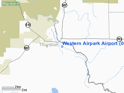
Location & QuickFacts
| FAA Information Effective: | 2008-09-25 |
| Airport Identifier: | 06WN |
| Airport Status: | Operational |
| Longitude/Latitude: | 122-33-10.9400W/46-55-29.9450N
-122.553039/46.924985 (Estimated) |
| Elevation: | 394 ft / 120.09 m (Estimated) |
| Land: | 50 acres |
| From nearest city: | 3 nautical miles SE of Yelm, WA |
| Location: | Thurston County, WA |
| Magnetic Variation: | 20E (1985) |
Owner & Manager
| Ownership: | Privately owned |
| Owner: | Western Airpark Association |
| Address: | 11247 Airpark Lane
Mckenna, WA 98558 |
| Phone number: | 360-458-3349 |
| Manager: | Rick Fernalld |
| Address: | 11247 Airpark Lane
Mckenna, WA 98558 |
| Phone number: | 360-458-3349 |
Airport Operations and Facilities
| Airport Use: | Private |
| Wind indicator: | Yes |
| Segmented Circle: | No |
| Control Tower: | No |
| Lighting Schedule: | DUSK-DAWN |
| Beacon Color: | Clear-Green (lighted land airport) |
| Landing fee charge: | No |
| Sectional chart: | Seattle |
| Region: | ANM - Northwest Mountain |
| Boundary ARTCC: | ZSE - Seattle |
| Tie-in FSS: | SEA - Seattle |
| FSS on Airport: | No |
| FSS Toll Free: | 1-800-WX-BRIEF |
Airport Communications
Airport Services
| Airframe Repair: | MINOR |
| Bottled Oxygen: | NONE |
| Bulk Oxygen: | NONE |
Runway Information
Runway 09/27
| Dimension: | 2845 x 30 ft / 867.2 x 9.1 m |
| Surface: | ASPH, Good Condition |
| Edge Lights: | Low |
| |
Runway 09 |
Runway 27 |
| Longitude: | 122-33-30.1713W | 122-32-51.7095W |
| Latitude: | 46-55-34.8018N | 46-55-25.0883N |
| Traffic Pattern: | Left | Left |
| Markings: | Nonstandard, Fair Condition
NUMBERS ONLY;DISPL THR MARKED WITH NON-STD CHEVRONS. | Nonstandard, Fair Condition
RWY 27 DSPLCD THR MARKED WITH NONSTANDARD CHEVRONS. |
| Displaced threshold: | 528.00 ft | 64.00 ft |
| Obstruction: | 87 ft trees, 205.0 ft from runway, 36 ft right of centerline
RWY 09 APCH RATIO 8:1 FROM DSPCLD THR.
+75' TREE 70' FM THR, 85' LEFT; +93' TREE AT 125' FM THR, 124' RIGHT, +20' TO 50' BRUSH 52'-200' FM THR, +2' FENCE. | 91 ft trees, 200.0 ft from runway, 125 ft left of centerline
225' - L.
RWY 27 APPROACH SLOPE 8:1 FROM 64' DSPLCD THR.
+75' TREE 70' FM THR, 100' LEFT; +8' BRUSH 70' FM THR 35' LEFT, +35' PLINE 10' FM THR, 90' LEFT, +5' SIGN 100' FM THR, 35' LEFT. |
|
Radio Navigation Aids
| ID |
Type |
Name |
Ch |
Freq |
Var |
Dist |
| LAC | NDB | Lacomas | | 328.00 | 18E | 5.0 nm |
| GR | NDB | Graye | | 216.00 | 18E | 13.7 nm |
| ODD | NDB | Dondo | | 224.00 | 19E | 28.2 nm |
| TDO | NDB | Toledo | | 219.00 | 20E | 29.1 nm |
| MNC | NDB | Mason County | | 348.00 | 19E | 29.2 nm |
| CAN | NDB | Carney | | 274.00 | 20E | 31.4 nm |
| PWT | NDB | Kitsap | | 206.00 | 20E | 35.1 nm |
| RNT | NDB | Renton | | 353.00 | 20E | 37.0 nm |
| LSO | NDB | Kelso | | 256.00 | 21E | 48.6 nm |
| TCM | VORTAC | Mcchord | 033X | 109.60 | 22E | 13.8 nm |
| OLM | VORTAC | Olympia | 081X | 113.40 | 19E | 14.6 nm |
| SEA | VORTAC | Seattle | 115X | 116.80 | 19E | 32.3 nm |
| SEA | VOT | Seattle-tacoma | | 117.50 | | 32.8 nm |
| BFI | VOT | Boeing Field | | 108.60 | | 37.6 nm |
Remarks
- LEFT HAND TFC AT 1200 FT MSL.
- HELICOPTERS LAND ON TARMAC AT SE AREA OF ARPT.
- AFTER DUSK LAND TO W.
- CAUTION: LOW LEVEL MILITARY OPNS IN VICINITY OF ARPT.
- ULTRALIGHTS PROHIBITED.
- WATCH FOR DEER ON & INVOF ARPT.
- ALL OBSTNS RMVD FM PRIMARY SURFACE;THR LCTD TO PROVIDE 20:1 RTO TO PWR LINE &TREE AT EAST END AND TREES AT WEST END. PRVDD ARPT MGMT INFORMS USERS ABOUT THE ADJACENT MILITARY RESTRICTED AREA AND UNUSUAL OPNS WHICH MAY OCCUR.
Images and information placed above are from
http://www.airport-data.com/airport/06WN/
We thank them for the data!
|
|


