 |
|
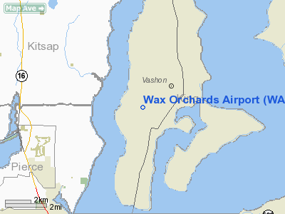
Location & QuickFacts
| FAA Information Effective: | 2008-09-25 |
| Airport Identifier: | WA69 |
| Airport Status: | Operational |
| Longitude/Latitude: | 122-29-54.4600W/47-24-06.3530N
-122.498461/47.401765 (Estimated) |
| Elevation: | 389 ft / 118.57 m (Surveyed) |
| Land: | 200 acres |
| From nearest city: | 3 nautical miles SW of Vashon, WA |
| Location: | King County, WA |
| Magnetic Variation: | 20E (1985) |
Owner & Manager
| Ownership: | Privately owned |
| Owner: | Robert Sestrap |
| Address: | Po Box 34489
Seattle, WA 98124-1489 |
| Phone number: | 206-933-4892 |
| Manager: | James T. English |
| Address: | 12011 Sw 220 Th
Vashon, WA 98070 |
| Phone number: | 206-463-6517
OR 206-463-3044. |
Airport Operations and Facilities
| Airport Use: | Private |
| Wind indicator: | Yes |
| Segmented Circle: | No |
| Control Tower: | No |
| Landing fee charge: | No |
| Sectional chart: | Seattle |
| Region: | ANM - Northwest Mountain |
| Boundary ARTCC: | ZSE - Seattle |
| Tie-in FSS: | SEA - Seattle |
| FSS on Airport: | No |
| FSS Toll Free: | 1-800-WX-BRIEF |
Airport Services
| Airframe Repair: | NONE |
| Power Plant Repair: | NONE |
Runway Information
Runway 16/34
| Dimension: | 2050 x 120 ft / 624.8 x 36.6 m
N/S 510' TURF STOPWAY SOUTHEND. |
| Surface: | TURF, Fair Condition |
| |
Runway 16 |
Runway 34 |
| Traffic Pattern: | Left | Left |
| Markings: | Nonstandard, Poor Condition
16/34 WHITE SPOT MARKERS EDGES OF RY (WHITE BUCKETS EVERY 150') | Nonstandard, Poor Condition |
| Obstruction: | 15 ft trees, 71 ft left of centerline | 10 ft road |
|
Radio Navigation Aids
| ID |
Type |
Name |
Ch |
Freq |
Var |
Dist |
| ODD | NDB | Dondo | | 224.00 | 19E | 8.0 nm |
| PWT | NDB | Kitsap | | 206.00 | 20E | 11.8 nm |
| RNT | NDB | Renton | | 353.00 | 20E | 12.8 nm |
| CAN | NDB | Carney | | 274.00 | 20E | 13.9 nm |
| GR | NDB | Graye | | 216.00 | 18E | 15.7 nm |
| LAC | NDB | Lacomas | | 328.00 | 18E | 23.8 nm |
| MNC | NDB | Mason County | | 348.00 | 19E | 25.7 nm |
| PAE | VOR/DME | Paine | 043X | 110.60 | 20E | 32.4 nm |
| SEA | VORTAC | Seattle | 115X | 116.80 | 19E | 7.9 nm |
| TCM | VORTAC | Mcchord | 033X | 109.60 | 22E | 15.3 nm |
| OLM | VORTAC | Olympia | 081X | 113.40 | 19E | 30.7 nm |
| SEA | VOT | Seattle-tacoma | | 117.50 | | 8.3 nm |
| BFI | VOT | Boeing Field | | 108.60 | | 11.0 nm |
Remarks
-
- 2' TO 40' POLES 510' S OF THR, ONE ON EA SIDE OF RWY EXTNDD WITH RED & WHITE HAZARD MARKED PLATES AT TOP, CONSTITUTES WARNING FOR +40' PLINES 560' S OF THR.
- RWY S +40' TREES 200' SOUTH OF THR, 40' R.
- FENCE ALONG BOTH SIDES RY FULL LENGTH.
- TALL TREES NORTH OF RY.
- EXPEDITE TAXI OPR ON RY.
- LIVESTOCK/WILDLIFE (DEER) ON & INVOF RY.
- PRVDD ARPT TFC PATS ARE ESTABD TO W.
Images and information placed above are from
http://www.airport-data.com/airport/WA69/
We thank them for the data!
| General Info
|
| Country |
United States
|
| State |
WASHINGTON
|
| FAA ID |
WA69
|
| Latitude |
47-24-06.353N
|
| Longitude |
122-29-54.460W
|
| Elevation |
389 feet
|
| Near City |
VASHON
|
We don't guarantee the information is fresh and accurate. The data may
be wrong or outdated.
For more up-to-date information please refer to other sources.
|
|


