|
 |
|
||||
|
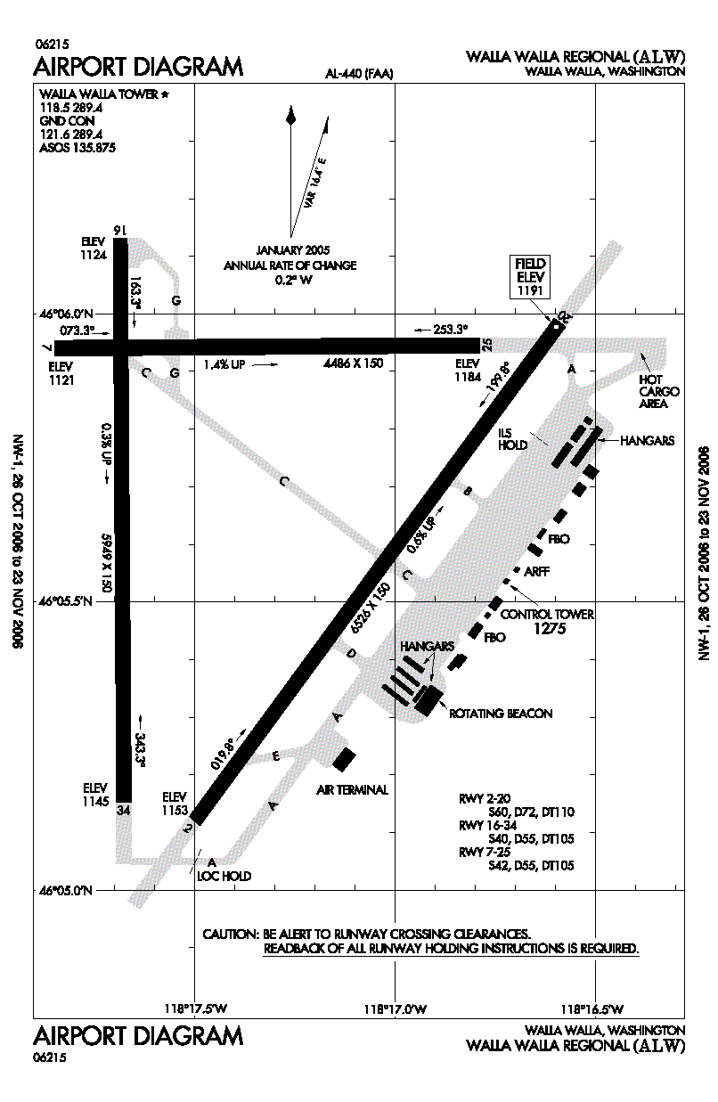
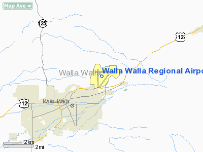
Walla Walla Regional Airport (IATA: ALW, ICAO: KALW, FAA LID: ALW) is a public airport located three miles (5 km) northeast of the central business district of Walla Walla, a city in Walla Walla County in the U.S. state of Washington. It is owned by the Port of Walla Walla. HistoryThe airport was the location of the U.S. Army Air Corps' Walla Walla Army Air Base in World War II. The War Department announced they would be spending over 7.5 million dollars to construct an Army Air Corps Training Airfield adjacent to the existing Walla Walla Airfield. With the old 200-acre municipal airport as a nucleus, they commenced development of the Walla Walla Army Air Base, which ultimately comprised 2,164 acres of land. Over 300 buildings were constructed and equipped to house, feed and train approximately 6,000 men at one time. The 91st Bomb Group lays claim to being the first Army Air Forces outfit to utilize the Walla Walla Base. They had initially trained in Florida before arriving in Walla Walla. Upon arrival, they trained and learned to fly B-17 airplanes. The 91st Bomb Group went on to distinguish itself in combat over Europe. Several of these crews made outstanding records during their tour of duty and were well publicized upon their return to the states with names such as “Jack the Ripper”, “Memphis Belle” and “Delta Rebel”. The “Memphis Belle” became the first B-17 to complete 25 missions in Europe. Late in 1943, Walla Walla Army Airfield lay idle when the Second Air Force withdrew its B-17 Flying Fortress training operation. However, in April of the following year, the Fourth Air Force took charge of the airstrip and established a training base for B-24 Liberator crews. During the war years, it is estimated that more than 8,000 officers and men were trained at this base producing 594 heavy bomber crews who compiled about 114,514 hours in the air while in training. In 1947 the United States Air Force declared the Walla Walla Airfield surplus and on December 1, 1947 the City and County took over operations. An Airport Board was formed to manage the airport and the complexities of the facilities transfer. After considerably less than the standard two year probationary period, the Airport Board received an approved Civil Aviation Authority’s full and complete title to the $13 million airport on April 10, 1949. This was the first joint ownership (City/County) permitted in the entire nation. In 1989, the "Port of Walla Walla" took over ownership and operational responsibility of the airport from the city and county of Walla Walla. The airport is mostly used for general aviation but is also served by one commercial airline. The former office and supply buildings surrounding the airport proper have become a haven for smaller industrial/manufacturing businesses, including, as of June 2007, fifteen full-line wineries that source their fruit from the Walla Walla and Columbia Valley appellations. The Port of Walla Walla, in fact, recently completed a "wine incubator" project; three specially-constructed buildings that are leased on non-renewable six-year contracts to fledgling wineries. Among the 20 plus wineries with primary operations at the Walla Walla Regional Airport are Dunham Cellars, Tamarack Cellars, Buty Wines, Syzygy Winery, Revelry Vintners, Five Star Cellars, and Stephenson Cellars. Facilities and aircraftWalla Walla Regional Airport covers an area of 2,319 acres (938 ha) which contains three paved runways: 2/20 measuring 6,527 x 150 ft (1,989 x 46 m), 7/25 measuring 4,486 x 150 ft (1,367 x 46 m) and 16/34 measuring 5,948 x 150 ft (1,813 x 46 m). There is a VOR on the field that operates on 116.4 MHz. For the 12-month period ending December 31, 2006, the airport had 28,516 aircraft operations, an average of 78 per day: 87% general aviation, 13% air taxi, <1% military and <1% scheduled commercial. At that time there were 134 aircraft based at this airport: 82% single-engine, 13% multi-engine, 2% jet, 1% ultralight and 1% glider. Walla Walla University and Skyrunners Corporation operate flight schools on the field, from primary training through multi-engine, commercial, and other training. Airlines and destinations
The above content comes from Wikipedia and is published under free licenses – click here to read more.
Location & QuickFacts
Owner & Manager
Airport Operations and Facilities
Airport Communications
Airport Services
Runway InformationRunway 02/20
Runway 07/25
Runway 16/34
Radio Navigation Aids
Remarks
Images and information placed above are from We thank them for the data!
We don't guarantee the information is fresh and accurate. The data may
be wrong or outdated.
|
|||||||||||||||||||||||||||||||||||||||||||||||||||||||||||||||||||||||||||||||||||||||||||||||||||||||||||||||||||||||||||||||||||||||||||||||||||||||||||||||||||||||||||||||||||||||||||||||||||||||||||||||||||||||||||||||||||||||||||||||||||||||||||||||||||||||||||||||||||||||||||||||||||||||||||||||||||||||||||||||||||||||||||||||||||||||||||||||||||||||||||||||

 |
|
Copyright 2004-2024 © by Airports-Worldwide.com, Vyshenskoho st. 36, Lviv 79010, Ukraine Legal Disclaimer |