 |
|
| Vista Field |
| IATA: none – ICAO: none – FAA LID: S98 |
| Summary |
| Airport type |
Public |
| Owner |
Port of Kennewick |
| Serves |
Kennewick, Washington |
| Elevation AMSL |
534 ft / 163 m |
| Coordinates |
46°13′07″N 119°12′36″W / 46.21861°N 119.21°W / 46.21861; -119.21 |
| Website |
VistaField.org |
| Runways |
| Direction |
Length |
Surface |
| ft |
m |
| 2/20 |
4,008 |
1,222 |
Asphalt |
| Statistics (2007) |
| Aircraft operations |
45,000 |
| Based aircraft |
35 |
| Source: Federal Aviation Administration |
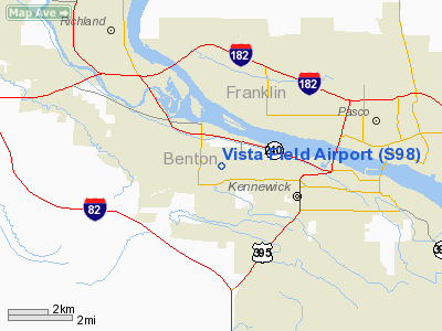
Vista Field (FAA LID: S98) is a public use airport located in Benton County, Washington, United States. The airport is three nautical miles (6 km) northwest of the central business district of the City of Kennewick and is owned by the Port of Kennewick. It is also known as Vista Field Airport.
Several shipping carriers operate out of the airport. There has been controversy in recent years over whether or not to continue to operate the airport or to shut it down.
Facilities and aircraft
Vista Field covers an area of 100 acres (40 ha) at an elevation of 534 feet (163 m) above mean sea level. It has one asphalt paved runway designated 2/20 which measures 4,008 by 150 feet (1,222 x 46 m).
For the 12-month period ending June 30, 2007, the airport had 45,000 general aviation aircraft operations, an average of 123 per day. At that time there were 35 aircraft based at this airport: 86% single-engine, 11% multi-engine and 3% helicopter.
The above content comes from Wikipedia and is published under free licenses – click here to read more.
Location & QuickFacts
| FAA Information Effective: | 2008-09-25 |
| Airport Identifier: | S98 |
| Airport Status: | Operational |
| Longitude/Latitude: | 119-12-36.0540W/46-13-06.8720N
-119.210015/46.218576 (Estimated) |
| Elevation: | 534 ft / 162.76 m (Estimated) |
| Land: | 100 acres |
| From nearest city: | 3 nautical miles NW of Kennewick, WA |
| Location: | Benton County, WA |
| Magnetic Variation: | 19E (1985) |
Owner & Manager
| Ownership: | Publicly owned |
| Owner: | Port Of Kennewick |
| Address: | 350 Clover Island Drive, Suite 200
Kennewick, WA 99336 |
| Phone number: | 509-586-1186 |
| Manager: | Dan Cryer |
| Address: | 350 Clover Island Drive, Suite 200
Kennewick, WA 99336 |
| Phone number: | 509-586-1188 |
Airport Operations and Facilities
| Airport Use: | Open to public |
| Wind indicator: | Yes |
| Segmented Circle: | No |
| Control Tower: | No |
| Lighting Schedule: | DUSK-DAWN
ACTVT MIRL RY 02/20 - CTAF. |
| Beacon Color: | Clear-Green (lighted land airport) |
| Landing fee charge: | No |
| Sectional chart: | Seattle |
| Region: | ANM - Northwest Mountain |
| Traffic Pattern Alt: | 800 ft |
| Boundary ARTCC: | ZSE - Seattle |
| Tie-in FSS: | SEA - Seattle |
| FSS on Airport: | No |
| FSS Toll Free: | 1-800-WX-BRIEF |
| NOTAMs Facility: | SEA (NOTAM-d service avaliable) |
Airport Communications
Airport Services
| Fuel available: | 100LLA |
| Airframe Repair: | MAJOR |
| Power Plant Repair: | MAJOR |
| Bottled Oxygen: | NONE |
| Bulk Oxygen: | NONE |
Runway Information
Runway 02/20
| Dimension: | 4008 x 150 ft / 1221.6 x 45.7 m |
| Surface: | ASPH, Good Condition |
| Weight Limit: | Single wheel: 26000 lbs. |
| Edge Lights: | Medium |
| |
Runway 02 |
Runway 20 |
| Longitude: | 119-12-56.1950W | 119-12-15.9100W |
| Latitude: | 46-12-52.8770N | 46-13-20.8660N |
| Elevation: | 534.00 ft | 496.00 ft |
| Traffic Pattern: | Left | Left |
| Markings: | Basic, Good Condition | Basic, Good Condition |
| VASI: | 2-light PAPI on left side | 2-light PAPI on left side |
| Obstruction: | 50 ft pline, 2000.0 ft from runway, 36:1 slope to clear | 29 ft pole, 1251.0 ft from runway, 86 ft left of centerline, 36:1 slope to clear |
|
Radio Navigation Aids
| ID |
Type |
Name |
Ch |
Freq |
Var |
Dist |
| PD | NDB | Foris | | 230.00 | 20E | 37.3 nm |
| PSC | VOR/DME | Pasco | 021X | 108.40 | 20E | 4.7 nm |
| ALW | VOR/DME | Walla Walla | 111X | 116.40 | 20E | 39.0 nm |
| PDT | VORTAC | Pendleton | 094X | 114.70 | 20E | 33.3 nm |
Remarks
- USE RY 02 WHEN WIND 5 KNOTS OR LESS.
- ESTABD PRIOR TO 5/15/59.
Images and information placed above are from
http://www.airport-data.com/airport/S98/
We thank them for the data!
| General Info
|
| Country |
United States
|
| State |
WASHINGTON
|
| FAA ID |
S98
|
| Latitude |
46-13-14.484N
|
| Longitude |
119-12-19.053W
|
| Elevation |
531 feet
|
| Near City |
KENNEWICK
|
We don't guarantee the information is fresh and accurate. The data may
be wrong or outdated.
For more up-to-date information please refer to other sources.
|
|


