 |
|
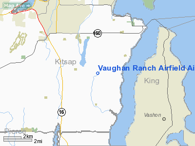
Vaughan Ranch Airfield Airport |
Location & QuickFacts
| FAA Information Effective: | 2008-09-25 |
| Airport Identifier: | WN13 |
| Airport Status: | Operational |
| Longitude/Latitude: | 122-34-08.4770W/47-27-49.3480N
-122.569021/47.463708 (Estimated) |
| Elevation: | 240 ft / 73.15 m (Estimated) |
| Land: | 3 acres |
| From nearest city: | 5 nautical miles SE of Port Orchard, WA |
| Location: | Kitsap County, WA |
| Magnetic Variation: | 20E (1985) |
Owner & Manager
| Ownership: | Privately owned |
| Owner: | Vaughan Ranch Homeowners Assn |
| Address: | P.o. Box 154
Olalla, WA 98359 |
| Phone number: | 253-858-4008 |
| Manager: | Nancy Hancock
HOMEOWNERS ASSOCIATION SECRETARY. |
| Address: | 6432 Se Mullenix Road
Port Orchard, WA 98367 |
Airport Operations and Facilities
| Airport Use: | Private |
| Wind indicator: | Yes |
| Segmented Circle: | No |
| Control Tower: | No |
| Landing fee charge: | No |
| Sectional chart: | Seattle |
| Region: | ANM - Northwest Mountain |
| Boundary ARTCC: | ZSE - Seattle |
| Tie-in FSS: | SEA - Seattle |
| FSS on Airport: | No |
| FSS Toll Free: | 1-800-WX-BRIEF |
Runway Information
Runway 02/20
| Dimension: | 1850 x 50 ft / 563.9 x 15.2 m |
| Surface: | TURF, |
| |
Runway 02 |
Runway 20 |
| Traffic Pattern: | Left | Left |
| Obstruction: | 60 ft tree, 400.0 ft from runway | 50 ft tree, 400.0 ft from runway |
|
Radio Navigation Aids
| ID |
Type |
Name |
Ch |
Freq |
Var |
Dist |
| PWT | NDB | Kitsap | | 206.00 | 20E | 7.8 nm |
| CAN | NDB | Carney | | 274.00 | 20E | 11.4 nm |
| ODD | NDB | Dondo | | 224.00 | 19E | 12.2 nm |
| RNT | NDB | Renton | | 353.00 | 20E | 14.5 nm |
| GR | NDB | Graye | | 216.00 | 18E | 18.9 nm |
| MNC | NDB | Mason County | | 348.00 | 19E | 24.7 nm |
| LAC | NDB | Lacomas | | 328.00 | 18E | 27.4 nm |
| PAE | VOR/DME | Paine | 043X | 110.60 | 20E | 29.8 nm |
| CVV | VOR/DME | Penn Cove | 119X | 117.20 | 19E | 47.4 nm |
| SEA | VORTAC | Seattle | 115X | 116.80 | 19E | 10.7 nm |
| TCM | VORTAC | Mcchord | 033X | 109.60 | 22E | 19.4 nm |
| OLM | VORTAC | Olympia | 081X | 113.40 | 19E | 32.5 nm |
| SEA | VOT | Seattle-tacoma | | 117.50 | | 10.9 nm |
| BFI | VOT | Boeing Field | | 108.60 | | 11.5 nm |
Remarks
- LAND NORTH TAKEOFF SOUTH.
- LANDING NORTH UPHILL.
- NORMAL PREVAILING WINDS ARE FROM SOUTHWEST.
- RY 02 HAS TERRAIN DROP OFF ON BOTH SIDES OF RY AND DIRT BANK ON LEFT SIDE.
- ANIMALS, DOMESTIC AND WILD, IN VICINITY OF ARPT.
- TREES BOTH SIDES OF RY.
Images and information placed above are from
http://www.airport-data.com/airport/WN13/
We thank them for the data!
| General Info
|
| Country |
United States
|
| State |
WASHINGTON
|
| FAA ID |
WN13
|
| Latitude |
47-27-49.348N
|
| Longitude |
122-34-08.477W
|
| Elevation |
240 feet
|
| Near City |
PORT ORCHARD
|
We don't guarantee the information is fresh and accurate. The data may
be wrong or outdated.
For more up-to-date information please refer to other sources.
|
|


