|
|
 |
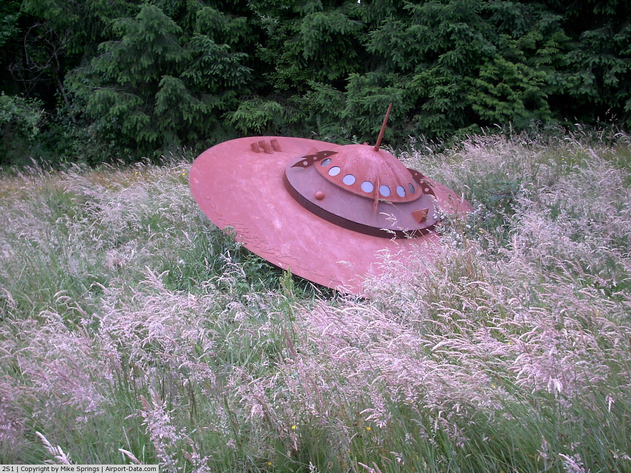
(Click on the photo to enlarge) |
 |
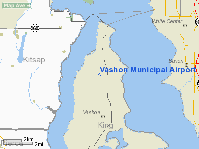
(Click on the photo to enlarge) |
 |
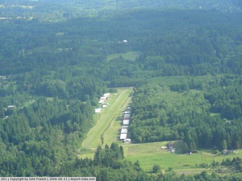
(Click on the photo to enlarge) |
Location & QuickFacts
| FAA Information Effective: | 2008-09-25 |
| Airport Identifier: | 2S1 |
| Airport Status: | Operational |
| Longitude/Latitude: | 122-28-27.0990W/47-27-30.9190N
-122.474194/47.458589 (Estimated) |
| Elevation: | 316 ft / 96.32 m (Surveyed) |
| Land: | 20 acres |
| From nearest city: | 1 nautical miles NW of Vashon, WA |
| Location: | King County, WA |
| Magnetic Variation: | 20E (1985) |
Owner & Manager
| Ownership: | Publicly owned |
| Owner: | King Co Arpt Dist Nr One |
| Address: | P.o. Box 2004
Vashon, WA 98070 |
| Manager: | Bob Therkelsen |
| Address: | 19710 87th Ave Sw
Vashon, WA 98070 |
| Phone number: | 206-463-3142 |
Airport Operations and Facilities
| Airport Use: | Open to public |
| Wind indicator: | Yes |
| Segmented Circle: | Yes |
| Control Tower: | No |
| Lighting Schedule: | DUSK-DAWN |
| Landing fee charge: | No |
| Sectional chart: | Seattle |
| Region: | ANM - Northwest Mountain |
| Traffic Pattern Alt: | 983 ft |
| Boundary ARTCC: | ZSE - Seattle |
| Tie-in FSS: | SEA - Seattle |
| FSS on Airport: | No |
| FSS Toll Free: | 1-800-WX-BRIEF |
| NOTAMs Facility: | SEA (NOTAM-d service avaliable) |
| Federal Agreements: | N |
Airport Communications
Airport Services
| Bottled Oxygen: | NONE |
| Bulk Oxygen: | NONE |
Runway Information
Runway 17/35
| Dimension: | 2001 x 60 ft / 609.9 x 18.3 m |
| Surface: | TURF, Good Condition |
| Edge Lights: | Non-standard lighting system
NSTD LIRL; THR LGTS NON-STD COLORS 360 DEG GREEN.
YELLOW PERIMETER LGTS. |
| |
Runway 17 |
Runway 35 |
| Longitude: | 122-28-35.2470W | 122-28-38.9510W |
| Latitude: | 47-27-40.7110N | 47-27-21.1270N |
| Elevation: | 324.00 ft | 308.00 ft |
| Alignment: | 127 | 7 |
| Traffic Pattern: | Right | Left |
| Obstruction: | 12 ft trees, 2.0 ft from runway, 49 ft left of centerline | 15 ft road, 0.0 ft from runway, 45 ft left of centerline |
|
Helipad H1
| Dimension: | 98 x 98 ft / 29.9 x 29.9 m |
| Surface: | TURF, |
| Edge Lights: | Non-standard lighting system
NSTD LIRL; THR LGTS NON-STD COLORS 360 DEG GREEN.
YELLOW PERIMETER LGTS. |
| |
Runway H1 |
Runway |
| Traffic Pattern: | Left | Left |
|
Radio Navigation Aids
| ID |
Type |
Name |
Ch |
Freq |
Var |
Dist |
| ODD | NDB | Dondo | | 224.00 | 19E | 8.8 nm |
| RNT | NDB | Renton | | 353.00 | 20E | 10.8 nm |
| PWT | NDB | Kitsap | | 206.00 | 20E | 11.7 nm |
| CAN | NDB | Carney | | 274.00 | 20E | 15.1 nm |
| GR | NDB | Graye | | 216.00 | 18E | 19.3 nm |
| LAC | NDB | Lacomas | | 328.00 | 18E | 27.3 nm |
| MNC | NDB | Mason County | | 348.00 | 19E | 28.0 nm |
| PAE | VOR/DME | Paine | 043X | 110.60 | 20E | 28.8 nm |
| CVV | VOR/DME | Penn Cove | 119X | 117.20 | 19E | 48.3 nm |
| SEA | VORTAC | Seattle | 115X | 116.80 | 19E | 6.8 nm |
| TCM | VORTAC | Mcchord | 033X | 109.60 | 22E | 18.7 nm |
| OLM | VORTAC | Olympia | 081X | 113.40 | 19E | 34.1 nm |
| SEA | VOT | Seattle-tacoma | | 117.50 | | 7.0 nm |
| BFI | VOT | Boeing Field | | 108.60 | | 8.1 nm |
Remarks
-
- DEEP DITCH 5-10 FT W OF RY EDGE THE FULL LENGHT.
- OCNL LARGE WILD ANIMALS ON ARPT.
- RWY 17/35 SOFT WHEN WET.
- HANGARS 90 FT E & W OF CNTRLN.
- USE NOISE ABATEMENT PROCEDURES CLIMB STRAIGHT AHEAD TO 700 FT AGL.
- TOUCH & GO LDGS NOT RECOMMENDED.
- TURBULENCE PSBL AT N END OF RY 17/35 WITH STRONG CROSSWINDS.
- RECOMMEND CALLING FOR FIELD CONDITIONS 206-463-3142.
- HEL PARKING AREA RSTRD TO MEDEVAC OPNS.
- ESTABD PRIOR TO 15 MAY 1959.
Images and information placed above are from
http://www.airport-data.com/airport/2S1/
We thank them for the data!
| General Info
|
| Country |
United States
|
| State |
WASHINGTON
|
| FAA ID |
2S1
|
| Latitude |
47-27-29.352N
|
| Longitude |
122-28-38.462W
|
| Elevation |
317 feet
|
| Near City |
VASHON
|
We don't guarantee the information is fresh and accurate. The data may
be wrong or outdated.
For more up-to-date information please refer to other sources.
|
|