 |
|
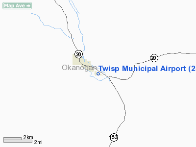
Location & QuickFacts
| FAA Information Effective: | 2008-09-25 |
| Airport Identifier: | 2S0 |
| Airport Status: | Operational |
| Longitude/Latitude: | 120-05-38.2230W/48-21-02.1070N
-120.093951/48.350585 (Estimated) |
| Elevation: | 1602 ft / 488.29 m (Estimated) |
| Land: | 40 acres |
| From nearest city: | 1 nautical miles SE of Twisp, WA |
| Location: | Okanogan County, WA |
| Magnetic Variation: | 20E (1985) |
Owner & Manager
| Ownership: | Publicly owned |
| Owner: | City Of Twisp |
| Address: | City Hall, 118 S Glover
Twisp, WA 98856 |
| Phone number: | 509-997-4081 |
| Manager: | Morgan Smith |
| Address: | 40 Wagner Road
Twisp, WA 98856 |
| Phone number: | 509-429-6328 |
Airport Operations and Facilities
| Airport Use: | Open to public |
| Wind indicator: | Yes |
| Segmented Circle: | No |
| Control Tower: | No |
| Lighting Schedule: | RDO-CTL
ACTVT ROTG BCN; MIRL RY 10/28 & PAPI RY 28 - CTAF. |
| Beacon Color: | Clear-Green (lighted land airport) |
| Landing fee charge: | No |
| Sectional chart: | Seattle |
| Region: | ANM - Northwest Mountain |
| Boundary ARTCC: | ZSE - Seattle |
| Tie-in FSS: | SEA - Seattle |
| FSS on Airport: | No |
| FSS Toll Free: | 1-800-WX-BRIEF |
| NOTAMs Facility: | SEA (NOTAM-d service avaliable) |
Airport Communications
Airport Services
| Airframe Repair: | NONE |
| Power Plant Repair: | NONE |
Runway Information
Runway 10/28
| Dimension: | 2701 x 36 ft / 823.3 x 11.0 m |
| Surface: | ASPH, Good Condition |
| Edge Lights: | Non-standard lighting system
RY 10/28 NSTD MIRL. RY 10 LIGHTED THR RELOCATED 124 FT. RY 28 LIGHTED THR RELOCATED 200 FT. ONLY 2366 FT OF RY 10/28 LIGHTED FOR NGT OPERS. |
| |
Runway 10 |
Runway 28 |
| Longitude: | 120-05-55.8210W | 120-05-20.6250W |
| Latitude: | 48-21-08.4360N | 48-20-55.7780N |
| Traffic Pattern: | Left | Left |
| Markings: | Nonstandard, Good Condition
RWY 10 NO RUNWAY MARKINGS. | Basic, Good Condition |
| Displaced threshold: | 0.00 ft | 200.00 ft
DSPLCD THR MARKED BY LIGHT FIXTURE. |
| VASI: | | 2-light PAPI on left side |
| Visual Glide Angle: | 0.00° | 4.00° |
| Obstruction: | 20 ft trees, 285.0 ft from runway, 19 ft right of centerline, 4:1 slope to clear
+20 FT-50 FT TREES AT 0'; 75' R. | 8 ft road, 205.0 ft from runway
HAS A 50:1 APCH SLOPE TO DSPLCD THLD.
+4' FENCE AT 9'. |
|
Radio Navigation Aids
| ID |
Type |
Name |
Ch |
Freq |
Var |
Dist |
| OMK | NDB | Omak | | 219.00 | 19E | 23.8 nm |
Remarks
- DEER & PEDESTRIANS ON & INVOF ARPT.
- TREES; FENCE; ROAD IN PRIM SFC.
- MOUNTAINOUS TERRAIN SURROUNDS AIRPORT.
- ESTABD PRIOR TO 15 MAY 1959.
Images and information placed above are from
http://www.airport-data.com/airport/2S0/
We thank them for the data!
| General Info
|
| Country |
United States
|
| State |
WASHINGTON
|
| FAA ID |
2S0
|
| Latitude |
48-21-01.522N
|
| Longitude |
120-05-38.286W
|
| Elevation |
1597 feet
|
| Near City |
TWISP
|
We don't guarantee the information is fresh and accurate. The data may
be wrong or outdated.
For more up-to-date information please refer to other sources.
|
|


