 |
|
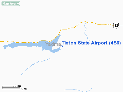
Location & QuickFacts
| FAA Information Effective: | 2008-09-25 |
| Airport Identifier: | 4S6 |
| Airport Status: | Operational |
| Longitude/Latitude: | 121-07-26.3240W/46-38-15.1850N
-121.123979/46.637551 (Estimated) |
| Elevation: | 2964 ft / 903.43 m (Estimated) |
| Land: | 15 acres |
| From nearest city: | 2 nautical miles S of Rimrock, WA |
| Location: | Yakima County, WA |
| Magnetic Variation: | 20E (1985) |
Owner & Manager
| Ownership: | Publicly owned |
| Owner: | Wsdot Aviation Division |
| Address: | 3704 172nd Street Ne, Suite K2, Po Box 3367
Arlington, WA 98223-6336 |
| Phone number: | 360-651-6300 |
| Manager: | Wsdot Aviation Division |
| Address: | 3704 172nd Street Ne, Suite K2, Po Box 3367
Arlington, WA 98223-6336 |
| Phone number: | 360-651-6300 |
Airport Operations and Facilities
| Airport Use: | Open to public |
| Wind indicator: | Yes |
| Segmented Circle: | Yes |
| Control Tower: | No |
| Landing fee charge: | No |
| Sectional chart: | Seattle |
| Region: | ANM - Northwest Mountain |
| Boundary ARTCC: | ZSE - Seattle |
| Tie-in FSS: | SEA - Seattle |
| FSS on Airport: | No |
| FSS Toll Free: | 1-800-WX-BRIEF |
| NOTAMs Facility: | SEA (NOTAM-d service avaliable) |
| Federal Agreements: | S1 |
Airport Communications
Airport Services
| Airframe Repair: | NONE |
| Power Plant Repair: | NONE |
| Bottled Oxygen: | NONE |
| Bulk Oxygen: | NONE |
Runway Information
Runway 02/20
| Dimension: | 2509 x 140 ft / 764.7 x 42.7 m |
| Surface: | TURF, Fair Condition
SFC ROUGH. |
| |
Runway 02 |
Runway 20 |
| Longitude: | 121-07-38.4920W | 121-07-14.1550W |
| Latitude: | 46-38-06.0690N | 46-38-24.3000N |
| Elevation: | 0.00 ft | 2964.00 ft |
| Traffic Pattern: | Left | Left |
| Obstruction: | 402 ft trees, 3760.0 ft from runway, 475 ft right of centerline, 9:1 slope to clear | 44 ft trees, 0.0 ft from runway, 90 ft right of centerline |
|
Radio Navigation Aids
| ID |
Type |
Name |
Ch |
Freq |
Var |
Dist |
| YKM | VORTAC | Yakima | 107X | 116.00 | 21E | 28.3 nm |
| ELN | VORTAC | Ellensburg | 126X | 117.90 | 21E | 35.9 nm |
Remarks
- DEEP CUTS ON NW EDGE OF RWY FIRST 800 FT OF RWY 02.
- ARPT CLSD 1 OCT - 1 JUN.
- RY 02 OBSTRUCTED BY MTNS AT 1000 FT.
- GROUND RISES TO NE.
- CTC WASHINGTON STATE AVIATION DIVISION (360) 651-6300 OR FOR WASHINGTON ONLY 1-800-552-0666 FOR FACILITY INFORMATION PRIOR TO USE.
- WATCH FOR PEDESTRAINS VEHICLES AND ANIMALS ON RWYS.
- ESTABD PRIOR TO 15 MAY 1959.
Images and information placed above are from
http://www.airport-data.com/airport/4S6/
We thank them for the data!
| General Info
|
| Country |
United States
|
| State |
WASHINGTON
|
| FAA ID |
4S6
|
| Latitude |
46-38-15.924N
|
| Longitude |
121-07-25.284W
|
| Elevation |
2961 feet
|
| Near City |
RIMROCK
|
We don't guarantee the information is fresh and accurate. The data may
be wrong or outdated.
For more up-to-date information please refer to other sources.
|
|


