 |
|
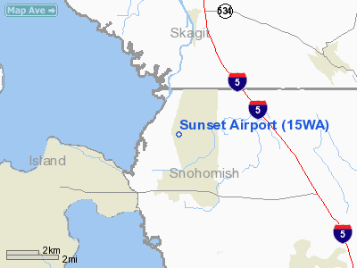
Location & QuickFacts
| FAA Information Effective: | 2008-09-25 |
| Airport Identifier: | 15WA |
| Airport Status: | Operational |
| Longitude/Latitude: | 122-21-25.5570W/48-16-20.3610N
-122.357099/48.272323 (Estimated) |
| Elevation: | 156 ft / 47.55 m (Estimated) |
| Land: | 0 acres |
| From nearest city: | 2 nautical miles NW of Stanwood, WA |
| Location: | Snohomish County, WA |
| Magnetic Variation: | 21E (1985) |
Owner & Manager
| Ownership: | Privately owned |
| Owner: | Dave Phifer |
| Address: | 9007 - 300th St Nw
Stanwood, WA 98292 |
| Phone number: | 360-939-0123 |
| Manager: | Dave Phifer |
| Address: | 9007 - 300th St Nw
Stanwood, WA 98292 |
| Phone number: | 360-939-0123 |
Airport Operations and Facilities
| Airport Use: | Private |
| Wind indicator: | Yes |
| Segmented Circle: | No |
| Control Tower: | No |
| Landing fee charge: | No |
| Sectional chart: | Seattle |
| Region: | ANM - Northwest Mountain |
| Boundary ARTCC: | ZSE - Seattle |
| Tie-in FSS: | SEA - Seattle |
| FSS on Airport: | No |
| FSS Toll Free: | 1-800-WX-BRIEF |
Runway Information
Runway 16/34
| Dimension: | 2000 x 50 ft / 609.6 x 15.2 m |
| Surface: | TURF, |
| |
Runway 16 |
Runway 34 |
| Traffic Pattern: | Right | Left |
|
Radio Navigation Aids
| ID |
Type |
Name |
Ch |
Freq |
Var |
Dist |
| BVS | NDB | Skagit/bay View | | 240.00 | 21E | 12.1 nm |
| OPZ | NDB | Lopez Island | | 356.00 | 21E | 25.7 nm |
| FHR | NDB | Friday Harbor | | 284.00 | 20E | 30.8 nm |
| XX | NDB | Abbotsford | | 344.00 | 21E | 45.0 nm |
| WC | NDB | White Rock | | 332.00 | 21E | 46.4 nm |
| LU | NDB | Cultus | | 214.00 | 22E | 46.6 nm |
| RNT | NDB | Renton | | 353.00 | 20E | 47.0 nm |
| YJ | NDB | Victoria | | 200.00 | 21E | 47.2 nm |
| PWT | NDB | Kitsap | | 206.00 | 20E | 49.6 nm |
| NUW | TACAN | Whidbey Island | 085X | | 21E | 13.2 nm |
| CVV | VOR/DME | Penn Cove | 119X | 117.20 | 19E | 14.8 nm |
| PAE | VOR/DME | Paine | 043X | 110.60 | 20E | 21.4 nm |
| HUH | VORTAC | Whatcom | 077X | 113.00 | 20E | 41.4 nm |
| BFI | VOT | Boeing Field | | 108.60 | | 44.8 nm |
| SEA | VOT | Seattle-tacoma | | 117.50 | | 49.9 nm |
Remarks
- RY END AND EDGE MARKERS PAINTED WHITE.
Images and information placed above are from
http://www.airport-data.com/airport/15WA/
We thank them for the data!
| General Info
|
| Country |
United States
|
| State |
WASHINGTON
|
| FAA ID |
15WA
|
| Latitude |
48-16-20.361N
|
| Longitude |
122-21-25.557W
|
| Elevation |
125 feet
|
| Near City |
STANWOOD
|
We don't guarantee the information is fresh and accurate. The data may
be wrong or outdated.
For more up-to-date information please refer to other sources.
|
|


