 |
|
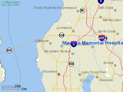
Stevens Memorial Hospital Heliport |
Location & QuickFacts
| FAA Information Effective: | 2008-09-25 |
| Airport Identifier: | 0WA6 |
| Airport Status: | Operational |
| Longitude/Latitude: | 122-20-03.4730W/47-48-13.3480N
-122.334298/47.803708 (Estimated) |
| Elevation: | 370 ft / 112.78 m (Estimated) |
| Land: | 0 acres |
| From nearest city: | 2 nautical miles E of Edmonds, WA |
| Location: | Snohomish County, WA |
| Magnetic Variation: | 20E (1985) |
Owner & Manager
| Ownership: | Privately owned |
| Owner: | Stevens Memorial Hospital |
| Address: | 21601 76th Ave W
Edmonds, WA 98026 |
| Phone number: | 425-744-4000 |
| Manager: | Steve C. Mc Cary |
| Address: | 21601 76th Ave W
Edmonds, WA 98026 |
| Phone number: | 425-744-4000 |
Airport Operations and Facilities
| Airport Use: | Private
MEDICAL USE. |
| Wind indicator: | Yes |
| Segmented Circle: | No |
| Control Tower: | No |
| Landing fee charge: | No |
| Sectional chart: | Seattle |
| Region: | ANM - Northwest Mountain |
| Boundary ARTCC: | ZSE - Seattle |
| Tie-in FSS: | SEA - Seattle |
| FSS on Airport: | No |
| FSS Toll Free: | 1-800-WX-BRIEF |
Airport Services
| Airframe Repair: | NONE |
| Power Plant Repair: | NONE |
Runway Information
Helipad H1
| Dimension: | 70 x 70 ft / 21.3 x 21.3 m |
| Surface: | ASPH, |
| |
Runway H1 |
Runway |
| Traffic Pattern: | Left | Left |
|
Radio Navigation Aids
| ID |
Type |
Name |
Ch |
Freq |
Var |
Dist |
| RNT | NDB | Renton | | 353.00 | 20E | 19.2 nm |
| PWT | NDB | Kitsap | | 206.00 | 20E | 25.4 nm |
| ODD | NDB | Dondo | | 224.00 | 19E | 26.4 nm |
| CAN | NDB | Carney | | 274.00 | 20E | 31.2 nm |
| BVS | NDB | Skagit/bay View | | 240.00 | 21E | 40.1 nm |
| GR | NDB | Graye | | 216.00 | 18E | 40.8 nm |
| MNC | NDB | Mason County | | 348.00 | 19E | 45.2 nm |
| OPZ | NDB | Lopez Island | | 356.00 | 21E | 46.9 nm |
| LAC | NDB | Lacomas | | 328.00 | 18E | 48.7 nm |
| NUW | TACAN | Whidbey Island | 085X | | 21E | 35.6 nm |
| PAE | VOR/DME | Paine | 043X | 110.60 | 20E | 7.3 nm |
| CVV | VOR/DME | Penn Cove | 119X | 117.20 | 19E | 30.8 nm |
| SEA | VORTAC | Seattle | 115X | 116.80 | 19E | 22.2 nm |
| TCM | VORTAC | Mcchord | 033X | 109.60 | 22E | 39.8 nm |
| BFI | VOT | Boeing Field | | 108.60 | | 16.6 nm |
| SEA | VOT | Seattle-tacoma | | 117.50 | | 21.7 nm |
Remarks
- LANDING SITE FOR EMERGENCY TRANSPORTATION OF SICK AND INJURED.
Images and information placed above are from
http://www.airport-data.com/airport/0WA6/
We thank them for the data!
| General Info
|
| Country |
United States
|
| State |
WASHINGTON
|
| FAA ID |
0WA6
|
| Latitude |
47-48-13.348N
|
| Longitude |
122-20-03.473W
|
| Elevation |
370 feet
|
| Near City |
EDMONDS
|
We don't guarantee the information is fresh and accurate. The data may
be wrong or outdated.
For more up-to-date information please refer to other sources.
|
|


