|
|
Spokane International Airport
Geiger Field |
 |
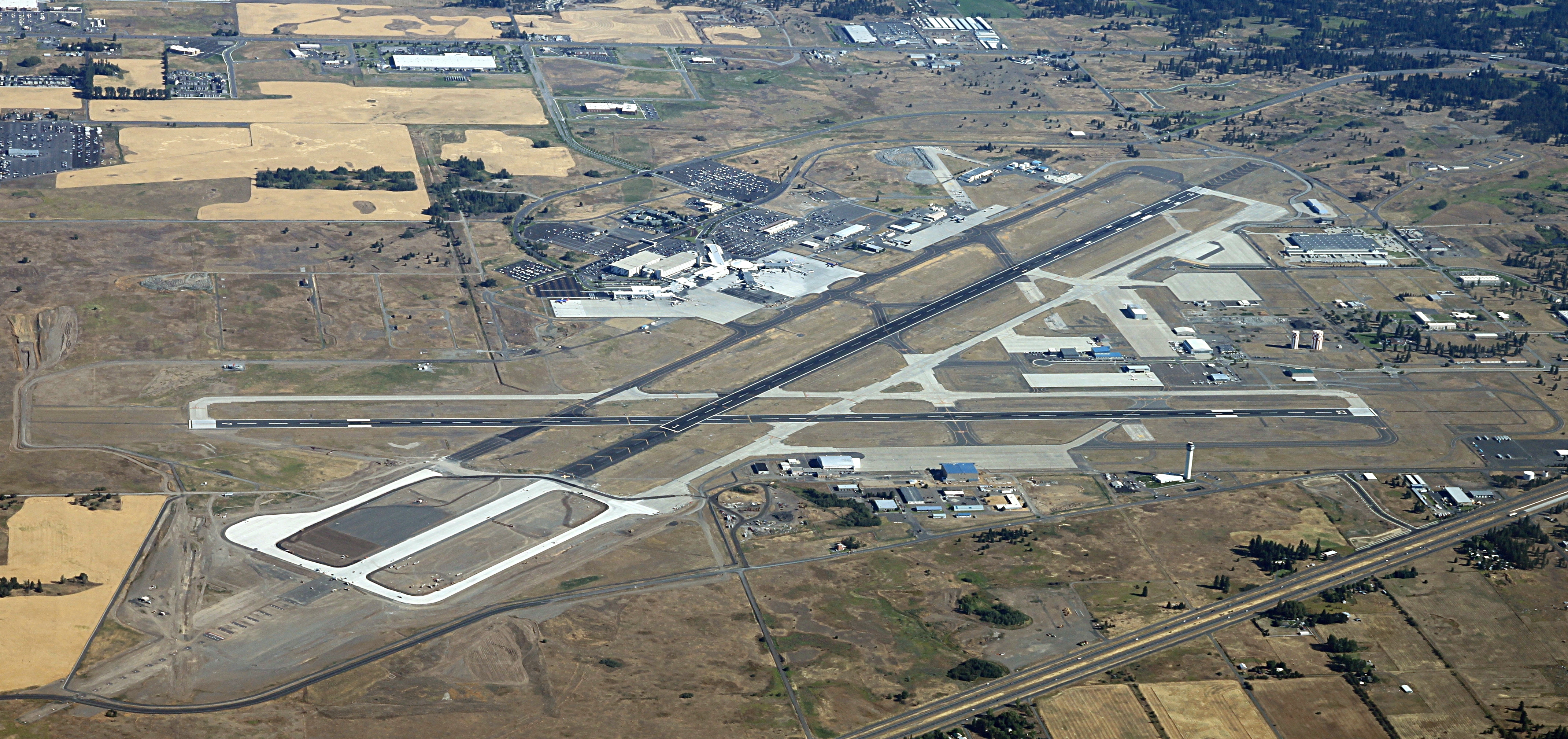
| Spokane International viewed from the south |
| IATA: GEG – ICAO: KGEG – FAA LID: GEG |
| Summary |
| Airport type |
Public |
| Operator |
Spokane County-City |
| Location |
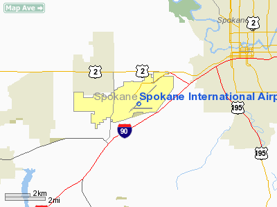
Spokane County, near Spokane, Washington, USA |
| Elevation AMSL |
2376 ft / 724 m |
| Coordinates |
47°37′12″N 117°32′02″W / 47.62°N 117.53389°W / 47.62; -117.53389 |
| Website |
SpokaneAirports.net |
| Runways |
| Direction |
Length |
Surface |
| ft |
m |
| 3/21 |
11000 |
3353 |
Asphalt |
| 7/25 |
8199 |
2499 |
Asphalt |
| Statistics (2009) |
| Cargo |
46,863 |
| Passengers |
3,423,500 |
| Source: Federal Aviation Administration |
Spokane International Airport (IATA: GEG, ICAO: KGEG, FAA LID: GEG) is a commercial airport located about 5 miles (8 km) west of downtown Spokane in Spokane County, Washington. It is the primary airport for Spokane, eastern Washington, Coeur d'Alene, and northern Idaho. It is the second largest airport in Washington, processing over 3 million passengers in 2009. History
Known as Sunset Field before 1941, it was purchased from the county by the War Department and renamed Geiger Field after Major Harold Geiger, an Army aviation pioneer who died in a crash in 1927.
During World War II, Geiger Field was a major training base by Second Air Force as a group training airfield for B-17 Flying Fortress heavy bombardment units, with new aircraft being obtained from Boeing near Seattle. It was also used by Air Technical Service Command as an aircraft maintenance and supply depot; auxiliary airfields were located at Deer Park Airport and Felts Field.
Geiger was closed in late 1945 and turned over to War Assets Administration (WAA) for disposal, then transferred to Spokane County and developed into a commercial airport. The airport hosted USAF Air Defense Command interceptor units during the Cold War; used for air defense of Hanford Nuclear Reservation and Grand Coulee Dam. Built in 1942 as the Spokane Air Depot, Fairchild Air Force Base is located just four miles (7 km) to the west.
It was designated Spokane's municipal airport in 1946, replacing Felts Field, and received its present name in 1960.
Growth and expansion
There is currently a plan in place for future expansion of the airport as it continues to grow in passenger volume. Big components of the master plan include extending the main runway, adding a third runway, and expanding Concourse C with more gates.
A new control tower has been built south of the airport, replacing the old one located near Concourse C. Currently, the new control tower is the tallest control tower in the State of Washington. Another project, recently completed, was the Terminal, Rotunda, and Concourse C Enhancement Project (TRACE). The project, which concluded in November 2006, added retail space and expanded the security checkpoints in the airport's three concourses, and gave the Rotunda an aesthetic renovation.
There have been, at times, non-stop flights to southern California since the 1970s. However, these are among the first to be suspended during economic downturns, high fuel prices, and airline restructuring.
With the rapid growth of the Spokane area, the airport plans to add another concourse in the next 5–10 years. Spokane International Airport (SIA) looks to add more direct flights to the east coast as the Spokane market in recent years has been hosting big events and attracting business to the area.
Airlines and destinations
Spokane International Airport provides 24 gates on 3 concourses. Gates on Concourse A are numbered 11-15, gates on Concourse B are numbered 1-10, and gates on Concourse C are numbered 21-26 and 30-32. Although American Airlines has never served Spokane, it currently code shares with Alaska Airlines and Horizon Air.
| Airlines |
Destinations |
Concourse |
| Alaska Airlines |
Seattle/Tacoma |
C |
| Delta Air Lines |
Minneapolis/St. Paul, Salt Lake City |
B |
| Delta Connection operated by SkyWest Airlines |
Salt Lake City |
B |
| Frontier Airlines |
Denver |
C |
| Horizon Air |
Portland (OR), Sacramento, San Jose (CA), Seattle/Tacoma |
C |
| Southwest Airlines |
Boise, Denver, Las Vegas, Oakland, Portland (OR), Phoenix [begins March 12], Salt Lake City, Seattle/Tacoma |
A |
| United Airlines |
Denver |
B |
| United Express operated by Shuttle America |
Chicago-O'Hare |
B |
| United Express operated by SkyWest Airlines |
San Francisco, Seattle/Tacoma |
B |
| US Airways |
Phoenix |
B |
Cargo
- ABX Air
- FedEx Express
- UPS Airlines
- USA Jet
Accidents and incidents
- On 21 January 1981, a Beechcraft Model 99A operated as Cascade Airways flight 201 crashed into a hill 4.5 miles from the runway. The accident was caused by an incorrect distance measuring equipment frequency, and premature descent to minimum distance altitude (MDA). Of the nine people onboard, seven were killed (including both pilots), and the other two passengers were seriously injured. The airline ceased operations about five years later.
- On 18 March 1994, Douglas DC-3C N3433Y of Salair crashed shortly after take-off on a cargo flight to Portland International Airport. The starboard engine failed shortly after take-off. The engine that failed had previously been in long-term service and had been fitted to the aircraft on 21 February, replacing an engine that developed a misfire and loss of power. It had accumulated 15 hrs flight time at the time of the accident. The aircraft was destroyed in the subsequent fire and both crew were killed.
The above content comes from Wikipedia and is published under free licenses – click here to read more.
Location & QuickFacts
| FAA Information Effective: | 2008-09-25 |
| Airport Identifier: | GEG |
| Airport Status: | Operational |
| Longitude/Latitude: | 117-32-01.8000W/47-37-11.5000N
-117.533833/47.619861 (Estimated) |
| Elevation: | 2376 ft / 724.20 m (Surveyed) |
| Land: | 4753 acres |
| From nearest city: | 5 nautical miles SW of Spokane, WA |
| Location: | Spokane County, WA |
| Magnetic Variation: | 18E (2000) |
Owner & Manager
| Ownership: | Publicly owned |
| Owner: | Spokane County-city |
| Address: | Arpt Board Box 19186
Spokane, WA 99219 |
| Phone number: | 509-455-6455 |
| Manager: | Neal Sealock |
| Address: | 9000 W Airport Dr.
Spokane, WA 99224 |
| Phone number: | 509-455-6455 |
Airport Operations and Facilities
| Airport Use: | Open to public |
| Wind indicator: | Yes |
| Segmented Circle: | No |
| Control Tower: | Yes |
| Lighting Schedule: | DUSK-DAWN |
| Beacon Color: | Clear-Green (lighted land airport) |
| Landing fee charge: | No |
| Sectional chart: | Seattle |
| Region: | ANM - Northwest Mountain |
| Boundary ARTCC: | ZSE - Seattle |
| Tie-in FSS: | SEA - Seattle |
| FSS on Airport: | No |
| FSS Toll Free: | 1-800-WX-BRIEF |
| NOTAMs Facility: | GEG (NOTAM-d service avaliable) |
| Certification type/date: | I C S 05/1973 |
| Federal Agreements: | NGPY |
Airport Communications
Airport Services
| Fuel available: | 100 100LLA |
| Airframe Repair: | MAJOR |
| Power Plant Repair: | MAJOR |
| Bottled Oxygen: | HIGH/LOW |
| Bulk Oxygen: | HIGH/LOW |
Runway Information
Runway 03/21
| Dimension: | 9001 x 150 ft / 2743.5 x 45.7 m |
| Surface: | ASPH, Good Condition |
| Surface Treatment: | Saw-cut or plastic Grooved |
| Weight Limit: | Single wheel: 200000 lbs.
Dual wheel: 200000 lbs.
Dual tandem wheel: 400000 lbs. |
| Edge Lights: | High |
| |
Runway 03 |
Runway 21 |
| Longitude: | 117-32-39.4701W | 117-31-05.7574W |
| Latitude: | 47-36-50.1283N | 47-37-52.3813N |
| Elevation: | 2371.00 ft | 2317.00 ft |
| Alignment: | 45 | 127 |
| ILS Type: | ILS/DME
| ILS/DME
|
| Traffic Pattern: | Right | Right |
| Markings: | Precision instrument, Good Condition | Precision instrument, Good Condition |
| VASI: | 6-box on left side | 4-light PAPI on left side |
| RVR Equipment: | touchdown, midfield, rollout | touchdown, midfield, rollout |
| Approach lights: | ALSF2 | ALSF2
ALSF 2 MAY BE OPERATED AS SSALR DURING FAVORABLE WX CONDITIONS. |
| Centerline Lights: | Yes | Yes |
| Touchdown Lights: | Yes | Yes |
| Obstruction: | , 50:1 slope to clear | 9 ft gnd, 325.0 ft from runway, 500 ft left of centerline, 13:1 slope to clear |
|
Runway 07/25
| Dimension: | 8199 x 150 ft / 2499.1 x 45.7 m |
| Surface: | ASPH, Good Condition |
| Surface Treatment: | Saw-cut or plastic Grooved |
| Weight Limit: | Single wheel: 150000 lbs.
Dual wheel: 180000 lbs.
Dual tandem wheel: 280000 lbs. |
| Edge Lights: | Medium |
| |
Runway 07 |
Runway 25 |
| Longitude: | 117-33-11.7639W | 117-31-12.1046W |
| Latitude: | 47-37-01.0688N | 47-37-00.3642N |
| Elevation: | 2376.00 ft | 2372.00 ft |
| Alignment: | 90 | 127 |
| Traffic Pattern: | Right | Left |
| Markings: | Basic, Good Condition | Basic, Good Condition |
| Crossing Height: | 60.00 ft | 50.00 ft |
| VASI: | 4-box on left side | 4-light PAPI on left side |
| Visual Glide Angle: | 3.20° | 3.00° |
| Runway End Identifier: | Yes | Yes |
| Obstruction: | , 50:1 slope to clear | 69 ft tree, 1975.0 ft from runway, 365 ft left of centerline, 25:1 slope to clear |
|
Radio Navigation Aids
| ID |
Type |
Name |
Ch |
Freq |
Var |
Dist |
| SFF | NDB | Felts | | 365.00 | 19E | 9.8 nm |
| DPY | NDB | Deer Park | | 216.00 | 19E | 21.4 nm |
| SKA | TACAN | Fairchild | 051X | | 19E | 5.2 nm |
| COE | VOR/DME | Coeur D'alene | 025X | 108.80 | 19E | 30.3 nm |
| GEG | VORTAC | Spokane | 102X | 115.50 | 21E | 5.0 nm |
| GEG | VOT | Spokane Intl | | 109.60 | | 0.3 nm |
| SFF | VOT | Spokane/felts Field | | 114.00 | | 9.4 nm |
Remarks
- BE ALERT TO TURBULENCE OVER SMOKE STACKS 1 MILE EAST OF ARPT.
- WATERFOWL & BIRDS ON & INVOF ARPT.
- TWY K UNLGTD ON RAMP SIDE ALONG HORIZON MAINTENANCE RAMP AND IS UNAVABL BLO 1200 RVR UNLESS UNDER ESCORT BY "FOLLOW ME".
- TY "H" RSTD TO WINGSPAN OF 75 FT OR LESS.
- TY "C" EAST OF TY "J" RSTD TO WINGSPAN OF 120 FT OR LESS.
- ESTABD PRIOR 1959
Images and information placed above are from
http://www.airport-data.com/airport/GEG/
We thank them for the data!
| General Info
|
| Country |
United States
|
| State |
WASHINGTON
|
| FAA ID |
GEG
|
| Latitude |
47-37-11.480N
|
| Longitude |
117-32-01.833W
|
| Elevation |
2372 feet
|
| Near City |
SPOKANE
|
We don't guarantee the information is fresh and accurate. The data may
be wrong or outdated.
For more up-to-date information please refer to other sources.
|
|