 |
|
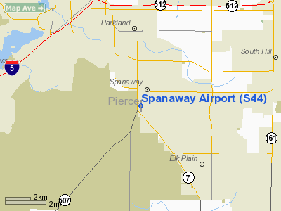
Location & QuickFacts
| FAA Information Effective: | 2008-09-25 |
| Airport Identifier: | S44 |
| Airport Status: | Operational |
| Longitude/Latitude: | 122-25-53.0210W/47-05-12.7920N
-122.431395/47.086887 (Estimated) |
| Elevation: | 373 ft / 113.69 m (Estimated) |
| Land: | 21 acres |
| From nearest city: | 1 nautical miles S of Spanaway, WA |
| Location: | Pierce County, WA |
| Magnetic Variation: | 20E (1985) |
Owner & Manager
| Ownership: | Privately owned |
| Owner: | Spanaway Airpark |
| Address: | 203 188th St East
Spanaway, WA 98387 |
| Phone number: | 253-847-2266 |
| Manager: | Gary R Lawson |
| Address: | 203 188th St E
Spanaway, WA 98387 |
| Phone number: | 253-847-2266 |
Airport Operations and Facilities
| Airport Use: | Open to public |
| Wind indicator: | Yes |
| Segmented Circle: | Yes
20' DIAMETER SEGMENTED CIRCLES PAINTED ON RY. |
| Control Tower: | No |
| Lighting Schedule: | DUSK-DAWN |
| Landing fee charge: | No
TIEDOWN FEE. |
| Sectional chart: | Seattle |
| Region: | ANM - Northwest Mountain |
| Traffic Pattern Alt: | 615 ft |
| Boundary ARTCC: | ZSE - Seattle |
| Tie-in FSS: | SEA - Seattle |
| FSS on Airport: | No |
| FSS Toll Free: | 1-800-WX-BRIEF |
| NOTAMs Facility: | SEA (NOTAM-d service avaliable) |
Airport Communications
Airport Services
| Fuel available: | 100LL |
| Bottled Oxygen: | NONE |
| Bulk Oxygen: | NONE |
Runway Information
Runway 16/34
| Dimension: | 2724 x 20 ft / 830.3 x 6.1 m |
| Surface: | ASPH, Good Condition |
| Weight Limit: | Single wheel: 12000 lbs. |
| Edge Lights: | Low |
| |
Runway 16 |
Runway 34 |
| Longitude: | 122-25-52.3320W | 122-25-53.7180W |
| Latitude: | 47-05-26.1910N | 47-04-59.3180N |
| Elevation: | 373.00 ft | 373.00 ft |
| Alignment: | 127 | 2 |
| Traffic Pattern: | Left | Right |
| Markings: | Nonstandard, Fair Condition
RWY 16 PAVED RWY HAS NON-STD NRS, EDGE LINES & THR MARKINGS ONLY RWY 16 NR LCTD 300' S OF PAINTED DSPLCD THR. | Nonstandard, Fair Condition |
| Displaced threshold: | 200.00 ft | 0.00 ft |
| Obstruction: | 77 ft trees, 348.0 ft from runway, 147 ft right of centerline, 1:1 slope to clear
APCH RATIO 5:1 FM DSPLCD THR.
6' FENCE AND 80' TREES IN PRIMARY SFC. | 103 ft trees, 804.0 ft from runway, 140 ft right of centerline, 5:1 slope to clear
+3' SIGN AT 70', 60' L; +6' FNC, +6' HILL, BRUSH & TREES AT 170', 100' R; TREES AT 0-200', 125' L. |
|
Radio Navigation Aids
| ID |
Type |
Name |
Ch |
Freq |
Var |
Dist |
| LAC | NDB | Lacomas | | 328.00 | 18E | 7.0 nm |
| GR | NDB | Graye | | 216.00 | 18E | 8.0 nm |
| ODD | NDB | Dondo | | 224.00 | 19E | 17.4 nm |
| CAN | NDB | Carney | | 274.00 | 20E | 25.6 nm |
| RNT | NDB | Renton | | 353.00 | 20E | 26.1 nm |
| PWT | NDB | Kitsap | | 206.00 | 20E | 27.7 nm |
| MNC | NDB | Mason County | | 348.00 | 19E | 28.5 nm |
| TDO | NDB | Toledo | | 219.00 | 20E | 40.0 nm |
| TCM | VORTAC | Mcchord | 033X | 109.60 | 22E | 4.1 nm |
| OLM | VORTAC | Olympia | 081X | 113.40 | 19E | 20.5 nm |
| SEA | VORTAC | Seattle | 115X | 116.80 | 19E | 21.5 nm |
| SEA | VOT | Seattle-tacoma | | 117.50 | | 22.1 nm |
| BFI | VOT | Boeing Field | | 108.60 | | 27.0 nm |
Remarks
- TREES IN TRANSITIONAL SURFACES BOTH SIDES OF RY.
- MILITARY TFC ON & INVOF ARPT.
- ESTABD PRIOR TO MAY 15 1959.
Images and information placed above are from
http://www.airport-data.com/airport/S44/
We thank them for the data!
| General Info
|
| Country |
United States
|
| State |
WASHINGTON
|
| FAA ID |
S44
|
| Latitude |
47-05-12.756N
|
| Longitude |
122-25-53.037W
|
| Elevation |
373 feet
|
| Near City |
SPANAWAY
|
We don't guarantee the information is fresh and accurate. The data may
be wrong or outdated.
For more up-to-date information please refer to other sources.
|
|


