 |
|
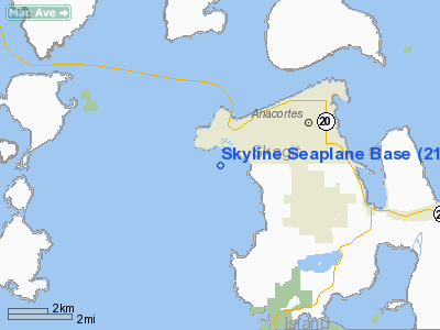
Skyline Seaplane Base Airport |
Location & QuickFacts
| FAA Information Effective: | 2008-09-25 |
| Airport Identifier: | 21H |
| Airport Status: | Operational |
| Longitude/Latitude: | 122-41-04.6250W/48-28-59.3700N
-122.684618/48.483158 (Estimated) |
| Elevation: | 0 ft / 0.00 m (Estimated) |
| Land: | 0 acres |
| From nearest city: | 3 nautical miles W of Anacortes, WA |
| Location: | Skagit County, WA |
| Magnetic Variation: | 21E (1985) |
Owner & Manager
| Ownership: | Privately owned |
| Owner: | Skyline Marine Center |
| Address: | 211 Skyline Way
Anacortes, WA 98221 |
| Phone number: | 206-293-5134 |
| Manager: | Kelly Larkin |
| Address: | Skyline Marine Center, 211 Skyline Way
Anacortes, WA 98221 |
| Phone number: | 360-588-9695 |
Airport Operations and Facilities
| Airport Use: | Open to public |
| Wind indicator: | Yes |
| Segmented Circle: | No |
| Control Tower: | No |
| Landing fee charge: | No |
| Sectional chart: | Seattle |
| Region: | ANM - Northwest Mountain |
| Boundary ARTCC: | ZSE - Seattle |
| Tie-in FSS: | SEA - Seattle |
| FSS on Airport: | No |
| FSS Toll Free: | 1-800-WX-BRIEF |
| NOTAMs Facility: | SEA (NOTAM-d service avaliable) |
Airport Communications
Airport Services
Runway Information
Runway NW/SE
| Dimension: | 5000 x 2500 ft / 1524.0 x 762.0 m |
| Surface: | WATER, |
| |
Runway NW |
Runway SE |
| Traffic Pattern: | Left | Left |
| Obstruction: | 600 ft hill, 2700.0 ft from runway, 4:1 slope to clear | 400 ft hill, 2700.0 ft from runway, 6:1 slope to clear |
|
Radio Navigation Aids
| ID |
Type |
Name |
Ch |
Freq |
Var |
Dist |
| OPZ | NDB | Lopez Island | | 356.00 | 21E | 9.4 nm |
| BVS | NDB | Skagit/bay View | | 240.00 | 21E | 10.6 nm |
| FHR | NDB | Friday Harbor | | 284.00 | 20E | 13.9 nm |
| YJ | NDB | Victoria | | 200.00 | 21E | 30.0 nm |
| WC | NDB | White Rock | | 332.00 | 21E | 31.3 nm |
| XX | NDB | Abbotsford | | 344.00 | 21E | 32.9 nm |
| AP | NDB | Active Pass | | 378.00 | 21E | 33.6 nm |
| MB | NDB | Mill Bay | | 293.00 | 21E | 35.7 nm |
| LU | NDB | Cultus | | 214.00 | 22E | 41.0 nm |
| VR | NDB | Vancouver | | 266.00 | 21E | 44.0 nm |
| CL | NDB | Elwha | | 515.00 | 22E | 44.2 nm |
| V | NDB | Victor | | 368.00 | 22E | 47.5 nm |
| NUW | TACAN | Whidbey Island | 085X | | 21E | 7.8 nm |
| CVV | VOR/DME | Penn Cove | 119X | 117.20 | 19E | 14.4 nm |
| YYJ | VOR/DME | Victoria | 084X | 113.70 | 21E | 35.0 nm |
| PAE | VOR/DME | Paine | 043X | 110.60 | 20E | 37.6 nm |
| HUH | VORTAC | Whatcom | 077X | 113.00 | 20E | 28.1 nm |
| YVR | VORTAC | Vancouver | 44 | 115.90 | 21E | 40.2 nm |
Remarks
- PREVAILING WIND FROM SE.
- 500' ENTRANCE TO HARBOR LIGHTED AND MARKED.
- EXCESSIVE CURRENTS POSSIBLE DURG HEAVY TIDES AT WEST END.
- MILITARY ARRIVAL CORRIDOR N & W OF ARPT.
Images and information placed above are from
http://www.airport-data.com/airport/21H/
We thank them for the data!
| General Info
|
| Country |
United States
|
| State |
WASHINGTON
|
| FAA ID |
21H
|
| Latitude |
48-28-59.370N
|
| Longitude |
122-41-04.625W
|
| Elevation |
0 feet
|
| Near City |
ANACORTES
|
We don't guarantee the information is fresh and accurate. The data may
be wrong or outdated.
For more up-to-date information please refer to other sources.
|
|


