 |
|
Coordinates: 48°15′58″N 124°18′50″W / 48.26611°N 124.31389°W / 48.26611; -124.31389
| Sekiu Airport |
| IATA: none – ICAO: none – FAA LID: 11S |
| Summary |
| Airport type |
Public |
| Owner |
Port of Port Angeles |
| Serves |
Sekiu, Washington |
| Elevation AMSL |
355 ft / 108 m |
| Runways |
| Direction |
Length |
Surface |
| ft |
m |
| 8/26 |
2,997 |
913 |
Asphalt |
| Statistics (2005) |
| Aircraft operations |
498 |
| Source: Federal Aviation Administration |
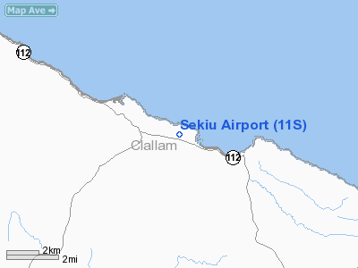
Sekiu Airport (FAA LID: 11S) is a public airport serving the small community of Sekiu, in Clallam County, Washington, United States. It is owned by the Port of Port Angeles.
Facilities and aircraft
Sekiu Airport covers an area of 25 acres (10 ha) which contains a 2,997 x 50 ft (913 x 15 m) lighted runway (8/26) with a visual approach indicator. For the 12-month period ending December 31, 2005, the airport had 498 aircraft operations: 95% general aviation and 5% air taxi.
The above content comes from Wikipedia and is published under free licenses – click here to read more.
Location & QuickFacts
| FAA Information Effective: | 2008-09-25 |
| Airport Identifier: | 11S |
| Airport Status: | Operational |
| Longitude/Latitude: | 124-18-50.2730W/48-15-58.0190N
-124.313965/48.266116 (Estimated) |
| Elevation: | 355 ft / 108.20 m (Estimated) |
| Land: | 25 acres |
| From nearest city: | 0 nautical miles NW of Sekiu, WA |
| Location: | Clallam County, WA |
| Magnetic Variation: | 21E (1985) |
Owner & Manager
| Ownership: | Publicly owned |
| Owner: | Port Of Port Angeles |
| Address: | 338 W First Street, Po Box 1350
Port Angeles, WA 98362 |
| Phone number: | 360-457-8527 |
| Manager: | Jeff Robb |
| Address: | Po Box 1350
Port Angeles, WA 98362 |
| Phone number: | 360-457-1138 |
Airport Operations and Facilities
| Airport Use: | Open to public |
| Wind indicator: | Yes |
| Segmented Circle: | No |
| Control Tower: | No |
| Lighting Schedule: | DUSK-DAWN |
| Beacon Color: | Clear-Green (lighted land airport) |
| Landing fee charge: | No |
| Sectional chart: | Seattle |
| Region: | ANM - Northwest Mountain |
| Boundary ARTCC: | ZSE - Seattle |
| Tie-in FSS: | SEA - Seattle |
| FSS on Airport: | No |
| FSS Toll Free: | 1-800-WX-BRIEF |
| NOTAMs Facility: | SEA (NOTAM-d service avaliable) |
Airport Communications
Airport Services
| Airframe Repair: | NONE |
| Power Plant Repair: | NONE |
| Bottled Oxygen: | NONE |
| Bulk Oxygen: | NONE |
Runway Information
Runway 08/26
| Dimension: | 2997 x 50 ft / 913.5 x 15.2 m |
| Surface: | ASPH, Poor Condition
RY 08-26 POOR SUBSURFACE DRAINAGE DURING WET WEATHER CONDITIONS CAUSES RY SFC MOVEMENT. |
| Edge Lights: | Low |
| |
Runway 08 |
Runway 26 |
| Longitude: | 124-19-12.0580W | 124-18-28.4890W |
| Latitude: | 48-16-00.7000N | 48-15-55.3380N |
| Elevation: | 312.00 ft | 355.00 ft |
| Traffic Pattern: | Left | Left |
| Markings: | Basic, Fair Condition
RY 08/26 MARKINGS FADED. | Basic, Fair Condition |
| Crossing Height: | 0.00 ft | 35.00 ft |
| Displaced threshold: | 900.00 ft | 0.00 ft |
| VASI: | | nonstandard system
NSTD 2-BOX VASI LEFT SIDE NGTS ONLY. |
| Visual Glide Angle: | 0.00° | 4.00° |
| Obstruction: | 19 ft hill, 213.0 ft from runway, 63 ft left of centerline
RY 08 APCH SLOPE 50:1 FROM DSPLCD THLD.
30 FT TREES 110 FT L ON CNTRLN 0 FT FM THR. | 17 ft tree, 210.0 ft from runway, 100 ft right of centerline
10 FT BRUSH 56 FT R OF CNTRLN 0 FT FM THR. |
|
Radio Navigation Aids
| ID |
Type |
Name |
Ch |
Freq |
Var |
Dist |
| CL | NDB | Elwha | | 515.00 | 22E | 26.7 nm |
| MB | NDB | Mill Bay | | 293.00 | 21E | 39.4 nm |
| YJ | NDB | Victoria | | 200.00 | 21E | 43.0 nm |
| YYJ | VOR/DME | Victoria | 084X | 113.70 | 21E | 43.1 nm |
| TOU | VORTAC | Tatoosh | 059X | 112.20 | 22E | 12.7 nm |
Remarks
- TURBULENCE ON E END APCH OVER WATER. DIFFICULT APCH WHEN WIND IS FROM N.
- HI RIDGE ALONG N SIDE OF RWY.
- DEER ON & INVOF ARPT SEP-MAR.
- BRUSH, BLDGS, FENCES IN PRIMARY SFC.
- TALL TREES IN TRANSITION AREAS BOTH SIDE OF RWY.
- PPR FOR OTHER THAN SINGLE ENGINE ACFT, CALL AMGR 360-457-1138.
- ESTABLISHED PRIOR TO 15 MAY 1959.
Images and information placed above are from
http://www.airport-data.com/airport/11S/
We thank them for the data!
| General Info
|
| Country |
United States
|
| State |
WASHINGTON
|
| FAA ID |
11S
|
| Latitude |
48-15-59.277N
|
| Longitude |
124-18-24.790W
|
| Elevation |
350 feet
|
| Near City |
SEKIU
|
We don't guarantee the information is fresh and accurate. The data may
be wrong or outdated.
For more up-to-date information please refer to other sources.
|
|


