 |
|
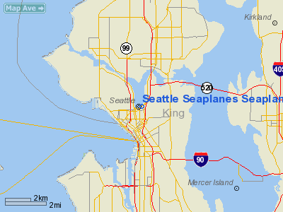
Seattle Seaplanes Seaplane Base Airport |
Location & QuickFacts
| FAA Information Effective: | 2008-09-25 |
| Airport Identifier: | 0W0 |
| Airport Status: | Operational |
| Longitude/Latitude: | 122-19-54.4570W/47-37-39.3530N
-122.331794/47.627598 (Estimated) |
| Elevation: | 14 ft / 4.27 m (Estimated) |
| Land: | 600 acres |
| From nearest city: | 1 nautical miles N of Seattle, WA |
| Location: | King County, WA |
| Magnetic Variation: | 21E (1980) |
Owner & Manager
| Ownership: | Privately owned |
| Owner: | Seattle Seaplanes |
| Address: | 1325 Fairview East
Seattle, WA 98102 |
| Phone number: | 206-329-9638 |
| Manager: | Jim Chrysler |
| Address: | 1325 Fairview East
Seattle, WA 98102 |
| Phone number: | 206-329-9638 |
Airport Operations and Facilities
| Airport Use: | Open to public |
| Wind indicator: | Yes |
| Segmented Circle: | No |
| Control Tower: | No |
| Sectional chart: | Seattle |
| Region: | ANM - Northwest Mountain |
| Boundary ARTCC: | ZSE - Seattle |
| Tie-in FSS: | SEA - Seattle |
| FSS Toll Free: | 1-800-WX-BRIEF |
| NOTAMs Facility: | SEA (NOTAM-d service avaliable) |
Airport Communications
Airport Services
| Airframe Repair: | MINOR |
| Power Plant Repair: | MINOR |
Runway Information
Runway 18W/36W
| Dimension: | 9500 x 300 ft / 2895.6 x 91.4 m |
| Surface: | WATER, |
| |
Runway 18W |
Runway 36W |
| Traffic Pattern: | Left | Left |
|
Radio Navigation Aids
| ID |
Type |
Name |
Ch |
Freq |
Var |
Dist |
| RNT | NDB | Renton | | 353.00 | 20E | 9.3 nm |
| ODD | NDB | Dondo | | 224.00 | 19E | 15.9 nm |
| PWT | NDB | Kitsap | | 206.00 | 20E | 19.1 nm |
| CAN | NDB | Carney | | 274.00 | 20E | 24.4 nm |
| GR | NDB | Graye | | 216.00 | 18E | 30.8 nm |
| MNC | NDB | Mason County | | 348.00 | 19E | 38.2 nm |
| LAC | NDB | Lacomas | | 328.00 | 18E | 38.4 nm |
| NUW | TACAN | Whidbey Island | 085X | | 21E | 45.7 nm |
| PAE | VOR/DME | Paine | 043X | 110.60 | 20E | 17.7 nm |
| CVV | VOR/DME | Penn Cove | 119X | 117.20 | 19E | 40.3 nm |
| SEA | VORTAC | Seattle | 115X | 116.80 | 19E | 11.6 nm |
| TCM | VORTAC | Mcchord | 033X | 109.60 | 22E | 29.4 nm |
| OLM | VORTAC | Olympia | 081X | 113.40 | 19E | 45.8 nm |
| BFI | VOT | Boeing Field | | 108.60 | | 6.1 nm |
| SEA | VOT | Seattle-tacoma | | 117.50 | | 11.1 nm |
Remarks
- SMALL WATERCRAFT ACTVT ON LAKE.
- FILED FOR RECORD PURPOSES ONLY.
Images and information placed above are from
http://www.airport-data.com/airport/0W0/
We thank them for the data!
| General Info
|
| Country |
United States
|
| State |
WASHINGTON
|
| FAA ID |
0W0
|
| Latitude |
47-37-39.353N
|
| Longitude |
122-19-54.457W
|
| Elevation |
14 feet
|
| Near City |
SEATTLE
|
We don't guarantee the information is fresh and accurate. The data may
be wrong or outdated.
For more up-to-date information please refer to other sources.
|
|


