|
|
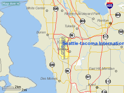
Seattle-tacoma Intl Airport |
Seattle–Tacoma International Airport
Sea-Tac Airport |
 |
 |
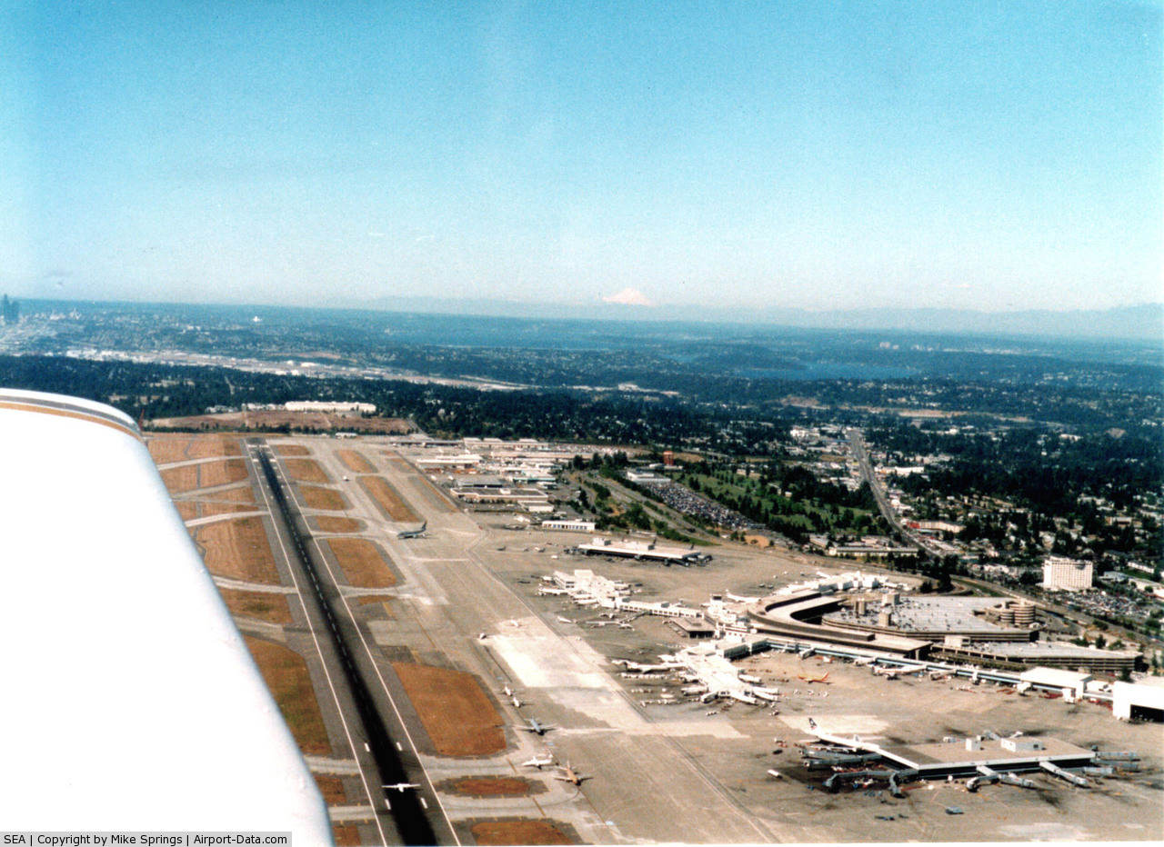
| Sea-Tac Airport from the air, looking north. |
IATA: SEA – ICAO: KSEA – FAA LID: SEA
+
Seattle–Tacoma
International Airport
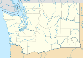
Location of airport in Washington
|
| Summary |
| Airport type |
Public |
| Operator |
Port of Seattle |
| Serves |
Seattle; Tacoma |
| Location |
SeaTac, Washington |
| Hub for |
- Alaska Airlines
- Horizon Air
|
| Elevation AMSL |
433 ft / 132 m |
| Coordinates |
47°26′56″N 122°18′34″W / 47.44889°N 122.30944°W / 47.44889; -122.30944Coordinates: 47°26′56″N 122°18′34″W / 47.44889°N 122.30944°W / 47.44889; -122.30944 |
| Website |
www.portseattle.org/seatac |
| Runways |
| Direction |
Length |
Surface |
| ft |
m |
| 16L/34R |
11,900 |
3,627 |
Concrete |
| 16C/34C |
9,426 |
2,873 |
Concrete |
| 16R/34L |
8,500 |
2,591 |
Concrete |
| Statistics (2009) |
| Passengers |
31,227,512 (3.0% down from 2008) |
| Aircraft movements |
317,873 (7.9% down from 2008) |
| Air Cargo (metric tons) |
269,337 (7.4% down from 2008) |
Sources: FAA and airport web site
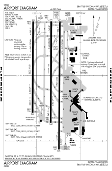
FAA diagram of Sea-Tac Airport
|
Seattle–Tacoma International Airport (IATA: SEA, ICAO: KSEA, FAA LID: SEA), also known as "Sea-Tac Airport" or Sea-Tac (pronounced /ˈsiːtæk/), is located in SeaTac, Washington, United States at the intersections of State Route 518, State Route 99 and State Route 509, about 1.5 miles (2.4 km) west of Interstate 5. It serves Seattle and Tacoma, Washington as well as the rest of western Washington. The airport is the primary hub for Alaska Airlines, whose headquarters is located near the airport, and its regional subsidiary Horizon Air. The airport has service to destinations throughout North America, Europe and East Asia.
"Welcome to Sea-Tac!" says the automated announcement in the airport's parking garage and skyways, using the nickname that residents of the Seattle metropolitan area have given it. The nickname arose before the city of SeaTac, Washington was founded.
In 2009 Sea-Tac served nearly 31.3 million passengers, making it the 18th busiest airport in the United States. It ranks 25th in total aircraft operations and 19th in total cargo volume. Seattle is the largest metropolitan area of the United States which does not serve as a hub nor secondary hub (or focus city) for any of the remaining legacy airlines. It is however a hub for Alaska Airlines and Horizon Air and the remaining legacy airlines run many flights to their hubs as well as a few non hub destinations from Sea-Tac.
The top five carriers at Sea-Tac in number of passengers carried in 2009 were Alaska Airlines (34.2%), Horizon Air (13.8%), Southwest Airlines (8.9%), United Airlines (7.0%), and Northwest Airlines (6.4%). History
 | |
Central terminal with views of the runways |
Seattle–Tacoma Airport was constructed by the Port of Seattle in 1944 to serve civilians of the region, after the U.S. military took control of Boeing Field for use in World War II. The Port received $1 million from the Civil Aeronautics Administration to build the airport, and $100,000 from the City of Tacoma. Commercial use of the airport began after the war ended, with the first scheduled flights occurring in 1947. Two years later, the word International was added to the airport's name as Northwest Airlines began direct service to Tokyo. The runway was lengthened twice, first in 1959 to allow use by jets, and again in 1961 to handle increased traffic for the upcoming Century 21 World's Fair. The current terminal complex was built in 1959. In 1966, SAS inaugurated the airport's first non-stop route to Europe. The Port embarked on a major expansion plan from 1967 to 1973, adding a second runway, a parking garage, two satellite terminals, and other improvements to the airport.
Numerous residents of the surrounding area filed lawsuits against the Port in the early 1970s, complaining of noise, vibration, smoke, and other problems caused by the airport. The Port, together with the government of King County, adopted the Sea-Tac Communities Plan in 1976 to address the airport's impact on the area and guide its future development. The Port spent more than $100 million over the next decade to buy out homes and school buildings in the immediate vicinity, and soundproof others nearby. In the mid 1980s Sea-Tac participated in the airport noise compatibility program initiated by Congress in 1979. Airport noise contours were developed, real estate was purchased and some homes were retrofitted to achieve noise mitigation.
In 1978, the U.S. ended airline regulation. Subsequently, U.S. airlines were allowed to determine routes and fares without government approval. Deregulation resulted in new service to Seattle, including TWA, which was the fourth largest U.S. airline.
After the death of U.S. Senator "Scoop" Jackson in 1983, the Seattle Port Commission voted to change the name of the airport to Henry M. Jackson International Airport, ostensibly to honor the late Senator. However, denizens of Tacoma interpreted the name change as an insult to their community —the second time in the airport's history that the port authorities had attempted to remove "Tacoma" from the official name. But the $100,000 that Tacoma had provided for the airport's construction during World War II had come with an explicit promise that the city would be included in the airport's name. The City of Tacoma eventually prevailed in their attempt to return the long-standing moniker, and the name reverted to Sea-Tac early in 1984.
 | |
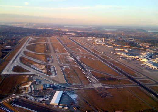
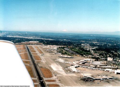
A view of the SeaTac Airport in September 2007, as construction of the new runway 16R/34L was underway. The runway opened in November 2008. |
Starting in the late 1980s, the Port of Seattle and a council representing local county governments considered the future of air traffic in the region and predicted that Sea-Tac Airport could reach capacity by 2000. The planning committee concluded in 1992 that the best solution was to add a third runway to Sea-Tac and construct a supplemental two-runway airport in one of the neighboring counties. Members of the community strongly opposed a third runway, as did Highline School District and the cities of Des Moines, Burien, Federal Way, Tukwila, and Normandy Park, but a 1994 study concluded there were no feasible sites for an additional airport. The Port of Seattle approved a plan for the new runway in 1996, prompting a lawsuit from opponents. The Port secured the necessary permits by agreeing to noise reduction programs and environmental protections. Runway opponents appealed these permits, but dropped their challenges in 2004. The runway opened on November 20, 2008, with a total construction cost of $1.1 billion.
Operations
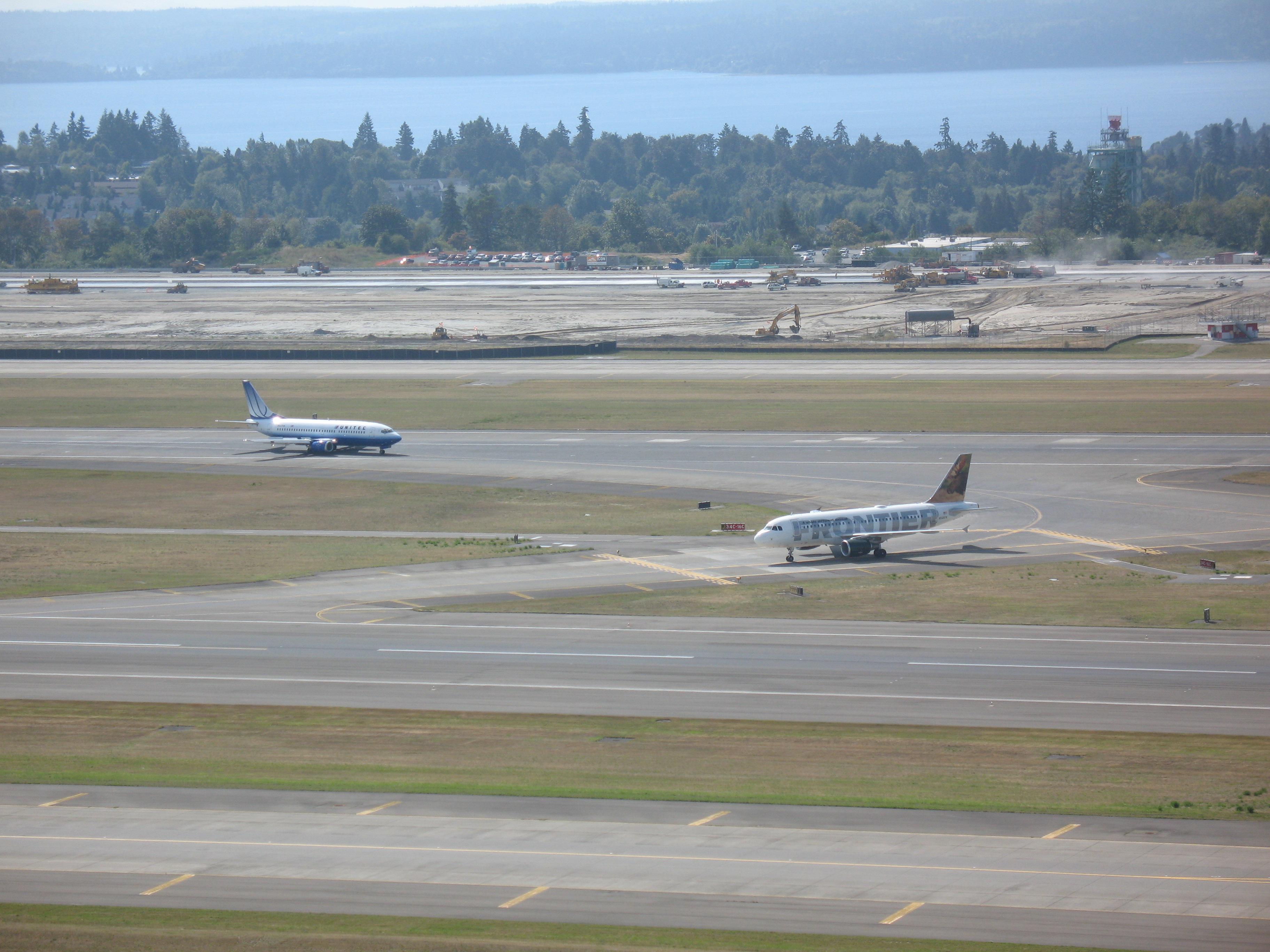
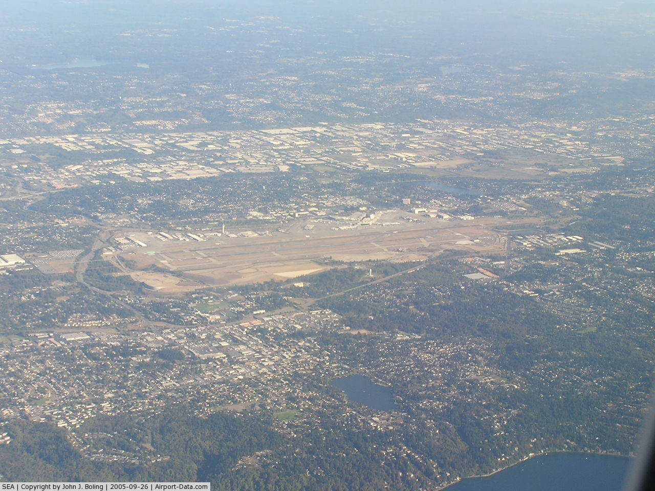
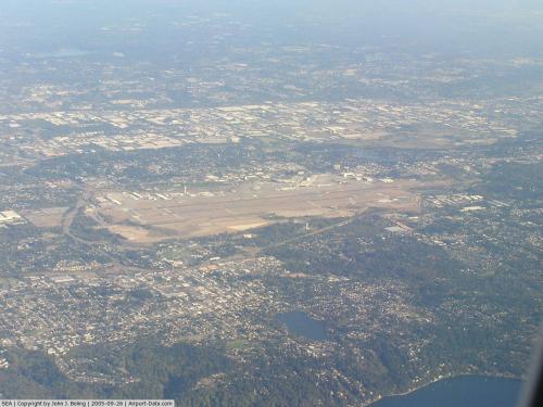
The Sea-Tac airport has three parallel runways that run nearly north-south, with a passenger terminal to the east. The runways range in length from about 8,500 ft (2,600 m) to 12,000 ft (3,700 m). During 2008, the airport averaged 946 aircraft operations per day, 89% of which were commercial flights, 10% of which were air taxi operations, and 1% of which were transient general aviation.
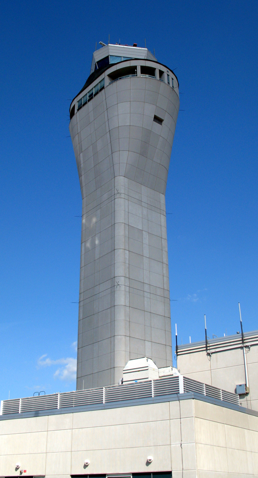 | |
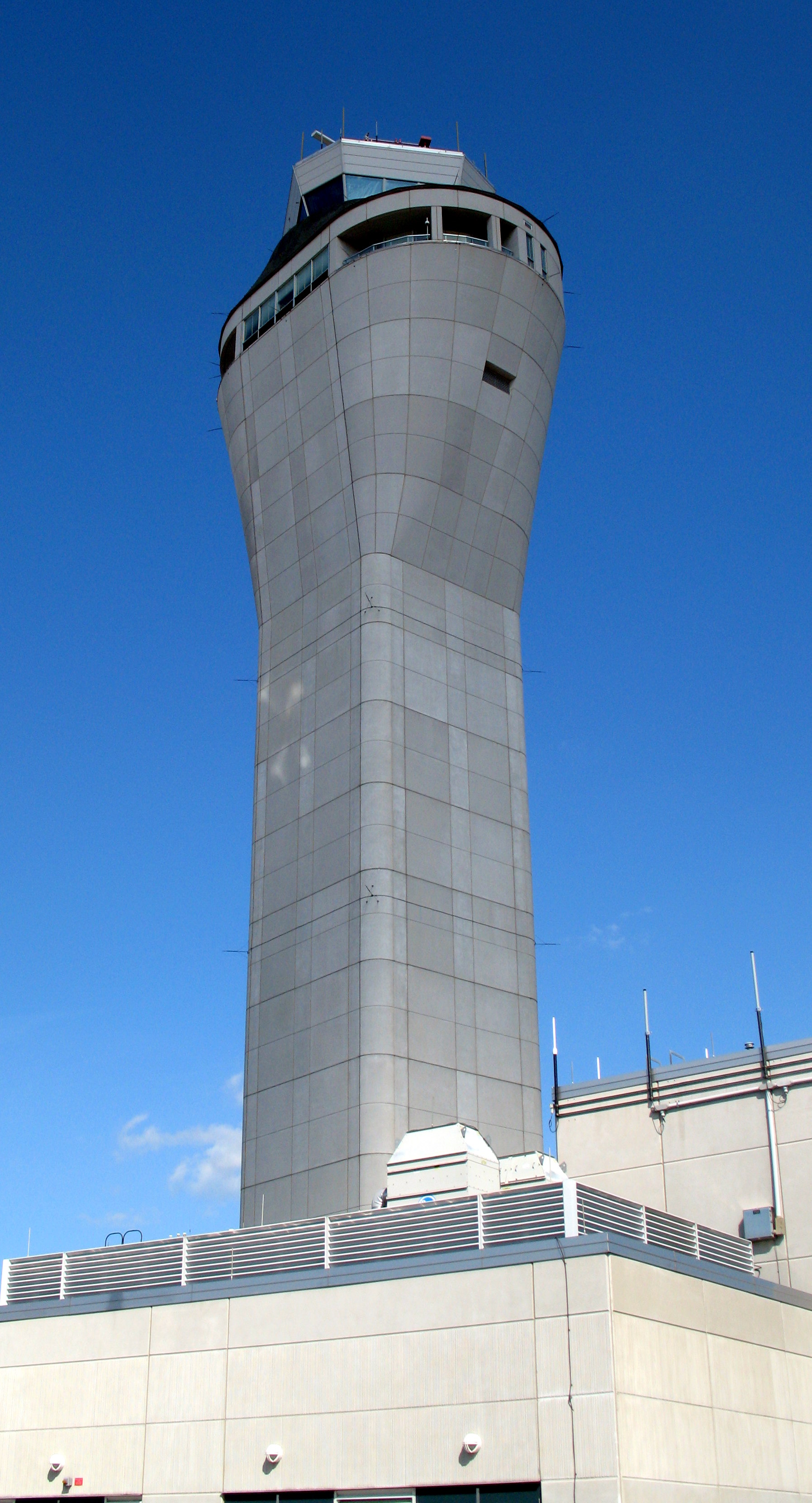
Sea-Tac's control tower, seen in 2007. |
 | |
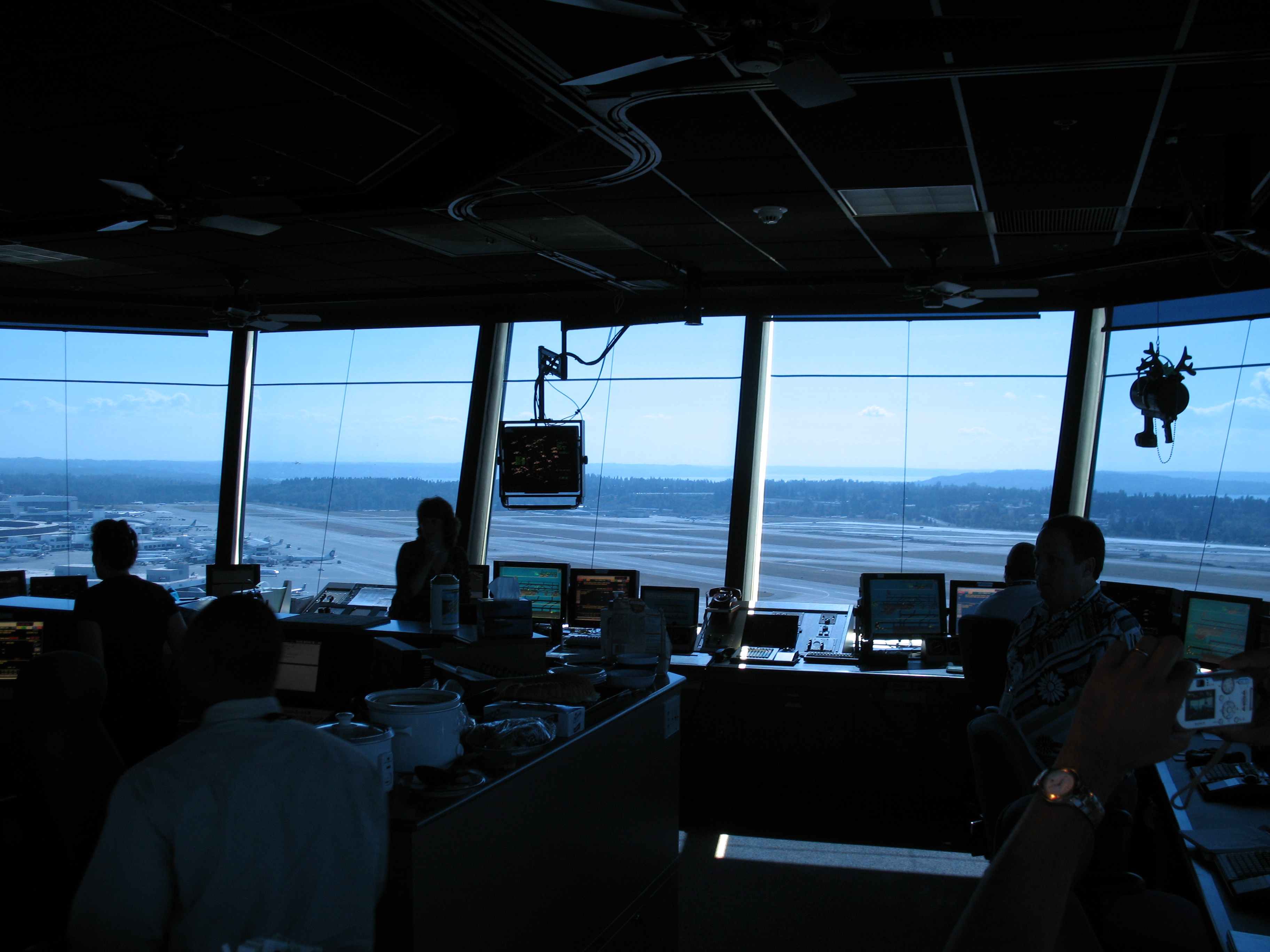
The interior of Sea-Tac's control tower, commissioned in 2004, is 850ft (79m). Visible at center is a radar display; at top right is the tower's light gun. |
A new control tower was constructed for Sea-Tac beginning in 2001, and brought into service November 2004, at a cost of $26 million. The floor of the new tower's control cab is 233 ft (71 m) above ground level; the tower's overall height including antennas is 269 ft (82 m). The cab has 850 sq ft (79 m) of space and was originally designed to support operation by ten controllers, with possible future expansion up to 15. The site and construction method of the tower were designed to maximize visibility and efficacy of radar systems. SeaTac's original control tower, built in the 1950s, is now located in the airport's passenger terminal and used as a ground control tower, after being repaired from damages caused by the Nisqually Earthquake in 2001.
A recurring operational problem at Sea-Tac is misidentification of the westernmost taxiway, Taxiway Tango, as a landing surface. A large "X" has been placed at the north end of the taxiway to prevent confusion, but a number of incidents of aircraft landing on the taxiway have still occurred. The FAA has issued an alert notice dated from August 27, 2009 to September 24, 2009 urging airplanes about taking precautions such as REILs and other visual cues while landing from the north.
In 2007 Sea-Tac airport, together with the University of Illinois Center of Excellence for Airport Technology (CEAT), became the first airport to implement an avian radar system providing 24-hour monitoring of wildlife activity across the airfield. This pilot program was designed to decrease potentially fatal incidents involving avian collisions and provide a test bed for widespread implementation of the technology in the US which was expected to begin in 2009. The technology is part of a multi-pronged strategy to reduce the dangerous presence of wildlife on the airfield.
Possible new airline service
Port of Seattle Commission President John Creighton said the Port of Seattle is working to secure nonstop service between Seattle and Shanghai. After the European Union and US signed an open skies agreement, airlines such as Aer Lingus and bmi, among others, have shown interest in starting service to Seattle.
Virgin Atlantic announced it looked at Seattle among other cities as a future destination when they announced their aircraft order of 15 Boeing 787-9.
V Australia has received permission from the DOT to fly to Seattle and several other U.S. cities from its planned hub in Sydney, Australia.
Emirates Airline has indicated that Seattle is being considered as a future destination, most likely using a Boeing 787.
All Nippon Airways (ANA) has stated that it is considering nonstop service to Seattle from Nagoya using Boeing 787 aircraft. Along with Seattle, ANA is considering service to Denver, Boston and Miami from Tokyo, and to Los Angeles from Nagoya.
Southwest Airlines controversy
Citing increased landing fees and other costs due to the aforementioned work at the airport, Southwest Airlines threatened in 2005 to move to nearby Boeing Field. This plan, however, ran into several problems. First, because Boeing Field is a public airport and each airline would have to have been offered equal access, this would have required more capacity than available on the airport's single runway suitable for large commercial airplanes. (Boeing Field has a parallel, smaller runway used by general-aviation airplanes.) Major renovations to the airport would have been required to alleviate this problem. While Southwest did indicate willingness to pay for upgrades to the airport, there were also problems with the transportation infrastructure around Boeing Field, which was not designed to handle traffic in and out of a major passenger airport. It eventually became clear that Southwest Airlines would not fund the necessary transportation improvements, and the plan was shot down by King County Executive Ron Sims. Furthermore, there were concerns that the high costs of operating the Seattle–Tacoma International Airport would be increased even further if some airline service were moved to Boeing Field, which was expected to be less expensive to operate for the airlines.
Christmas tree controversy
On December 9, 2006, a controversy arose over the airport's display of Christmas trees, which the Port of Seattle officially called "holiday trees" in all public statements. Rabbi Elazar Bogomilsky of Northwest Friends of Chabad-Lubavitch requested that he be permitted to install a chanukkiyah in addition to the trees. Talks were unproductive. The rabbi's attorney, Harvey Grad, sent a legal document to the port. Fearing a lawsuit, the airport took 14 Christmas trees down. This attracted international media attention. After Rabbi Bogomilsky and other Jewish leaders stated that they had no intention of suing the Port of Seattle, the port reinstalled the trees on the night of December 11, 2006.
Incidents and accidents
- November 30, 1947: Alaska Airlines Flight 009, a Douglas C-54A en route to Seattle from Anchorage, Alaska, landed in heavy fog and damp conditions after failed attempts at nearby Boeing Field and Paine Field in Everett. The plane touched down 2,748 ft (838 m) beyond the approach area to Runway 20 and sped onto a nearby road, colliding with an automobile and bursting into flames. Nine fatalities resulted from the accident, including a blind woman riding in the car.
- April 2, 1956: Northwest Orient Airlines Flight 2, a Boeing 377 Stratocruiser headed to Portland, Oregon and points east, experienced reduced power and extreme buffeting shortly after take-off due to an improper setting of the airplane's cowl flaps by the flight engineer. Plans were initially made to land at McChord Air Force Base, but the pilot was forced to make a water landing in Puget Sound east of Maury Island. The plane sank within 15 minutes; five of the 38 on board died.
- November 24, 1971: Northwest Airlines Flight 305, a Boeing 727 flying to Sea-Tac from Portland International Airport, was hijacked by D. B. Cooper. Cooper released the passengers after landing in exchange for $200,000 and four parachutes, ordered the plane back into the air, and jumped out over Southwest Washington with the money.
- April 15, 1988: Horizon Air Flight 2658, a twin-engine de Havilland Canada Dash-8 departing for Spokane, experienced a power loss in the #2 engine shortly after takeoff. While the crew lowered the gear for landing as they returned to the airport, a massive fire broke out in the right engine nacelle, resulting in a loss of braking and directional control. After touchdown, the aircraft veered off the runway and crossed the ramp, colliding with multiple jetways before coming to a stop. Four of the 37 passengers were seriously injured, but there were no fatalities.
- May 23, 1990: Horizon Air Flight 2300, a twin-engine Fairchild Metro III flying from Portland, Oregon, to Seattle, Washington, made an emergency descent and safe landing at Seattle–Tacoma International Airport when a window blew out of the aircraft at 14,000 ft (4,300 m). over Olympia, Washington, sucking a seat-belted passenger's head and shoulder through the broken window. Passenger Gale Sears, 38 of Portland, was held by another passenger until the aircraft landed, after Sears' head and shoulder were sucked out of the blown aircraft window. Oxygen masks deployed during the flight. Sears was treated for minor puncture wounds from the broken glass, but was otherwise uninjured. The airline stated that it appeared to be an isolated incident. The FAA and NTSB assigned investigators to the case.
- February 28, 2001: The 2001 Nisqually earthquake damaged the Air Traffic Control tower at Sea-Tac, although a new earthquake-resistant tower was being built at the time to replace the old one. The new tower entered service in November 2004. A temporary tower was used in the interim.
- December 26, 2005: Alaska Airlines Flight 536, an MD-83 headed from Seattle to Burbank, California, experienced a loss of cabin pressure shortly after takeoff. Emergency oxygen masks were deployed in the cabin and the aircraft returned to Sea-Tac to make an emergency landing. No fatalities or serious injuries were reported. According to the NTSB, a baggage handler admitted to failing to immediately report bumping the plane at the gate with baggage handling equipment. The dent created by bumping the aircraft became a 1-foot (30 cm) gash when the aircraft reached altitude.
- February 2009: More than a dozen planes landing in Seattle were targeted at night by bright green laser beams from a nearby neighborhood next to the airport. No accidents occurred, but local police and the FBI searched for suspects in the apparent prank.
- On April 29, 2009, Asiana Airlines Flight 271, a Boeing 777 flying from Seattle to Incheon International Airport (ICN) in South Korea with 179 passengers and 16 crew aboard, made an emergency landing shortly after taking off from Sea-Tac after fire and smoke were seen emanating from the left engine. The airplane dumped fuel over Puget Sound before landing safely at Sea-Tac around 3:30pm. As of May 4, 2009, a compressor stall is blamed for the incident. Local residents expressed environmental concerns about the fuel dump but authorities at Washington State's Department of Ecology assured the general public that most of the fuel evaporated, and what few fuel droplets that did reach the ground or water posed no health risks.
Terminals, airlines, and destinations
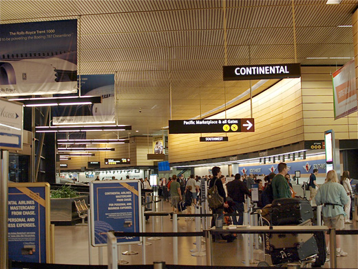 | |
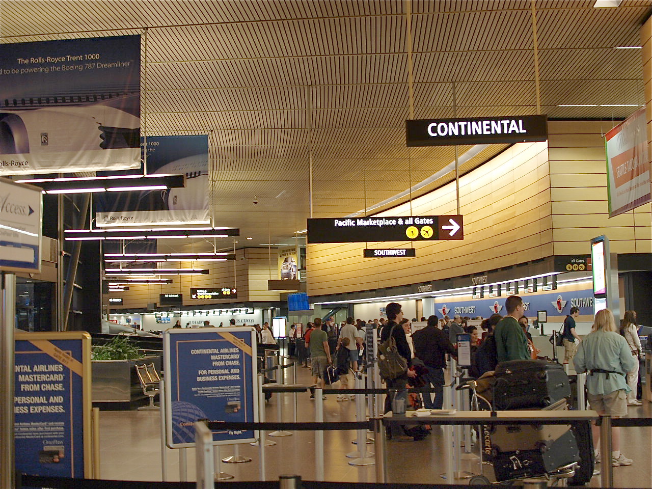
Continental & Southwest ticketing counters in SeaTac's Main Terminal |
 | |
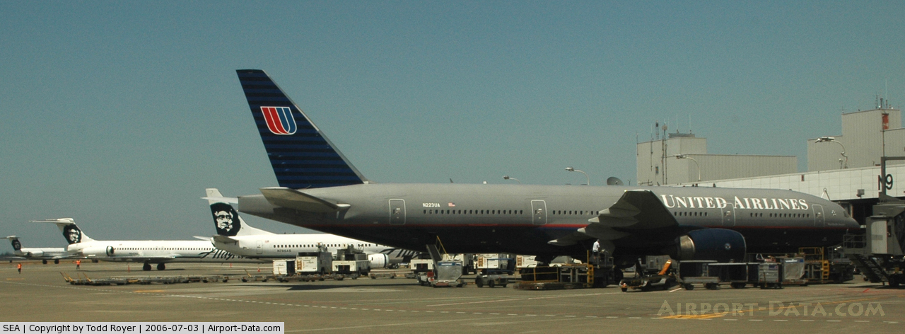
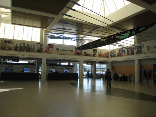
Alaska and United planes at the North Satellite Terminal |
 | |
Interior of the D Concourse near Alaska gates D10 & D11 |
Seattle–Tacoma International Airport has a Central Terminal building, designed by Curtis W. Fentress, FAIA, RIBA of Fentress Architects, with four concourses (A–D) and two Satellite Terminals (North and South). The satellite terminals are connected to the central terminal by an underground people mover system made by Bombardier. There are three security checkpoints for the entire airport. Once through security, passengers have access to all gates. The
- Central Terminal
- Concourse A has 14 gates (A1–A14)
- Concourse B has 13 gates (B1, B3, B4, B5–B12, B14, B15)
- Concourse C has
- 13 gates (C1, C3, C8–C12, C14–C18, C20)
- 12 parking slips (C2B — C2H, C2J — C2N)
- Concourse D has 12 gates (D1–D12)
- North Satellite Terminal
- The North Satellite has 14 gates (N1–N3, N6–N16)
- South Satellite Terminal
- The South Satellite has
- 13 gates (S1–S12, S15)
- 4 parking slips (S16A-S16D)
Note: All international arrivals (except flights from cities with customs preclearance) are handled at the South Satellite Terminal, regardless of their departure terminal.
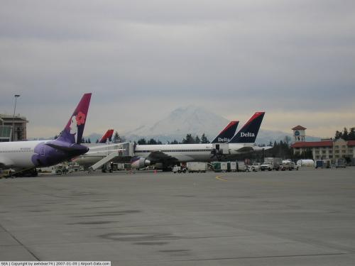
| Airlines |
Destinations |
Concourse |
| Air Canada |
Toronto-Pearson |
North Satellite |
| Air Canada Jazz |
Calgary, Vancouver |
North Satellite |
| Air France |
Paris-Charles de Gaulle |
South Satellite |
| AirTran Airways |
Milwaukee
Seasonal: Atlanta, Baltimore |
Concourse A |
| Alaska Airlines |
Anchorage, Atlanta, Austin, Boston, Burbank, Chicago-O'Hare, Dallas/Fort Worth, Denver, Fairbanks, Honolulu, Houston-Intercontinental, Juneau, Kahului, Ketchikan, Kona, Las Vegas, Lihue, Los Angeles, Miami, Minneapolis/St. Paul, Newark, Oakland, Ontario, Orange County, Orlando, Palm Springs, Phoenix, St. Louis, Sacramento, San Diego, San Francisco, San Jose (CA), Spokane, Tucson, Vancouver, Washington-Reagan
Seasonal: Mazatlán, Puerto Vallarta, San Jose del Cabo, Sitka |
Concourses C, D, and North Satellite |
| American Airlines |
Chicago-O'Hare, Dallas/Fort Worth, New York-JFK |
Concourse A |
| Asiana |
Seoul-Incheon |
South Satellite |
| British Airways |
London-Heathrow |
South Satellite |
| Continental Airlines |
Anchorage, Houston-Intercontinental, Newark
Seasonal: Cleveland |
Concourse B |
| Delta Air Lines |
Amsterdam, Atlanta, Beijing-Capital, Cincinnati/Northern Kentucky, Detroit, Honolulu, Memphis, Minneapolis/St. Paul, New York-JFK, Osaka-Kansai, Salt Lake City, Tokyo-Narita |
South Satellite |
| Delta Connection operated by Mesaba Airlines |
Salt Lake City |
South Satellite |
| Delta Connection operated by SkyWest Airlines |
Salt Lake City |
South Satellite |
| EVA Air |
Taipei-Taoyuan |
South Satellite |
| Frontier Airlines |
Denver |
Concourse A |
| Frontier Airlines operated by Republic Airlines |
Denver, Kansas City
Seasonal: Milwaukee |
Concourse A |
| Hainan Airlines |
Beijing-Capital |
South Satellite |
| Hawaiian Airlines |
Honolulu, Kahului |
Concourse A |
| Horizon Air |
Bellingham, Billings, Boise, Bozeman, Calgary, Edmonton, Eugene, Fresno, Great Falls, Helena, Kalispell, Kelowna, Lewiston, Long Beach, Los Angeles, Medford, Missoula, Pasco, Portland (OR), Pullman, Redmond, Reno/Tahoe, Santa Barbara, Santa Rosa, Spokane, Sun Valley, Vancouver, Victoria, Walla Walla, Wenatchee, Yakima |
Concourse C |
| Icelandair |
Reykjavík-Keflavík |
South Satellite |
| JetBlue Airways |
Boston, Long Beach, New York-JFK |
Concourse A |
| Korean Air |
Seoul-Incheon |
South Satellite |
| Lufthansa |
Frankfurt |
South Satellite |
| Southwest Airlines |
Albuquerque, Boise, Chicago-Midway, Denver, Kansas City [ends January 9], Las Vegas, Oakland, Phoenix, Reno/Tahoe, Sacramento, Salt Lake City, San Jose (CA), Spokane
Seasonal: Baltimore, Nashville, St. Louis |
Concourse B |
| Sun Country Airlines |
Minneapolis/St. Paul [seasonal] |
South Satellite |
| United Airlines |
Chicago-O'Hare, Denver, San Francisco, Tokyo-Narita, Washington-Dulles |
North Satellite |
| United Express operated by SkyWest Airlines |
Los Angeles, Portland (OR), San Francisco, Spokane |
North Satellite |
| US Airways |
Charlotte, Philadelphia, Phoenix |
Concourse A |
| Virgin America |
Los Angeles, San Francisco |
Concourse A |
Statistics
Top Ten Busiest Domestic Routes Out of SeaTac International Airport
| Rank |
City |
12 month passengers starting in 2009 |
Top Carriers |
| 1 |
Los Angeles, CA |
744,000 |
Alaska, United, Virgin America |
| 2 |
San Francisco, CA |
719,000 |
Alaska, United, Virgin America |
| 3 |
Anchorage, AK |
681,000 |
Alaska, Continental |
| 4 |
Denver, CO |
650,000 |
Alaska, Frontier, Southwest, United |
| 5 |
Chicago, IL (O'Hare) |
589,000 |
Alaska, American, United |
| 6 |
Phoenix, AZ |
550,000 |
Alaska, Southwest, US Airways |
| 7 |
Las Vegas, NV |
540,000 |
Alaska, Southwest |
| 8 |
Minneapolis/St. Paul, MN |
519,000 |
Alaska, Delta, Sun Country |
| 9 |
Spokane, WA |
503,000 |
Alaska, Horizon, Southwest, United |
| 10 |
Dallas/Fort Worth, TX |
484,000 |
Alaska, American |
Other Services
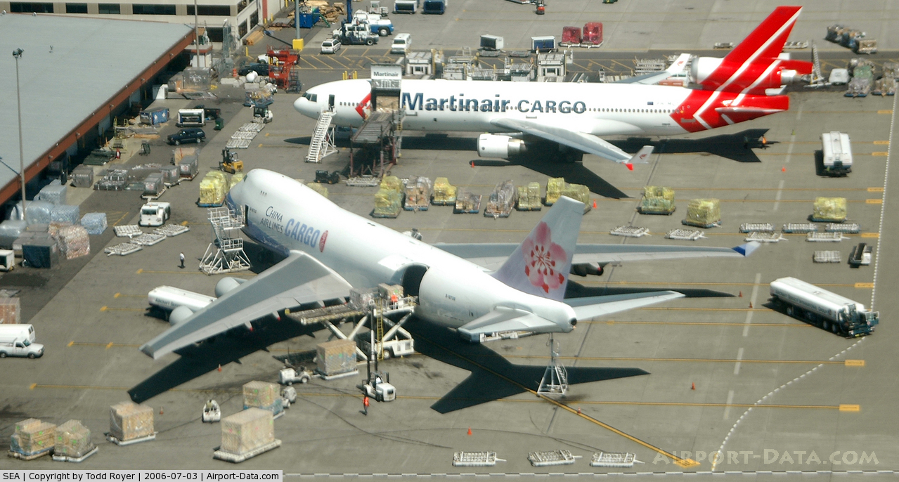
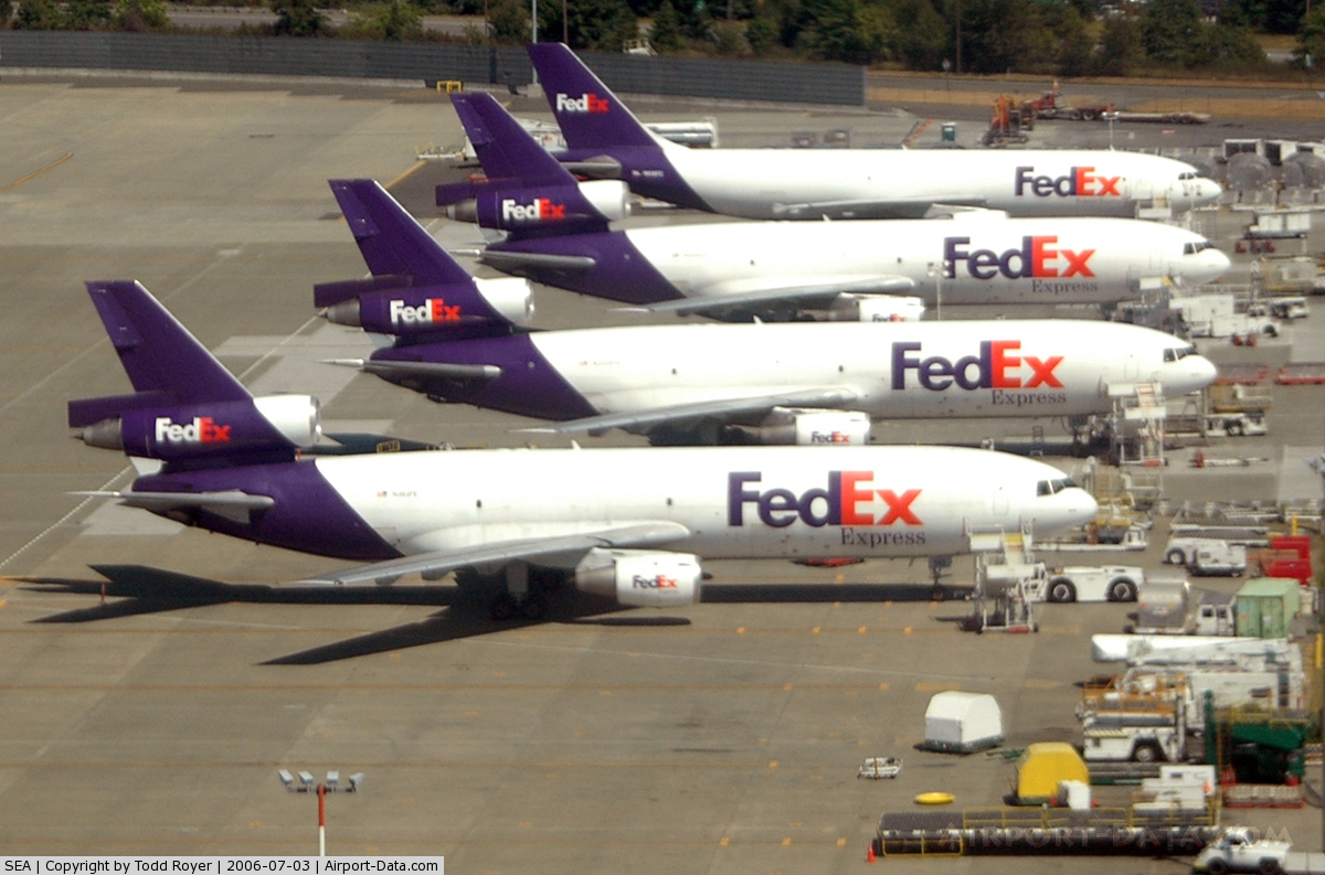
Cargo Terminal
- Alaska Air Cargo
- Asiana Cargo
- Cargolux
- China Airlines Cargo
- Evergreen International Airlines
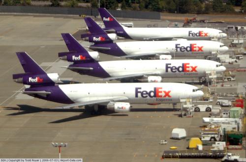
- FedEx
- Great Wall Airlines
- Lufthansa Cargo
- Martinair Cargo
Ground transportation and access
Seattle's Central Link light rail line serves the airport at the new SeaTac/Airport Station, which opened on December 19, 2009.
The airport is also served both by King County's Metro Transit bus system and Sound Transit regional express buses. Taxis, rental cars and door-to-door shuttle service are available. All public transit services are located at the end of baggage claim next to door 00. Taxis and door-to-door shuttle services are located on the third floor of the parking garage in the Ground Transportation center. STITA (Seattle Tacoma International Taxi Association) has the exclusive taxi contract with the Port of Seattle to operate at SeaTac Airport, as does STILA (Seattle Tacoma International Limo Association) for all "for hire" limo services. Shuttle Express is the only on demand door-to-door shuttle service operating out of SeaTac, with service covering Seattle, Tacoma, Everett, and the Eastside. Shuttle Express also provides limos, towncars, and buses on a charter basis. Free parking for the first 30 minutes was discontinued in the mid 1990s.
There is also a scheduled bus service to downtown Vancouver, Canada through Quick Shuttle, with other pick up stops at downtown Seattle, Bellingham International Airport, and drop off stops just inside the Canadian-U.S. boundary and at Vancouver International Airport.
Future development
- A 23-acre (93,000 m) rental car facility was originally scheduled to open in Spring 2011. However, construction was suspended on December 15, 2008 by vote of the Port of Seattle Commission and didn't begin again until June 2009. The new scheduled completion date is in 2012 and construction of the project recommenced in July 2009. The project site is located at the northeastern portion of the airport at the intersection of South 160th Street and International Boulevard South. The rental car facility will have 5,400 parking spaces when completed and will free up 3,200 parking spaces in the current central parking structure.
The above content comes from Wikipedia and is published under free licenses – click here to read more.
 |
(Click on the photo to enlarge) |
 |
(Click on the photo to enlarge) |
 |
(Click on the photo to enlarge) |
 |
(Click on the photo to enlarge) |
 |
(Click on the photo to enlarge) |
 |
(Click on the photo to enlarge) |
 |
(Click on the photo to enlarge) |
 |
(Click on the photo to enlarge) |
Location & QuickFacts
| FAA Information Effective: | 2008-09-25 |
| Airport Identifier: | SEA |
| Airport Status: | Operational |
| Longitude/Latitude: | 122-18-42.4000W/47-26-59.6000N
-122.311778/47.449889 (Estimated) |
| Elevation: | 433 ft / 131.98 m (Surveyed) |
| Land: | 2500 acres |
| From nearest city: | 10 nautical miles S of Seattle, WA |
| Location: | King County, WA |
| Magnetic Variation: | 19E (2000) |
Owner & Manager
| Ownership: | Publicly owned |
| Owner: | Port Of Seattle |
| Address: | Box 1209
Seattle, WA 98111 |
| Phone number: | 206-728-3201 |
| Manager: | Mark Reis |
| Address: | Box 68727
Seattle, WA 98168 |
| Phone number: | 206-433-4682 |
Airport Operations and Facilities
| Airport Use: | Open to public |
| Wind indicator: | Yes |
| Segmented Circle: | No |
| Control Tower: | Yes |
| Lighting Schedule: | DUSK-DAWN |
| Beacon Color: | Clear-Green (lighted land airport) |
| Landing fee charge: | Yes |
| Sectional chart: | Seattle |
| Region: | ANM - Northwest Mountain |
| Boundary ARTCC: | ZSE - Seattle |
| Tie-in FSS: | SEA - Seattle |
| FSS on Airport: | No |
| FSS Toll Free: | 1-800-WX-BRIEF |
| NOTAMs Facility: | SEA (NOTAM-d service avaliable) |
| Certification type/date: | I E S 05/1973 |
| Federal Agreements: | NGY3 |
Airport Communications
Airport Services
| Fuel available: | 100LLA A1 |
| Airframe Repair: | NONE |
| Power Plant Repair: | NONE |
| Bottled Oxygen: | NONE |
| Bulk Oxygen: | NONE |
Runway Information
Runway 16C/34C
| Dimension: | 9426 x 150 ft / 2873.0 x 45.7 m |
| Surface: | CONC, Good Condition |
| Surface Treatment: | Saw-cut or plastic Grooved |
| Weight Limit: | Single wheel: 75000 lbs.
Dual wheel: 139000 lbs.
Dual tandem wheel: 281000 lbs.
Dual dual tandem wheel: 695000 lbs.
TDT 678
TDT 807
TDT 816 |
| Edge Lights: | High |
| |
Runway 16C |
Runway 34C |
| Longitude: | 122-18-39.5460W | 122-18-40.3601W |
| Latitude: | 47-27-49.7126N | 47-26-16.6913N |
| Elevation: | 430.00 ft | 363.00 ft |
| Alignment: | 127 | 0 |
| ILS Type: | ILS/DME
| ILS/DME
|
| Traffic Pattern: | Left | Left |
| Markings: | Precision instrument, Good Condition | Precision instrument, Good Condition |
| Crossing Height: | 76.00 ft | 62.00 ft |
| VASI: | 4-light PAPI on left side | 4-light PAPI on left side |
| Visual Glide Angle: | 3.00° | 3.00° |
| RVR Equipment: | touchdown, midfield, rollout | touchdown, midfield, rollout |
| Approach lights: | ALSF2 | MALSR |
| Runway End Identifier: | Yes | |
| Centerline Lights: | Yes | Yes |
| Touchdown Lights: | Yes | No |
| Obstruction: | , 50:1 slope to clear | 131 ft tree, 5100.0 ft from runway, 700 ft left of centerline, 37:1 slope to clear
+16 FT ANT 160 FT FM RY END 400 FT R; +16 FT ANT 400 FT FM RY END 330 FT R, 12:1. |
|
Runway 16L/34R
| Dimension: | 11901 x 150 ft / 3627.4 x 45.7 m |
| Surface: | ASPH, Good Condition |
| Surface Treatment: | Saw-cut or plastic Grooved |
| Weight Limit: | Single wheel: 75000 lbs.
Dual wheel: 212000 lbs.
Dual tandem wheel: 412000 lbs.
Dual dual tandem wheel: 957000 lbs.
TDT 678
TDT 807
TDT 816 |
| Edge Lights: | High |
| |
Runway 16L |
Runway 34R |
| Longitude: | 122-18-27.9042W | 122-18-28.9441W |
| Latitude: | 47-27-49.6636N | 47-25-52.2168N |
| Elevation: | 432.00 ft | 347.00 ft |
| Alignment: | 127 | 0 |
| ILS Type: | ILS/DME
| ILS/DME
|
| Traffic Pattern: | Left | Left |
| Markings: | Precision instrument, Good Condition | Precision instrument, Good Condition |
| Crossing Height: | 79.00 ft | 82.00 ft |
| VASI: | 4-light PAPI on left side | 4-light PAPI on left side |
| Visual Glide Angle: | 3.00° | 2.75° |
| RVR Equipment: | touchdown, midfield, rollout | touchdown, midfield, rollout |
| Approach lights: | ALSF2 | MALSR |
| Runway End Identifier: | Yes | |
| Centerline Lights: | Yes | Yes |
| Touchdown Lights: | Yes | Yes |
|
Runway 16R/34L
| Dimension: | 8500 x 150 ft / 2590.8 x 45.7 m |
| Surface: | CONC, Good Condition |
| Surface Treatment: | Saw-cut or plastic Grooved |
| Weight Limit: | Single wheel: 75000 lbs.
Dual wheel: 216000 lbs.
Dual tandem wheel: 448000 lbs.
Dual dual tandem wheel: 1157000 lbs.
TDT 678
TDT 807
TDT 816 |
| |
Runway 16R |
Runway 34L |
| Longitude: | 122-19-04.2853W | 122-19-05.0116W |
| Latitude: | 47-27-49.8093N | 47-26-25.9210N |
| Elevation: | 415.00 ft | 356.00 ft |
| Alignment: | 127 | 0 |
| Traffic Pattern: | Left | Left |
|
Radio Navigation Aids
| ID |
Type |
Name |
Ch |
Freq |
Var |
Dist |
| RNT | NDB | Renton | | 353.00 | 20E | 4.8 nm |
| ODD | NDB | Dondo | | 224.00 | 19E | 5.2 nm |
| PWT | NDB | Kitsap | | 206.00 | 20E | 18.3 nm |
| CAN | NDB | Carney | | 274.00 | 20E | 21.6 nm |
| GR | NDB | Graye | | 216.00 | 18E | 21.6 nm |
| LAC | NDB | Lacomas | | 328.00 | 18E | 28.4 nm |
| MNC | NDB | Mason County | | 348.00 | 19E | 33.8 nm |
| PAE | VOR/DME | Paine | 043X | 110.60 | 20E | 28.3 nm |
| SEA | VORTAC | Seattle | 115X | 116.80 | 19E | 0.9 nm |
| TCM | VORTAC | Mcchord | 033X | 109.60 | 22E | 19.3 nm |
| OLM | VORTAC | Olympia | 081X | 113.40 | 19E | 37.5 nm |
| SEA | VOT | Seattle-tacoma | | 117.50 | | 0.5 nm |
| BFI | VOT | Boeing Field | | 108.60 | | 4.7 nm |
Remarks
- BIRD FLOCKS WITHIN ARPT VCNTY - CHECK LCL ADZYS.
- TWY A SOUTH OF TWY G RSTRD TO ACFT WITH WINGSPAN 214 FT AND SMALLER.
- TWY T IS UNLGTD WITH TWY CNTRLN REFLECTORS AND IS UNAVBL BLO 1200 RVR.
- DO NOT MISTAKE TWY T FOR LNDG SFC.
- TAXILANE AROUND N SATELLITE RESTRICTED TO ACFT WITH WINGSPANS OF 200 FT OR LESS. ACCESS TO AIR CARGO 4 PARKING AND CARGO AREAS RESTRICTED TO AIRCRAFT WITH WINGSPANS OF 117'6" OR LESS.
- TWY FOR CORPORATE HANGAR RAMP LTD TO ACFT WITH 104 FT OR LESS WINGSPAN FOR TAXI OPS.GA CUSTOMS PARKING IS VERY LIMITED, EXPECT POSSIBLE DELAYS.
- TWY T DIRECTION & LOCATION SIGNS ARE NOT ILLUMINATED. TWY T DIRECTIONAL/LOCATION/MANDATORY INSTRUCTION SIGNS ON WEST SIDE OF TWY & ARE SITED 125 FT WEST OF TWY EDGE.
- ASDE-X SURVEILLANCE SYSTEM IN USE: PILOTS SHOULD OPERATE TRANSPONDERS WITH MODE C ON ALL TWYS AND RYS.
- TWY T SOUTH OF TWY E RSTD TO AIRCRAFT WITH WINGSPANS LESS THAN 118 FT. TWY T FROM TWY E NORTH RSTD TO ACFT WITH WINGSPANS LESS THAN 171 FT.
- RY 16R/34L PPR ONLY.
- FLIGHT NOTIFICATION SERVICE (ADCUS) AVBL.
- BTN THE HRS OF 2200-0700 THE USE OF EXTDD REVERSE THRUST IS DISCOURAGED BYD WHAT IS NECCESSARY FOR OPNL OR SAFETY REASONS. NOISE ABATEMENT PROCEDURES IN EFFECT BTN 2200-0600. FOR FURTHER INFO CONTACT SEA NOISE ABATEMENT OFFICE AT 206-248-7496.
- HELICOPTERS LANDING & DEPARTING AVOID OVERFLYING FUEL FARM LCTD AT THE SE CORNER OF THE ARPT.
- EXISTED PRIOR TO MAY 15, 1959.
Images and information placed above are from
http://www.airport-data.com/airport/SEA/
We thank them for the data!
| General Info
|
| Country |
United States
|
| State |
WASHINGTON
|
| FAA ID |
SEA
|
| Latitude |
47-26-56.335N
|
| Longitude |
122-18-33.527W
|
| Elevation |
429 feet
|
| Near City |
SEATTLE
|
We don't guarantee the information is fresh and accurate. The data may
be wrong or outdated.
For more up-to-date information please refer to other sources.
|
|