 |
|
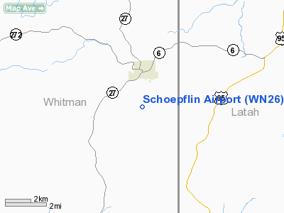
Location & QuickFacts
| FAA Information Effective: | 2008-09-25 |
| Airport Identifier: | WN26 |
| Airport Status: | Operational |
| Longitude/Latitude: | 117-04-36.7400W/46-53-05.8900N
-117.076872/46.884969 (Estimated) |
| Elevation: | 2607 ft / 794.61 m (Estimated) |
| Land: | 14 acres |
| From nearest city: | 2 nautical miles S of Palouse, WA |
| Location: | Whitman County, WA |
| Magnetic Variation: | () |
Owner & Manager
| Ownership: | Privately owned |
| Owner: | Dale E Schoepflin |
| Address: | 801 Ringo Rd
Palouse, WA 99161 |
| Phone number: | 509-878-1531 |
| Manager: | Dale E Schoepflin |
| Address: | 801 Ringo Rd
Palouse, WA 99161 |
| Phone number: | 509-878-1531 |
Airport Operations and Facilities
| Airport Use: | Private |
| Wind indicator: | Yes |
| Control Tower: | No |
| Sectional chart: | Seattle |
| Region: | ANM - Northwest Mountain |
| Boundary ARTCC: | ZSE - Seattle |
| Tie-in FSS: | SEA - Seattle |
| FSS Toll Free: | 1-800-WX-BRIEF |
Runway Information
Runway 04/22
| Dimension: | 2200 x 40 ft / 670.6 x 12.2 m |
| Surface: | ASPH, Good Condition |
| Edge Lights: | Non-standard lighting system
RYS 04/22 & 11/29 NSTD REFLECTORS ONLY. |
| |
Runway 04 |
Runway 22 |
| Traffic Pattern: | Left | Left |
| Markings: | Basic, | Basic, |
|
Runway 11/29
| Dimension: | 1600 x 25 ft / 487.7 x 7.6 m |
| Surface: | ASPH, Good Condition |
| Edge Lights: | Non-standard lighting system
RYS 04/22 & 11/29 NSTD REFLECTORS ONLY. |
| |
Runway 11 |
Runway 29 |
| Traffic Pattern: | Left | Left |
| Markings: | Basic, | Basic, |
|
Radio Navigation Aids
| ID |
Type |
Name |
Ch |
Freq |
Var |
Dist |
| SFF | NDB | Felts | | 365.00 | 19E | 49.1 nm |
| SKA | TACAN | Fairchild | 051X | | 19E | 49.7 nm |
| PUW | VOR/DME | Pullman | 027X | 109.00 | 20E | 14.0 nm |
| MQG | VOR/DME | Nez Perce | 019X | 108.20 | 20E | 31.4 nm |
| GEG | VORTAC | Spokane | 102X | 115.50 | 21E | 46.6 nm |
| GEG | VOT | Spokane Intl | | 109.60 | | 48.2 nm |
| SFF | VOT | Spokane/felts Field | | 114.00 | | 48.8 nm |
Images and information placed above are from
http://www.airport-data.com/airport/WN26/
We thank them for the data!
| General Info
|
| Country |
United States
|
| State |
WASHINGTON
|
| FAA ID |
WN26
|
| Latitude |
48-02-22.353N
|
| Longitude |
122-04-12.478W
|
| Elevation |
320 feet
|
| Near City |
LAKE STEVENS
|
We don't guarantee the information is fresh and accurate. The data may
be wrong or outdated.
For more up-to-date information please refer to other sources.
|
|


