|
|
| Sanderson Field |
| IATA: SHN – ICAO: KSHN – FAA LID: SHN |
| Summary |
| Airport type |
Public |
| Owner |
Port of Shelton |
| Serves |
Shelton, Washington |
| Elevation AMSL |
273 ft / 83 m |
| Coordinates |
47°14′01″N 123°08′51″W / 47.23361°N 123.1475°W / 47.23361; -123.1475 |
| Runways |
| Direction |
Length |
Surface |
| ft |
m |
| 5/23 |
5,005 |
1,526 |
Asphalt |
| Statistics (2007) |
| Aircraft operations |
44,209 |
| Based aircraft |
107 |
| Source: Federal Aviation Administration |
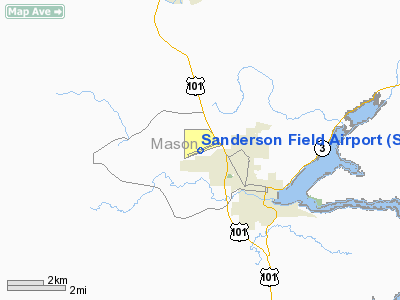
Sanderson Field (IATA: SHN, ICAO: KSHN, FAA LID: SHN) is a public lighted-land airport located in Shelton, a city in Mason County, Washington, United States. It is located roughly one mile north and outside the Shelton city limits, and is owned by the Port of Shelton. It is bordered on the south by the Mason County Fairgrounds, on the north by a business park and Dayton Airport Road, on the west by the Washington State Patrol Training Academy, and on the east by U.S. Highway 101. The airport was named after Major General Lawson H. Sanderson of the United States Marine Corps. History
Sanderson Field originally operated under the name Mason County Airport. and opened in the late 1920s. In 1941, the United States Navy took over operations of Mason County Airport for use as a Naval Air Station during World War II and became Naval Air Station Shelton. Under the ownership of the Navy, a new runway was added, and the facilities expanded. The airport closed down as a naval air installation in 1955 and sat unused for eleven years until reopening in August of 1966. At the reopening dedication on August 28, it was deeded back to the Port of Shelton (who owns the airport today), christened "Sanderson Field" and the facilities improved. The largest of two runways (north-south; designated 17-35) was closed, and runway 5-23 (east-west) was expanded and kept open. The closed runway has occasionally been used as a drag strip. In late 1993, a chainlink security fence was added to the perimeter of the airport and in 1994 five new hangers were built at the southeast corner. A large number of buildings today are remnants of the WWII era.
Facilities and aircraft
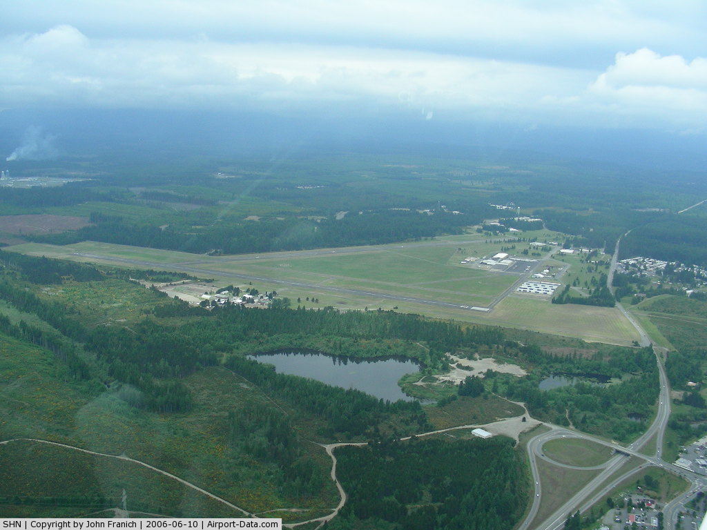
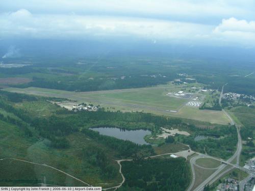
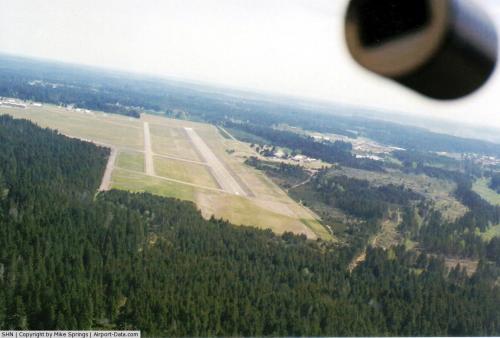
Sanderson Field covers an area of 1,054 acres (427 ha) at an elevation of 273 feet (83 m) above mean sea level. It has one active runway (5/23), running in an east-west orientation with a 5,005 by 100 ft (1,526 x 30 m) asphalt pavement. The active runway has medium-intensity runway edge lighting, installed in 1986, that operates from dusk to dawn. The primary approach is on Runway 23, which has a four-light Precision Approach Path Indicator system. A former runway (17/35) runs in a north-south orientation and has been deactivated since the early 1960s. Remnants of the former runway's markings are visible from the air and in high-resolution satellite imagery.
Services at Sanderson include minor airframe and powerplant repair by Olympic Air. Additionally, a 24-hour fuel station offers 100LL and JET-A grades of aircraft fuel. There are parking tiedowns for up to 36 aircraft on a spacious parking ramp adjacent to the Olympic Air maintenance shop. In 2006, a new 10,000 sq ft (930 m) hangar was built to the north of Olympic Air, housing the airport's newest FBO (Fixed Base Operator) Kapowsin Air Sports. The new facility was built to house two planes equipped for skydiving operations as well as an on-site pilot's cafe.
For the 12-month period ending December 31, 2007, the airport had 44,209 aircraft operations, an average of 121 per day: 50.2% general aviation, 49.5% military and <0.2% air taxi. At that time there were 107 aircraft based at this airport: 93% single-engine, 2% multi-engine, 1% jet, 2% helicopter and 3% ultralight.
The above content comes from Wikipedia and is published under free licenses – click here to read more.
 |
(Click on the photo to enlarge) |
 |
(Click on the photo to enlarge) |
Location & QuickFacts
| FAA Information Effective: | 2008-09-25 |
| Airport Identifier: | SHN |
| Airport Status: | Operational |
| Longitude/Latitude: | 123-08-51.2000W/47-14-00.8000N
-123.147556/47.233556 (Estimated) |
| Elevation: | 273 ft / 83.21 m (Surveyed) |
| Land: | 1054 acres |
| From nearest city: | 3 nautical miles NW of Shelton, WA |
| Location: | Mason County, WA |
| Magnetic Variation: | 19E (2000) |
Owner & Manager
| Ownership: | Publicly owned |
| Owner: | Port Of Shelton |
| Address: | 21 West Sanderson Way
Shelton, WA 98584 |
| Phone number: | 360-426-1151 |
| Manager: | Bob Robinson |
| Address: | 21 West Sanderson Way
Shelton, WA 98584 |
| Phone number: | 360-426-1151 |
Airport Operations and Facilities
| Airport Use: | Open to public |
| Wind indicator: | Yes |
| Segmented Circle: | Yes |
| Control Tower: | No |
| Lighting Schedule: | DUSK-DAWN |
| Beacon Color: | Clear-Green (lighted land airport) |
| Landing fee charge: | No |
| Sectional chart: | Seattle |
| Region: | ANM - Northwest Mountain |
| Boundary ARTCC: | ZSE - Seattle |
| Tie-in FSS: | SEA - Seattle |
| FSS on Airport: | No |
| FSS Toll Free: | 1-800-WX-BRIEF |
| NOTAMs Facility: | SHN (NOTAM-d service avaliable) |
| Federal Agreements: | NGPY |
Airport Communications
| CTAF: | 122.800 |
| Unicom: | 122.800 |
Airport Services
| Fuel available: | 100LLA
24 HR CREDIT CARD FUEL FAC. |
| Airframe Repair: | MAJOR |
| Power Plant Repair: | MAJOR |
| Bottled Oxygen: | NONE |
| Bulk Oxygen: | NONE |
Runway Information
Runway 05/23
| Dimension: | 5005 x 100 ft / 1525.5 x 30.5 m |
| Surface: | ASPH, Good Condition |
| Weight Limit: | Single wheel: 55000 lbs.
Dual wheel: 72000 lbs.
Dual tandem wheel: 130000 lbs. |
| Edge Lights: | Medium |
| |
Runway 05 |
Runway 23 |
| Longitude: | 123-09-24.7577W | 123-08-17.5551W |
| Latitude: | 47-13-51.5182N | 47-14-10.1017N |
| Elevation: | 258.00 ft | 273.00 ft |
| Alignment: | 68 | 127 |
| Traffic Pattern: | Right | Left |
| Markings: | Basic, Fair Condition | Non-precision instrument, Fair Condition |
| Crossing Height: | 0.00 ft | 35.00 ft |
| VASI: | | 4-light PAPI on left side |
| Visual Glide Angle: | 0.00° | 3.00° |
| Runway End Identifier: | | Yes |
| Obstruction: | 78 ft trees, 2250.0 ft from runway, 26:1 slope to clear | 80 ft trees, 2298.0 ft from runway, 22:1 slope to clear |
|
Radio Navigation Aids
| ID |
Type |
Name |
Ch |
Freq |
Var |
Dist |
| MNC | NDB | Mason County | | 348.00 | 19E | 2.6 nm |
| CAN | NDB | Carney | | 274.00 | 20E | 16.5 nm |
| PWT | NDB | Kitsap | | 206.00 | 20E | 22.3 nm |
| GR | NDB | Graye | | 216.00 | 18E | 22.7 nm |
| LAC | NDB | Lacomas | | 328.00 | 18E | 27.7 nm |
| ODD | NDB | Dondo | | 224.00 | 19E | 35.1 nm |
| RNT | NDB | Renton | | 353.00 | 20E | 41.1 nm |
| TDO | NDB | Toledo | | 219.00 | 20E | 47.5 nm |
| OLM | VORTAC | Olympia | 081X | 113.40 | 19E | 18.7 nm |
| TCM | VORTAC | Mcchord | 033X | 109.60 | 22E | 28.0 nm |
| SEA | VORTAC | Seattle | 115X | 116.80 | 19E | 36.2 nm |
| HQM | VORTAC | Hoquiam | 124X | 117.70 | 19E | 44.5 nm |
| SEA | VOT | Seattle-tacoma | | 117.50 | | 36.6 nm |
| BFI | VOT | Boeing Field | | 108.60 | | 38.7 nm |
Remarks
Images and information placed above are from
http://www.airport-data.com/airport/SHN/
We thank them for the data!
| General Info
|
| Country |
United States
|
| State |
WASHINGTON
|
| FAA ID |
SHN
|
| Latitude |
47-14-00.800N
|
| Longitude |
123-08-51.200W
|
| Elevation |
273 feet
|
| Near City |
SHELTON
|
We don't guarantee the information is fresh and accurate. The data may
be wrong or outdated.
For more up-to-date information please refer to other sources.
|
|