 |
|
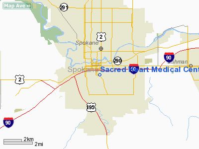
Sacred Heart Medical Center Helistop Heliport |
Location & QuickFacts
| FAA Information Effective: | 2008-09-25 |
| Airport Identifier: | 05WA |
| Airport Status: | Operational |
| Longitude/Latitude: | 117-24-48.7640W/47-38-53.6100N
-117.413546/47.648225 (Estimated) |
| Elevation: | 2220 ft / 676.66 m (Estimated) |
| Land: | 0 acres |
| From nearest city: | 0 nautical miles N of Spokane, WA |
| Location: | Spokane County, WA |
| Magnetic Variation: | 19E (1985) |
Owner & Manager
| Ownership: | Privately owned |
| Owner: | Sacred Heart Medical Center |
| Address: | W 101 8th Ave Taf C-9
Spokane, WA 99220 |
| Phone number: | 509-455-3131 |
| Manager: | Gerald P Leahy |
| Address: | Spokane, Wa 99220
Spokane, WA 99204 |
| Phone number: | 509-455-3131 |
Airport Operations and Facilities
| Airport Use: | Private
MEDICAL USE. |
| Wind indicator: | Yes |
| Segmented Circle: | No |
| Control Tower: | No |
| Landing fee charge: | No |
| Sectional chart: | Seattle |
| Region: | ANM - Northwest Mountain |
| Boundary ARTCC: | ZSE - Seattle |
| Tie-in FSS: | SEA - Seattle |
| FSS on Airport: | No |
| FSS Toll Free: | 1-800-WX-BRIEF |
Airport Services
| Airframe Repair: | NONE |
| Power Plant Repair: | NONE |
Runway Information
Helipad H1
| Dimension: | 40 x 40 ft / 12.2 x 12.2 m |
| Surface: | CONC, |
| |
Runway H1 |
Runway |
| Elevation: | 2220.00 ft | 0.00 ft |
| Traffic Pattern: | Right | Left |
|
Radio Navigation Aids
| ID |
Type |
Name |
Ch |
Freq |
Var |
Dist |
| SFF | NDB | Felts | | 365.00 | 19E | 4.7 nm |
| DPY | NDB | Deer Park | | 216.00 | 19E | 19.2 nm |
| SKA | TACAN | Fairchild | 051X | | 19E | 10.3 nm |
| COE | VOR/DME | Coeur D'alene | 025X | 108.80 | 19E | 25.1 nm |
| GEG | VORTAC | Spokane | 102X | 115.50 | 21E | 10.0 nm |
| SFF | VOT | Spokane/felts Field | | 114.00 | | 4.3 nm |
| GEG | VOT | Spokane Intl | | 109.60 | | 5.4 nm |
Images and information placed above are from
http://www.airport-data.com/airport/05WA/
We thank them for the data!
| General Info
|
| Country |
United States
|
| State |
WASHINGTON
|
| FAA ID |
05WA
|
| Latitude |
47-38-53.610N
|
| Longitude |
117-24-48.764W
|
| Elevation |
2220 feet
|
| Near City |
SPOKANE
|
We don't guarantee the information is fresh and accurate. The data may
be wrong or outdated.
For more up-to-date information please refer to other sources.
|
|


