 |
|
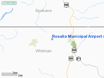
Location & QuickFacts
| FAA Information Effective: | 2008-09-25 |
| Airport Identifier: | 72S |
| Airport Status: | Operational |
| Longitude/Latitude: | 117-25-16.6940W/47-14-11.6530N
-117.421304/47.236570 (Estimated) |
| Elevation: | 2169 ft / 661.11 m (Estimated) |
| Land: | 27 acres |
| From nearest city: | 2 nautical miles W of Rosalia, WA |
| Location: | Whitman County, WA |
| Magnetic Variation: | 19E (1985) |
Owner & Manager
| Ownership: | Publicly owned |
| Owner: | Town Of Rosalia |
| Address: | Box 277
Rosalia, WA 99170 |
| Phone number: | 509-523-5991 |
| Manager: | Glen Myers |
| Address: | 2771 Squaw Road
Rosalia, WA 99170 |
| Phone number: | 509-523-3498 |
Airport Operations and Facilities
| Airport Use: | Open to public |
| Wind indicator: | Yes |
| Segmented Circle: | Yes |
| Control Tower: | No |
| Lighting Schedule: | DUSK-DAWN
ACTVT MIRL RY 02/20 FREQ 122.8. |
| Beacon Color: | Clear-Green (lighted land airport) |
| Landing fee charge: | No |
| Sectional chart: | Seattle |
| Region: | ANM - Northwest Mountain |
| Boundary ARTCC: | ZSE - Seattle |
| Tie-in FSS: | SEA - Seattle |
| FSS on Airport: | No |
| FSS Toll Free: | 1-800-WX-BRIEF |
| NOTAMs Facility: | SEA (NOTAM-d service avaliable) |
| Federal Agreements: | N |
Airport Communications
Airport Services
Runway Information
Runway 02/20
| Dimension: | 2800 x 45 ft / 853.4 x 13.7 m |
| Surface: | ASPH, Good Condition |
| Edge Lights: | Medium
TAXIWAY REFLECTORS - NO TAXIWAY LGTS. |
| |
Runway 02 |
Runway 20 |
| Longitude: | 117-25-29.6860W | 117-25-04.2400W |
| Latitude: | 47-14-00.8890N | 47-14-22.4170N |
| Elevation: | 2169.00 ft | 2159.00 ft |
| Alignment: | 39 | 127 |
| Traffic Pattern: | Left | Left |
| Markings: | Numbers only, Good Condition | Numbers only, Good Condition |
| VASI: | | 2-light PAPI on left side |
| Visual Glide Angle: | 0.00° | 4.50° |
| Obstruction: | 66 ft tree, 1274.0 ft from runway, 39 ft right of centerline, 16:1 slope to clear
3' BARBED WIRE FENCE 134' FROM RUNWAY O2 END. | 13 ft road, 238.0 ft from runway, 2:1 slope to clear |
|
Radio Navigation Aids
| ID |
Type |
Name |
Ch |
Freq |
Var |
Dist |
| SFF | NDB | Felts | | 365.00 | 19E | 27.4 nm |
| DPY | NDB | Deer Park | | 216.00 | 19E | 43.9 nm |
| SKA | TACAN | Fairchild | 051X | | 19E | 24.5 nm |
| PUW | VOR/DME | Pullman | 027X | 109.00 | 20E | 34.8 nm |
| COE | VOR/DME | Coeur D'alene | 025X | 108.80 | 19E | 40.5 nm |
| GEG | VORTAC | Spokane | 102X | 115.50 | 21E | 21.4 nm |
| GEG | VOT | Spokane Intl | | 109.60 | | 23.7 nm |
| SFF | VOT | Spokane/felts Field | | 114.00 | | 27.0 nm |
Remarks
- BCN OTS INDEFLY.
- ESTABD PRIOR TO 1959.
Images and information placed above are from
http://www.airport-data.com/airport/72S/
We thank them for the data!
| General Info
|
| Country |
United States
|
| State |
WASHINGTON
|
| FAA ID |
72S
|
| Latitude |
47-14-12.616N
|
| Longitude |
117-25-15.688W
|
| Elevation |
2170 feet
|
| Near City |
ROSALIA
|
We don't guarantee the information is fresh and accurate. The data may
be wrong or outdated.
For more up-to-date information please refer to other sources.
|
|


