|
|
| Renton Municipal Airport |
 |
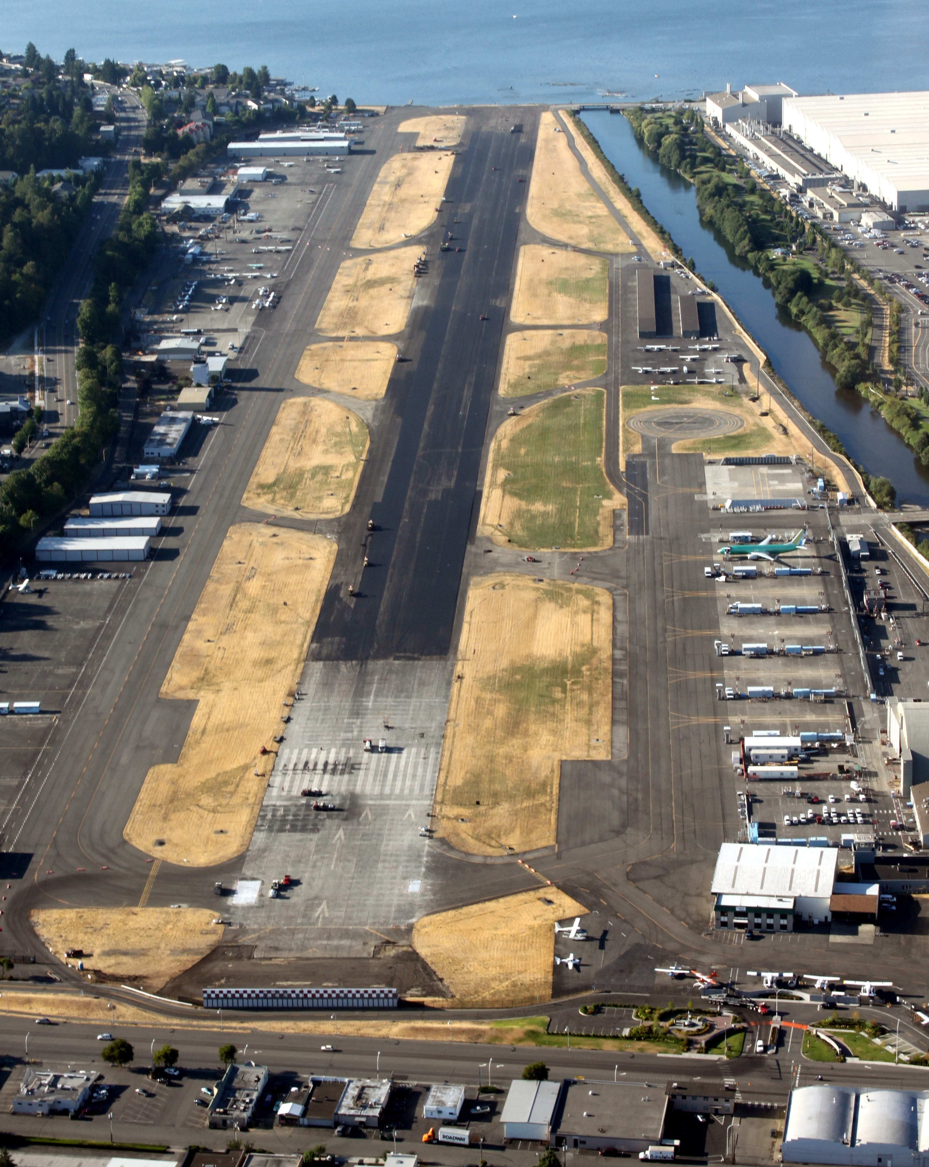
| Renton Airport during a runway resurfacing project in August of 2009 |
| IATA: RNT – ICAO: KRNT |
| Summary |
| Airport type |
Public |
| Operator |
City of Renton |
| Location |
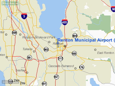
Renton, Washington |
| Elevation AMSL |
32 ft / 9.7 m |
| Coordinates |
47°29′32.77″N 122°12′55.33″W / 47.4924361°N 122.2153694°W / 47.4924361; -122.2153694Coordinates: 47°29′32.77″N 122°12′55.33″W / 47.4924361°N 122.2153694°W / 47.4924361; -122.2153694 |
| Runways |
| Direction |
Length |
Surface |
| ft |
m |
| 16/34 |
5,382 |
1,640 |
Asphalt/Concrete |

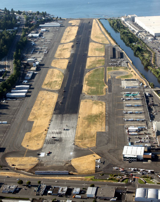
Runway layout at Renton Airport
|
Aerial view showing airport and adjacent Boeing Renton Factory (large structures) Renton Municipal Airport (renamed Clayton Scott Field in 2005 to celebrate the 100th birthday of Clayton Scott) (IATA: RNT, ICAO: KRNT) is located in Renton, Washington, USA. It has a single paved runway, 16/34, which is roughly 5,400' (1,640 m) long. The runway was resurfaced and realigned in August of 2009; prior to this time, the runway was designated 15/33 .
The airport's northern boundary is Lake Washington and the Will Rogers - Wiley Post Memorial Seaplane Base. Renton Airport has a floating dock and a launching ramp for conversion from wheeled landings to water takeoffs and landings.
Renton Airport is colocated with the Boeing Renton Factory that manufactures 737s and formerly 757s.
The above content comes from Wikipedia and is published under free licenses – click here to read more.
Location & QuickFacts
| FAA Information Effective: | 2008-09-25 |
| Airport Identifier: | RNT |
| Airport Status: | Operational |
| Longitude/Latitude: | 122-12-56.7000W/47-29-35.3000N
-122.215750/47.493139 (Estimated) |
| Elevation: | 32 ft / 9.75 m (Surveyed) |
| Land: | 170 acres |
| From nearest city: | 0 nautical miles NW of Renton, WA |
| Location: | King County, WA |
| Magnetic Variation: | 20E (1990) |
Owner & Manager
| Ownership: | Publicly owned |
| Owner: | City Of Renton |
| Address: | 1055 South Grady Way
Renton, WA 98055 |
| Phone number: | 425-430-6400 |
| Manager: | Ryan Zulauf |
| Address: | 616 West Perimeter Road, Unit - A
Renton, WA 98055
AIRPORT MANAGER'S OFFICE IN AIR TRAFFIC CONTROL TOWER. |
| Phone number: | 425-430-7471 |
Airport Operations and Facilities
| Airport Use: | Open to public |
| Wind indicator: | Yes |
| Segmented Circle: | No |
| Control Tower: | Yes |
| Lighting Schedule: | DUSK-DAWN
ACTVT MIRL RY 15/33, REIL RYS 15 & 33 AND TWY LGTS - CTAF. |
| Beacon Color: | Clear-Green (lighted land airport) |
| Landing fee charge: | No |
| Sectional chart: | Seattle |
| Region: | ANM - Northwest Mountain |
| Traffic Pattern Alt: | 1000 ft |
| Boundary ARTCC: | ZSE - Seattle |
| Tie-in FSS: | SEA - Seattle |
| FSS on Airport: | No |
| FSS Toll Free: | 1-800-WX-BRIEF |
| NOTAMs Facility: | RNT (NOTAM-d service avaliable) |
| Federal Agreements: | NGPY |
Airport Communications
| CTAF: | 124.700 |
| Unicom: | 122.950
ACFT REQUIRING SVCS CTC 122.85 OR 122.95. |
Airport Services
| Fuel available: | 100LLA1+ |
| Airframe Repair: | MAJOR |
| Power Plant Repair: | MAJOR |
| Bottled Oxygen: | NONE |
| Bulk Oxygen: | HIGH/LOW |
Runway Information
Runway 15/33
| Dimension: | 5382 x 200 ft / 1640.4 x 61.0 m |
| Surface: | ASPH-CONC, Good Condition |
| Weight Limit: | Single wheel: 100000 lbs.
Dual wheel: 130000 lbs.
Dual tandem wheel: 340000 lbs. |
| Edge Lights: | Non-standard lighting system
NSTD MIRL; 340 FT SE END UNLIT. |
| |
Runway 15 |
Runway 33 |
| Longitude: | 122-13-00.6744W | 122-12-52.6766W |
| Latitude: | 47-30-01.7032N | 47-29-08.8602N |
| Elevation: | 24.00 ft | 32.00 ft |
| Alignment: | 127 | 127 |
| Traffic Pattern: | Left | Right |
| Markings: | Non-precision instrument, Fair Condition | Non-precision instrument, Fair Condition |
| Crossing Height: | 50.00 ft | 59.00 ft |
| Displaced threshold: | 300.00 ft | 340.00 ft |
| VASI: | 2-light PAPI on left side | 2-light PAPI on left side |
| Visual Glide Angle: | 3.00° | 3.75° |
| Runway End Identifier: | Yes | Yes |
| Obstruction: | 290 ft trees, 10000.0 ft from runway, 33:1 slope to clear
10,000' FM THR. | 15 ft road, 200.0 ft from runway
APCH RATIO 13:1 AT DSPLCD THLD TO TREE AT 1323 FT, 442 FT L OF CTRLN; 17:1 AT DSPLCD THLD TO TREE AT 933 FT, 180 FT L OF CTRLN; 26:1 TO 20 FT BLAST FENCE 530 FT FM DSPLCD THLD.
20' BLAST FENCE190', FROM END OF RWY. |
|
Radio Navigation Aids
| ID |
Type |
Name |
Ch |
Freq |
Var |
Dist |
| RNT | NDB | Renton | | 353.00 | 20E | 0.1 nm |
| ODD | NDB | Dondo | | 224.00 | 19E | 8.6 nm |
| PWT | NDB | Kitsap | | 206.00 | 20E | 22.0 nm |
| CAN | NDB | Carney | | 274.00 | 20E | 25.8 nm |
| GR | NDB | Graye | | 216.00 | 18E | 26.0 nm |
| LAC | NDB | Lacomas | | 328.00 | 18E | 32.3 nm |
| MNC | NDB | Mason County | | 348.00 | 19E | 38.4 nm |
| PAE | VOR/DME | Paine | 043X | 110.60 | 20E | 25.8 nm |
| CVV | VOR/DME | Penn Cove | 119X | 117.20 | 19E | 49.6 nm |
| SEA | VORTAC | Seattle | 115X | 116.80 | 19E | 5.2 nm |
| TCM | VORTAC | Mcchord | 033X | 109.60 | 22E | 23.3 nm |
| OLM | VORTAC | Olympia | 081X | 113.40 | 19E | 42.0 nm |
| BFI | VOT | Boeing Field | | 108.60 | | 4.1 nm |
| SEA | VOT | Seattle-tacoma | | 117.50 | | 4.6 nm |
Remarks
-
- WEST TWY CLSD TO ACFT WITH WING SPAN 118 FT OR OVER.
- OBSTRUCTIONS EVALUATED THROUGH PHOTOSCOPE PROCESS.
- FLIGHT NOTIFICATION SERVICE (ADCUS) AVBL.
- BE ALERT FOR BOEING PRODUCTION ACFT BEING TOWED ACROSS THE RY DURG HRS ATCT CLOSED.
- NOISE ABATEMENT PROCEDURES IN EFFECT CTC AMGR 425-430-7471.
- SEAPLANE BASE NW CORNER ARPT.
- ESTABD PRIOR TO 1959.
Images and information placed above are from
http://www.airport-data.com/airport/RNT/
We thank them for the data!
| General Info
|
| Country |
United States
|
| State |
WASHINGTON
|
| FAA ID |
RNT
|
| Latitude |
47-29-35.300N
|
| Longitude |
122-12-56.700W
|
| Elevation |
32 feet
|
| Near City |
RENTON
|
We don't guarantee the information is fresh and accurate. The data may
be wrong or outdated.
For more up-to-date information please refer to other sources.
|
|