 |
|
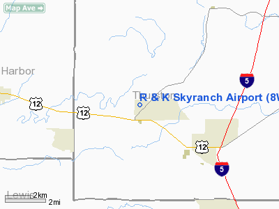
Location & QuickFacts
| FAA Information Effective: | 2008-09-25 |
| Airport Identifier: | 8W9 |
| Airport Status: | Operational |
| Longitude/Latitude: | 123-05-29.1070W/46-49-57.6580N
-123.091419/46.832683 (Estimated) |
| Elevation: | 149 ft / 45.42 m (Surveyed) |
| Land: | 64 acres |
| From nearest city: | 1 nautical miles N of Rochester, WA |
| Location: | Thurston County, WA |
| Magnetic Variation: | 20E (1985) |
Owner & Manager
| Ownership: | Privately owned |
| Owner: | Robert L Hugo |
| Address: | 10011 173rd Ave Sw
Rochester, WA 98579 |
| Phone number: | 360-273-9893 |
| Manager: | Robert L Hugo |
| Address: | 10011 173rd Ave Sw
Rochester, WA 98579 |
| Phone number: | 360-273-9893 |
Airport Operations and Facilities
| Airport Use: | Open to public |
| Wind indicator: | Yes |
| Segmented Circle: | No |
| Control Tower: | No |
| Landing fee charge: | Yes |
| Sectional chart: | Seattle |
| Region: | ANM - Northwest Mountain |
| Traffic Pattern Alt: | 850 ft |
| Boundary ARTCC: | ZSE - Seattle |
| Tie-in FSS: | SEA - Seattle |
| FSS on Airport: | No |
| FSS Toll Free: | 1-800-WX-BRIEF |
| NOTAMs Facility: | SEA (NOTAM-d service avaliable) |
Airport Communications
| CTAF: | 123.000 |
| Unicom: | 123.000 |
Airport Services
| Airframe Repair: | NONE |
| Power Plant Repair: | NONE |
| Bottled Oxygen: | NONE |
| Bulk Oxygen: | NONE |
Runway Information
Runway 16/34
| Dimension: | 2480 x 35 ft / 755.9 x 10.7 m |
| Surface: | TURF, Good Condition |
| |
Runway 16 |
Runway 34 |
| Traffic Pattern: | Left | Left |
| Displaced threshold: | 700.00 ft | 327.00 ft |
| Obstruction: | 92 ft trees
APCH SLOPE 7:1 TO DSPLCD THR. | 4 ft fence, 0.0 ft from runway, 17 ft right of centerline
APCH SLOPE 50:1 TO DSPLCD THR. |
|
Runway 18/36
| Dimension: | 2750 x 45 ft / 838.2 x 13.7 m |
| Surface: | TURF, Good Condition |
| |
Runway 18 |
Runway 36 |
| Traffic Pattern: | Left | Left |
| Displaced threshold: | 575.00 ft | 300.00 ft |
| Obstruction: | 40 ft pline
APCH SLOPE 14:1 TO DSPLCD THR. | 4 ft fence, 0.0 ft from runway
APCH SLOPE 50:1 TO DSPLCD THR. |
|
Radio Navigation Aids
| ID |
Type |
Name |
Ch |
Freq |
Var |
Dist |
| TDO | NDB | Toledo | | 219.00 | 20E | 24.2 nm |
| LAC | NDB | Lacomas | | 328.00 | 18E | 24.4 nm |
| MNC | NDB | Mason County | | 348.00 | 19E | 25.0 nm |
| GR | NDB | Graye | | 216.00 | 18E | 27.6 nm |
| CAN | NDB | Carney | | 274.00 | 20E | 36.2 nm |
| LSO | NDB | Kelso | | 256.00 | 21E | 41.4 nm |
| PWT | NDB | Kitsap | | 206.00 | 20E | 41.9 nm |
| ODD | NDB | Dondo | | 224.00 | 19E | 45.2 nm |
| PEN | NDB | Karpen | | 201.00 | 20E | 46.4 nm |
| OLM | VORTAC | Olympia | 081X | 113.40 | 19E | 11.4 nm |
| TCM | VORTAC | Mcchord | 033X | 109.60 | 22E | 31.6 nm |
| HQM | VORTAC | Hoquiam | 124X | 117.70 | 19E | 44.0 nm |
| SEA | VORTAC | Seattle | 115X | 116.80 | 19E | 48.3 nm |
| SEA | VOT | Seattle-tacoma | | 117.50 | | 48.8 nm |
Remarks
- NO TOUCH AND GO LANDINGS.
- ARPT CLSD SUNDAYS.
- RWY 16 FIRST 1,100 FT HAS SHRUBS & 70 FT+ TREES APPROX 15 FT FM RY EDGES.
- PRVDD RWY 18 THR DSPLCD TO PRVD OBSTN FREE 20:1 APCH SFC OVER PLINE & TREES N OF RWY; & PRVDD PLINE LCTD 10' N OF RWY 18 END IS OBSTN MKD & LGTD IAW AC70/7460-1E; & PRVDD RWY 36 THR DSPLCD TO PRVD OBSTN FREE 20:1 APCH SFC & OBSTN FREE PRIMARY SFC.
Images and information placed above are from
http://www.airport-data.com/airport/8W9/
We thank them for the data!
| General Info
|
| Country |
United States
|
| State |
WASHINGTON
|
| FAA ID |
8W9
|
| Latitude |
46-49-57.658N
|
| Longitude |
123-05-29.107W
|
| Elevation |
149 feet
|
| Near City |
ROCHESTER
|
We don't guarantee the information is fresh and accurate. The data may
be wrong or outdated.
For more up-to-date information please refer to other sources.
|
|


