 |
|
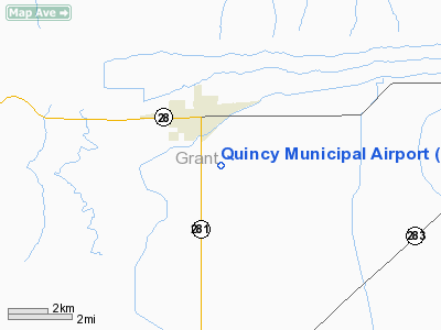
Location & QuickFacts
| FAA Information Effective: | 2008-09-25 |
| Airport Identifier: | 80T |
| Airport Status: | Operational |
| Longitude/Latitude: | 119-50-23.4000W/47-12-41.8000N
-119.839833/47.211611 (Estimated) |
| Elevation: | 1271 ft / 387.40 m (Surveyed) |
| Land: | 38 acres |
| From nearest city: | 2 nautical miles SE of Quincy, WA |
| Location: | Grant County, WA |
| Magnetic Variation: | 20E (1985) |
Owner & Manager
| Ownership: | Publicly owned |
| Owner: | City Of Quincy
LESSOR: QUINCY PORT DISTRICT. |
| Address: | 202 G Street Se
Quincy, WA 98848 |
| Phone number: | 509-787-3705 |
| Manager: | Pat Connelly |
| Address: | Port Of Quincy, 202 G Street Se
Quincy, WA 98848 |
| Phone number: | 509-787-3715 |
Airport Operations and Facilities
| Airport Use: | Open to public |
| Wind indicator: | Yes |
| Segmented Circle: | No |
| Control Tower: | No |
| Lighting Schedule: | DUSK-DAWN |
| Beacon Color: | Clear-Green (lighted land airport) |
| Landing fee charge: | No |
| Sectional chart: | Seattle |
| Region: | ANM - Northwest Mountain |
| Boundary ARTCC: | ZSE - Seattle |
| Tie-in FSS: | SEA - Seattle |
| FSS on Airport: | No |
| FSS Toll Free: | 1-800-WX-BRIEF |
| NOTAMs Facility: | SEA (NOTAM-d service avaliable) |
Airport Communications
Airport Services
| Airframe Repair: | NONE |
| Power Plant Repair: | NONE |
| Bottled Oxygen: | NONE |
| Bulk Oxygen: | NONE |
Runway Information
Runway 09/27
| Dimension: | 3660 x 50 ft / 1115.6 x 15.2 m |
| Surface: | ASPH, Good Condition |
| Edge Lights: | Medium |
| |
Runway 09 |
Runway 27 |
| Longitude: | 119-50-48.8501W | 119-49-57.9372W |
| Latitude: | 47-12-46.7936N | 47-12-36.7264N |
| Elevation: | 1271.00 ft | 1260.00 ft |
| Alignment: | 106 | 127 |
| Traffic Pattern: | Left | Left |
| Markings: | Basic, Good Condition | Basic, Good Condition |
| Crossing Height: | 0.00 ft | 100.00 ft |
| VASI: | | 2-light PAPI on right side
PAPI RY 27 OTS INDEFLY. |
| Visual Glide Angle: | 0.00° | 3.00° |
| Centerline Lights: | Yes | Yes |
| Obstruction: | 18 ft road, 234.0 ft from runway, 48 ft left of centerline, 1:1 slope to clear
RWY 09 +19FT RD 0-200 FT. | 18 ft road, 224.0 ft from runway, 1:1 slope to clear
RWY 27 +4 FT FENCE AT 145 FT. |
|
Radio Navigation Aids
| ID |
Type |
Name |
Ch |
Freq |
Var |
Dist |
| EAT | FAN MARKER | Malaga | | | 21E | 15.1 nm |
| MW | NDB | Pelly | | 408.00 | 18E | 23.8 nm |
| EAT | VOR/DME | Wenatchee | 047X | 111.00 | 19E | 18.9 nm |
| MWH | VOR/DME | Moses Lake | 097X | 115.00 | 18E | 21.4 nm |
| EPH | VORTAC | Ephrata | 073X | 112.60 | 21E | 19.7 nm |
| ELN | VORTAC | Ellensburg | 126X | 117.90 | 21E | 27.7 nm |
| YKM | VORTAC | Yakima | 107X | 116.00 | 21E | 45.9 nm |
Remarks
- GRVL ROADS CROSS RY 27 2175' FM APCH END WHERE DITCHES PASS UNDER RY.
- BRUSH, ROADS, FENCES AND -20' DITCHES IN PRIM SFC.
- TWYS MARKED WITH REFLECTIVE DEVICES.
Images and information placed above are from
http://www.airport-data.com/airport/80T/
We thank them for the data!
| General Info
|
| Country |
United States
|
| State |
WASHINGTON
|
| FAA ID |
80T
|
| Latitude |
47-12-41.800N
|
| Longitude |
119-50-23.400W
|
| Elevation |
1271 feet
|
| Near City |
QUINCY
|
We don't guarantee the information is fresh and accurate. The data may
be wrong or outdated.
For more up-to-date information please refer to other sources.
|
|


