 |
|
Coordinates: 47°56′12″N 124°33′45″W / 47.93667°N 124.5625°W / 47.93667; -124.5625
| Quillayute Airport |
| IATA: UIL – ICAO: KUIL – FAA LID: UIL |
| Summary |
| Airport type |
Public |
| Owner |
City of Forks |
| Serves |
Forks, Washington |
| Location |
Quillayute, Washington |
| Elevation AMSL |
194 ft / 59 m |
| Runways |
| Direction |
Length |
Surface |
| ft |
m |
| 4/22 |
4,210 |
1,283 |
Concrete |
| Statistics (2006) |
| Aircraft operations |
6,700 |
| Source: Federal Aviation Administration |
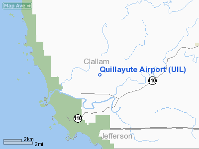
Quillayute Airport (IATA: UIL, ICAO: KUIL, FAA LID: UIL), formerly known as Quillayute State Airport, is a public airport located approximately 10 miles (16 km) west of the city of Forks, in Clallam County, Washington, United States. It is owned by the City of Forks. This former Naval Auxiliary Air Station was deeded to the City of Forks by the Washington State Department of Transportation in 1999.
Facilities and aircraft
Quillayute Airport covers an area of 739 acres (299 ha). For the 12-month period ending December 31, 2006, the airport had 6,700 aircraft operations: 97% general aviation and 3% military.
The airport has two concrete runways, each one close to 5,000 feet (1,500 m) long. Runway 12/30 is closed (the north-south runway). Runway 4/22 is open with a displaced threshold of 1,089 feet (332 m). In the Master Planning effort currently underway, it is the intent, in the long-term plan, to remove the displacement on runway 4/22 in the future, and reopen runway 12/30 at a shortened length.
The above content comes from Wikipedia and is published under free licenses – click here to read more.
Location & QuickFacts
| FAA Information Effective: | 2008-09-25 |
| Airport Identifier: | UIL |
| Airport Status: | Operational |
| Longitude/Latitude: | 124-33-45.4810W/47-56-11.7000N
-124.562634/47.936583 (Estimated) |
| Elevation: | 194 ft / 59.13 m (Surveyed) |
| Land: | 739 acres |
| From nearest city: | 1 nautical miles SW of Quillayute, WA |
| Location: | Clallam County, WA |
| Magnetic Variation: | 21E (1985) |
Owner & Manager
| Ownership: | Publicly owned |
| Owner: | City Of Forks |
| Address: | 500 East Civision St.
Forks, WA 98331 |
| Phone number: | 360-374-5412
EXT 245. |
| Manager: | Rod Fleck |
| Address: | 500 East Division St.
Forks, WA 98331 |
| Phone number: | 360-374-5412 |
Airport Operations and Facilities
| Airport Use: | Open to public |
| Wind indicator: | Yes |
| Control Tower: | No |
| Landing fee charge: | No |
| Sectional chart: | Seattle |
| Region: | ANM - Northwest Mountain |
| Boundary ARTCC: | ZSE - Seattle |
| Tie-in FSS: | SEA - Seattle |
| FSS on Airport: | No |
| FSS Toll Free: | 1-800-WX-BRIEF |
| NOTAMs Facility: | UIL (NOTAM-d service avaliable) |
| Federal Agreements: | NP |
Airport Communications
Airport Services
| Airframe Repair: | NONE |
| Power Plant Repair: | NONE |
| Bottled Oxygen: | NONE |
| Bulk Oxygen: | NONE |
Runway Information
Runway 04/22
| Dimension: | 4210 x 100 ft / 1283.2 x 30.5 m |
| Surface: | CONC, Good Condition |
| Weight Limit: | Single wheel: 30000 lbs.
Dual wheel: 50000 lbs. |
| |
Runway 04 |
Runway 22 |
| Longitude: | 124-34-11.7980W | 124-33-19.1621W |
| Latitude: | 47-56-00.7980N | 47-56-22.6008N |
| Elevation: | 175.00 ft | 193.00 ft |
| Alignment: | 58 | 127 |
| Traffic Pattern: | Left | Left |
| Markings: | Basic, | Nonstandard, Poor Condition
RY 22 MKGS FADED. |
| Displaced threshold: | 0.00 ft | 800.00 ft |
| Obstruction: | 15 ft trees, 830.0 ft from runway, 42:1 slope to clear | 77 ft trees, 1539.0 ft from runway, 200 ft right of centerline, 17:1 slope to clear
RWY 22 APCH SLOPE 0:1 FRM DSPLCD THR TO 6' BRUSH 200', 102' R.
RWY 22 +6-10 FT BRUSH 0 FT. |
|
Radio Navigation Aids
| ID |
Type |
Name |
Ch |
Freq |
Var |
Dist |
| CL | NDB | Elwha | | 515.00 | 22E | 38.1 nm |
| TOU | VORTAC | Tatoosh | 059X | 112.20 | 22E | 22.0 nm |
Remarks
- PEDESTRIANS; VEHICLES & ANIMALS ON & INVOF RY.
- 4 FT SQUARE GRATED DRAIN ON N SIDE OF APRON.
- ESTABD PRIOR 1959.
Images and information placed above are from
http://www.airport-data.com/airport/UIL/
We thank them for the data!
| General Info
|
| Country |
United States
|
| State |
WASHINGTON
|
| FAA ID |
UIL
|
| Latitude |
47-56-13.720N
|
| Longitude |
124-33-40.499W
|
| Elevation |
194 feet
|
| Near City |
QUILLAYUTE
|
We don't guarantee the information is fresh and accurate. The data may
be wrong or outdated.
For more up-to-date information please refer to other sources.
|
|


