|
|
Pullman/moscow Rgnl Airport |
| Pullman-Moscow Regional Airport |
| IATA: PUW – ICAO: KPUW – FAA LID: PUW |
| Summary |
| Airport type |
Public |
| Owner |
Pullman Moscow
Regional Airport Board |
| Serves |
Pullman, Washington
Moscow, Idaho
United States |
| Elevation AMSL |
2556 ft / 779 m |
| Coordinates |
46°44′38″N 117°06′34″W / 46.74389°N 117.10944°W / 46.74389; -117.10944 |
| Website |
pullman-wa.gov/airport/ |
| Runways |
| Direction |
Length |
Surface |
| ft |
m |
| 5/23 |
6730 |
2051 |
Asphalt |
| Statistics (2008) |
| Aircraft operations |
29,350 |
| Based aircraft |
71 |
| Source: Federal Aviation Administration |
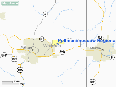
Pullman-Moscow Regional Airport (IATA: PUW, ICAO: KPUW, FAA LID: PUW) is a public airport located in Whitman County in the U.S. state of Washington, two miles (3 km) east of Pullman and four miles west (6.4 km) of Moscow, Idaho. The airport is accessed from spurs from State Route 270, and has a single 6730 foot (2051 m) runway, headed northeast/southwest.
The rural airport in the Palouse region is the primary air link for its two land-grant universities, Washington State University in Pullman and the University of Idaho in Moscow. Both universities use the airport for jet charters from Frontier Airlines and Allegiant Air for their intercollegiate athletic teams. Horizon Air is the sole commercial airline serving the airport, flying Bombardier Q400 turboprop aircraft.
Routes are shared by Lewiston, Idaho, and Pullman through reversing circular routes that continue to the Sea-Tac hub south of Seattle, as well as direct flights to Boise, with stops in Lewiston.
Seattle air traffic control, 250 miles (400 km) west, manages commercial traffic for the airport. The nearest major airport is Spokane International, 90 miles (145 km ) north. Facilities and aircraft
Pullman-Moscow Regional Airport covers an area of 467 acres (1.89 km²) at an elevation of 2556 feet (779 m) above sea level. It has one asphalt paved runway designated 5/23, which measures 6730 x 100 feet (2051 x 30 m).
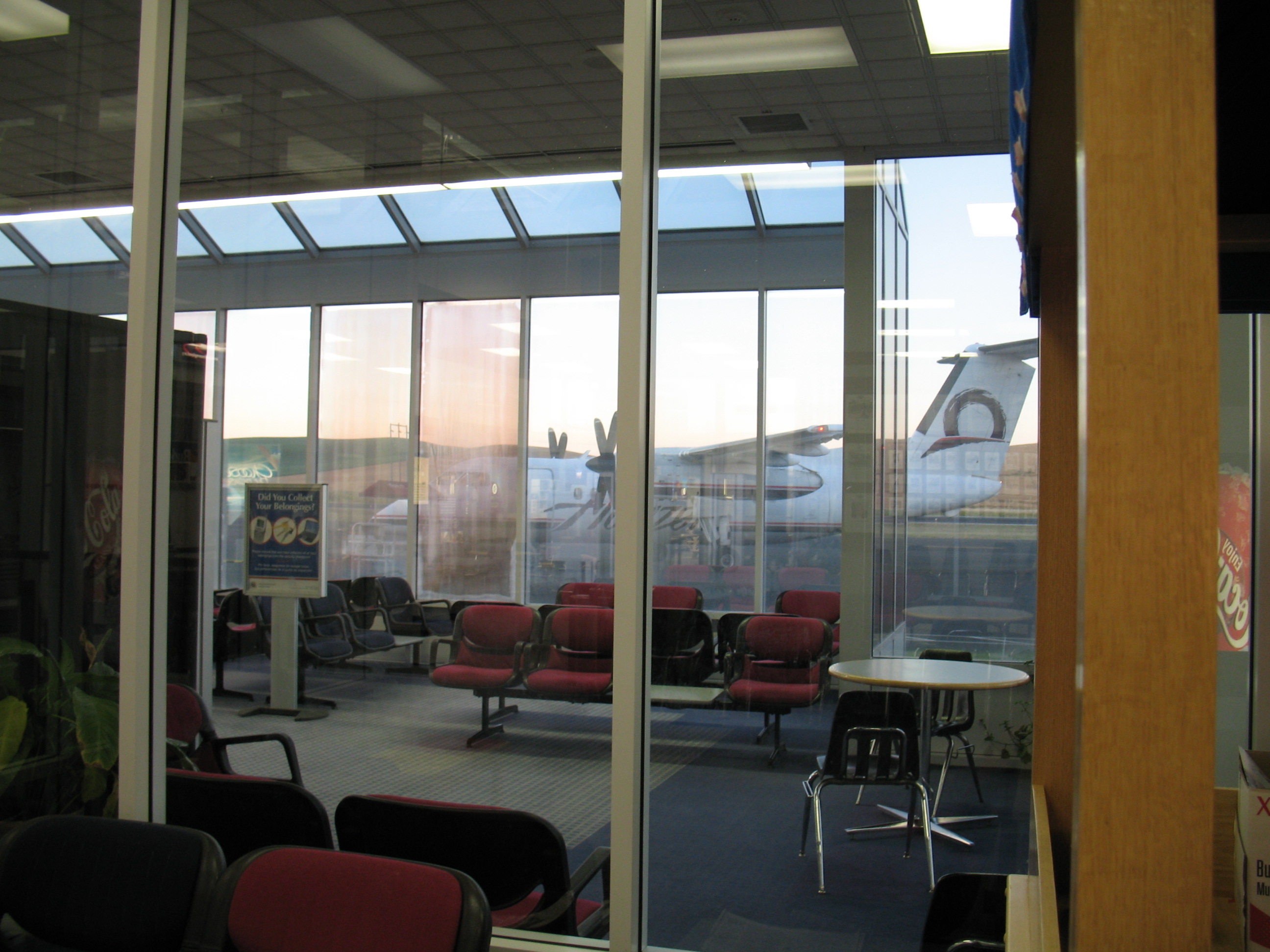
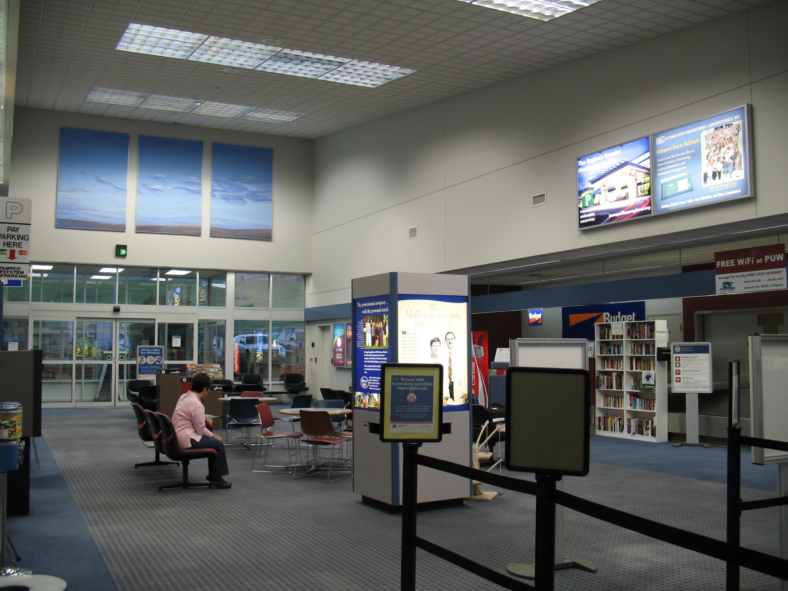
The modest commercial terminal is a single large room, divided between pre- and post-security areas by a single security checkpoint and glass walls. The waiting area occupies all space beyond the checkpoint, but is not commonly used for waiting, as most passengers pass through the security checkpoint immediately before boarding. Both passenger gates are ground-level doors to the tarmac; passengers board via the fold-down aircraft-door stairs, or airstairs (for larger charter aircraft).
 | |
The post-security waiting area at PUW. |
Gate 1 on the east side of the terminal is used by Horizon Air. A cat named "Dash" occupies the airport, and freely roams through the security checkpoint.
The public airport shares the runway with a fixed base operator, Interstate Aviation, which conducts chartered air service. Several hangars are available for private jet aircraft, most notably those of Edmund Schweitzer, founder of the local Schweitzer Engineering Laboratories in Pullman.
For the 12-month period ending April 30, 2008, the airport had 29,350 aircraft operations, an average of 80 per day: 85% general aviation, 14% scheduled commercial, 1% air taxi and <1% military.
At that time there were 71 aircraft based at this airport: 85% single-engine, 10% multi-engine,
4% jet and 1% glider.
Airlines and destinations
 | |
Interior of main terminal. |
| Airlines |
Destinations |
| Horizon Air |
Boise, Lewiston, Seattle-Tacoma, Spokane |
The above content comes from Wikipedia and is published under free licenses – click here to read more.
Location & QuickFacts
| FAA Information Effective: | 2008-09-25 |
| Airport Identifier: | PUW |
| Airport Status: | Operational |
| Longitude/Latitude: | 117-06-34.5000W/46-44-37.9000N
-117.109583/46.743861 (Estimated) |
| Elevation: | 2556 ft / 779.07 m (Surveyed) |
| Land: | 467 acres |
| From nearest city: | 3 nautical miles NE of Pullman/moscow,id, WA |
| Location: | Whitman County, WA |
| Magnetic Variation: | 19E (1975) |
Owner & Manager
| Ownership: | Publicly owned |
| Owner: | Pullman Moscow Rgl Arpt Board |
| Address: | 3200 Airport Complex N
Pullman, WA 99163 |
| Phone number: | 509-338-3223 |
| Manager: | Robb Parish |
| Address: | 3200 Airport Complex N
Pullman, WA 99163 |
| Phone number: | 509-338-3223 |
Airport Operations and Facilities
| Airport Use: | Open to public |
| Wind indicator: | Yes |
| Segmented Circle: | Yes |
| Control Tower: | No |
| Lighting Schedule: | DUSK-DAWN
ACTVT HIRL RY 05/23 & REIL RYS 05 & 23 - CTAF. |
| Beacon Color: | Clear-Green (lighted land airport) |
| Landing fee charge: | Yes
LANDING FEE FOR ALL COMMERCIAL AIRCRAFT. |
| Sectional chart: | Seattle |
| Region: | ANM - Northwest Mountain |
| Boundary ARTCC: | ZSE - Seattle |
| Tie-in FSS: | SEA - Seattle |
| FSS on Airport: | No |
| FSS Toll Free: | 1-800-WX-BRIEF |
| NOTAMs Facility: | PUW (NOTAM-d service avaliable) |
| Certification type/date: | I A S 05/1973
CLSD TO UNSKED ACR OPNS WITH MORE THAN 30 PSGR SEATS EXCP PPR CALL AMGR 509-338-3223. |
| Federal Agreements: | NGY |
Airport Communications
| CTAF: | 122.800 |
| Unicom: | 122.800 |
Airport Services
| Fuel available: | 100LLA |
| Airframe Repair: | MAJOR |
| Power Plant Repair: | MAJOR |
| Bottled Oxygen: | NONE |
| Bulk Oxygen: | NONE |
Runway Information
Runway 05/23
| Dimension: | 6730 x 100 ft / 2051.3 x 30.5 m |
| Surface: | ASPH, Good Condition |
| Surface Treatment: | Saw-cut or plastic Grooved |
| Weight Limit: | Single wheel: 57000 lbs.
Dual wheel: 75000 lbs.
Dual tandem wheel: 135000 lbs. |
| Edge Lights: | High |
| |
Runway 05 |
Runway 23 |
| Longitude: | 117-07-19.9373W | 117-05-49.0812W |
| Latitude: | 46-44-26.5906N | 46-44-49.1820N |
| Elevation: | 2541.00 ft | 2555.00 ft |
| Alignment: | 70 | 127 |
| Traffic Pattern: | Left | Left |
| Markings: | Non-precision instrument, Good Condition | Precision instrument, Good Condition |
| Crossing Height: | 55.00 ft | 60.00 ft |
| Displaced threshold: | 290.00 ft | 801.00 ft |
| VASI: | 2-light PAPI on left side | 4-light PAPI on left side |
| Visual Glide Angle: | 3.00° | 4.00° |
| Runway End Identifier: | Yes | Yes |
| Obstruction: | 7 ft fence, 374.0 ft from runway, 253 ft left of centerline, 24:1 slope to clear | 29 ft gnd, 200.0 ft from runway, 250 ft left of centerline
+149' GND, DIST 4291', 116'L; APCH SLOPE 28:1 TO DSPLCD THR. +7 TO 29' GND, 0 TO 200' FM RY END, 250'L. |
| Decleard distances: | Take off run available 6730.00 ft
Take off distance available 6730.00 ft
Actual stop distance available 6490.00 ft
Landing distance available 6200.00 ft
| Take off run available 6730.00 ft
Take off distance available 6730.00 ft
Actual stop distance available 6040.00 ft
Landing distance available 5240.00 ft
|
|
Radio Navigation Aids
| ID |
Type |
Name |
Ch |
Freq |
Var |
Dist |
| PUW | VOR/DME | Pullman | 027X | 109.00 | 20E | 6.3 nm |
| MQG | VOR/DME | Nez Perce | 019X | 108.20 | 20E | 23.9 nm |
Remarks
- NON-PAVED AREAS SOFT. NO PARKING BTWEEN RWY AND TWY AND WITHIN 30' OF TWY TO THE NORTH WEST.
- NUMEROUS OBJECTS PENETRATE IMAGINARY SFCS JUST NORTH AND SOUTH OF RWY.
- AIRCRAFT MUST DELAY TAXING AND REMAIN BEHIND THE INTERMEDIATE HOLDING POSITION LINE WHEN LARGE AIRCRAFT OPERATIONS ARE IN PROGRESS.
Images and information placed above are from
http://www.airport-data.com/airport/PUW/
We thank them for the data!
| General Info
|
| Country |
United States
|
| State |
WASHINGTON
|
| FAA ID |
PUW
|
| Latitude |
46-44-37.900N
|
| Longitude |
117-06-34.500W
|
| Elevation |
2555 feet
|
| Near City |
PULLMAN/MOSCOW,ID
|
We don't guarantee the information is fresh and accurate. The data may
be wrong or outdated.
For more up-to-date information please refer to other sources.
|
|