 |
|
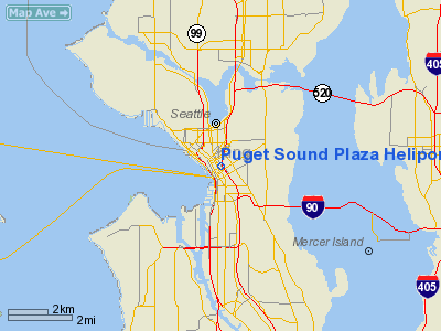
Puget Sound Plaza Heliport |
Location & QuickFacts
| FAA Information Effective: | 2008-09-25 |
| Airport Identifier: | 9WA6 |
| Airport Status: | Operational |
| Longitude/Latitude: | 122-19-54.4560W/47-36-29.3540N
-122.331793/47.608154 (Estimated) |
| Elevation: | 670 ft / 204.22 m (Estimated) |
| Land: | 0 acres |
| From nearest city: | 0 nautical miles W of Seattle, WA |
| Location: | King County, WA |
| Magnetic Variation: | 20E (1985) |
Owner & Manager
| Ownership: | Privately owned |
| Owner: | Univ Of Wash/univ Properties |
| Address: | 1325 4th Avenue
Seattle, WA 98107 |
| Manager: | John F. Schoettler |
| Address: | 1010 Unigard Financial Ct.
Seattle, WA 98161 |
| Phone number: | 206-628-5050 |
Airport Operations and Facilities
| Airport Use: | Private |
| Wind indicator: | No |
| Segmented Circle: | No |
| Control Tower: | No |
| Landing fee charge: | Yes
A $100.00 LANDING FEE FOR ANY LANDING THAT IS NOT A TENANT AFFILIATION WITH OWNER. |
| Sectional chart: | Seattle |
| Region: | ANM - Northwest Mountain |
| Boundary ARTCC: | ZSE - Seattle |
| Tie-in FSS: | SEA - Seattle |
| FSS on Airport: | No |
| FSS Toll Free: | 1-800-WX-BRIEF |
Airport Services
| Airframe Repair: | NONE |
| Power Plant Repair: | NONE |
Runway Information
Helipad H1
| Dimension: | 52 x 36 ft / 15.8 x 11.0 m |
| Surface: | CONC, |
| |
Runway H1 |
Runway |
| Elevation: | 670.00 ft | 0.00 ft |
| Traffic Pattern: | Left | Left |
|
Radio Navigation Aids
| ID |
Type |
Name |
Ch |
Freq |
Var |
Dist |
| RNT | NDB | Renton | | 353.00 | 20E | 8.3 nm |
| ODD | NDB | Dondo | | 224.00 | 19E | 14.7 nm |
| PWT | NDB | Kitsap | | 206.00 | 20E | 18.6 nm |
| CAN | NDB | Carney | | 274.00 | 20E | 23.8 nm |
| GR | NDB | Graye | | 216.00 | 18E | 29.7 nm |
| LAC | NDB | Lacomas | | 328.00 | 18E | 37.2 nm |
| MNC | NDB | Mason County | | 348.00 | 19E | 37.5 nm |
| NUW | TACAN | Whidbey Island | 085X | | 21E | 46.8 nm |
| PAE | VOR/DME | Paine | 043X | 110.60 | 20E | 18.9 nm |
| CVV | VOR/DME | Penn Cove | 119X | 117.20 | 19E | 41.4 nm |
| SEA | VORTAC | Seattle | 115X | 116.80 | 19E | 10.4 nm |
| TCM | VORTAC | Mcchord | 033X | 109.60 | 22E | 28.3 nm |
| OLM | VORTAC | Olympia | 081X | 113.40 | 19E | 44.8 nm |
| BFI | VOT | Boeing Field | | 108.60 | | 5.0 nm |
| SEA | VOT | Seattle-tacoma | | 117.50 | | 10.0 nm |
Remarks
- THIS FACILITY NOT USED FOR SKED FLGTS. MAYBE USED FOR EMERGENCY OR V.I.P. SVC ONLY.
Images and information placed above are from
http://www.airport-data.com/airport/9WA6/
We thank them for the data!
| General Info
|
| Country |
United States
|
| State |
WASHINGTON
|
| FAA ID |
9WA6
|
| Latitude |
47-36-29.354N
|
| Longitude |
122-19-54.456W
|
| Elevation |
670 feet
|
| Near City |
SEATTLE
|
We don't guarantee the information is fresh and accurate. The data may
be wrong or outdated.
For more up-to-date information please refer to other sources.
|
|


