 |
|
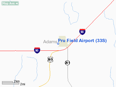
Location & QuickFacts
| FAA Information Effective: | 2008-09-25 |
| Airport Identifier: | 33S |
| Airport Status: | Operational |
| Longitude/Latitude: | 118-23-22.2620W/47-07-23.5580N
-118.389517/47.123211 (Estimated) |
| Elevation: | 1801 ft / 548.94 m (Surveyed) |
| Land: | 30 acres |
| From nearest city: | 1 nautical miles W of Ritzville, WA |
| Location: | Adams County, WA |
| Magnetic Variation: | 19E (1985) |
Owner & Manager
| Ownership: | Publicly owned |
| Owner: | City Of Ritzville |
| Address: | 216 E. Main
Ritzville, WA 99169 |
| Phone number: | 509-659-1930 |
| Manager: | Larry Swift |
| Address: | 216 E. Main
Ritzville, WA 99169-1417 |
| Phone number: | 509-659-1930 |
Airport Operations and Facilities
| Airport Use: | Open to public |
| Wind indicator: | Yes |
| Segmented Circle: | No |
| Control Tower: | No |
| Lighting Schedule: | DUSK-DAWN
ACTVT MIRL RY 01/19 - CTAF. |
| Beacon Color: | Clear-Green (lighted land airport) |
| Landing fee charge: | No |
| Sectional chart: | Seattle |
| Region: | ANM - Northwest Mountain |
| Boundary ARTCC: | ZSE - Seattle |
| Tie-in FSS: | SEA - Seattle |
| FSS on Airport: | No |
| FSS Toll Free: | 1-800-WX-BRIEF |
| NOTAMs Facility: | SEA (NOTAM-d service avaliable) |
| Federal Agreements: | N |
Airport Communications
| CTAF: | 122.800 |
| Unicom: | 122.800 |
Airport Services
| Airframe Repair: | NONE |
| Power Plant Repair: | NONE |
| Bottled Oxygen: | NONE |
| Bulk Oxygen: | NONE |
Runway Information
Runway 01/19
| Dimension: | 3635 x 40 ft / 1107.9 x 12.2 m |
| Surface: | ASPH, Fair Condition |
| Edge Lights: | Non-standard lighting system
RY 01/19 NSTD MIRL. 3 FT RED LGTS 3 EACH SIDE OF RY AT ENDS OF PAVEMENT. |
| |
Runway 01 |
Runway 19 |
| Longitude: | 118-23-34.5280W | 118-23-09.9900W |
| Latitude: | 47-07-07.6920N | 47-07-39.4230N |
| Alignment: | 28 | 127 |
| Traffic Pattern: | Left | Left |
| Markings: | Basic, Fair Condition | Basic, Fair Condition |
| Displaced threshold: | 387.00 ft | 816.00 ft |
| Obstruction: | 29 ft pline, 1081.0 ft from runway, 70 ft right of centerline, 30:1 slope to clear
RWY 01 APCH SLOPE 50:1 AT DSPLCD THR.
+4' FNC 28' FM THR; RD 55' FM THR; +6' FNC 96' FM THR. | 46 ft trees, 426.0 ft from runway, 12 ft left of centerline, 4:1 slope to clear
RWY 19 APCH SLOPE 23:1 AT DSPLCD THR.
+4' SIGN 58' FM THR 5' L; +35' MKD PLINE 81' FM THR; +35' UNMKD PLINE 111' FM THR; +40' TREES 111-200' FM THR. |
|
Radio Navigation Aids
| ID |
Type |
Name |
Ch |
Freq |
Var |
Dist |
| MW | NDB | Pelly | | 408.00 | 18E | 36.2 nm |
| SKA | TACAN | Fairchild | 051X | | 19E | 41.7 nm |
| MWH | VOR/DME | Moses Lake | 097X | 115.00 | 18E | 38.3 nm |
| GEG | VORTAC | Spokane | 102X | 115.50 | 21E | 40.9 nm |
| EPH | VORTAC | Ephrata | 073X | 112.60 | 21E | 44.9 nm |
| GEG | VOT | Spokane Intl | | 109.60 | | 45.8 nm |
Remarks
- ARPT CLSD WHEN SNOW/ICE ON RY.
- ESTABD PRIOR TO 15 MAY 1959.
Images and information placed above are from
http://www.airport-data.com/airport/33S/
We thank them for the data!
| General Info
|
| Country |
United States
|
| State |
WASHINGTON
|
| FAA ID |
33S
|
| Latitude |
47-07-29.539N
|
| Longitude |
118-23-33.914W
|
| Elevation |
1796 feet
|
| Near City |
RITZVILLE
|
We don't guarantee the information is fresh and accurate. The data may
be wrong or outdated.
For more up-to-date information please refer to other sources.
|
|


