 |
|
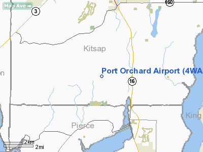
Location & QuickFacts
| FAA Information Effective: | 2008-09-25 |
| Airport Identifier: | 4WA9 |
| Airport Status: | Operational |
| Longitude/Latitude: | 122-40-04.4880W/47-25-56.3430N
-122.667913/47.432317 (Estimated) |
| Elevation: | 370 ft / 112.78 m (Estimated) |
| Land: | 120 acres |
| From nearest city: | 7 nautical miles SW of Port Orchard, WA |
| Location: | Kitsap County, WA |
| Magnetic Variation: | 20E (1985) |
Owner & Manager
| Ownership: | Privately owned |
| Owner: | Port Orchard Airstrip, Inc. |
| Address: |
|
| Manager: | Danny A Schnitzer |
| Address: | 11221 Pacific Hwy S.
Tacoma, WA 98499 |
| Phone number: | 206-581-6611 |
Airport Operations and Facilities
| Airport Use: | Private |
| Wind indicator: | Yes |
| Segmented Circle: | No |
| Control Tower: | No |
| Lighting Schedule: | RDO-CTL
ACTVT LIRL RY 18/36 - CTAF. |
| Landing fee charge: | No |
| Sectional chart: | Seattle |
| Region: | ANM - Northwest Mountain |
| Boundary ARTCC: | ZSE - Seattle |
| Tie-in FSS: | SEA - Seattle |
| FSS on Airport: | No |
| FSS Toll Free: | 1-800-WX-BRIEF |
Airport Services
| Airframe Repair: | NONE |
| Power Plant Repair: | NONE |
| Bottled Oxygen: | NONE |
| Bulk Oxygen: | NONE |
Runway Information
Runway 18/36
| Dimension: | 2460 x 28 ft / 749.8 x 8.5 m |
| Surface: | ASPH, Fair Condition
GRASS GROWING IN PAVEMENT, AREAS OF DETERIORATION & POTHOLES ON BOTH RY & TWY. |
| Edge Lights: | Low
<2000' RWY LGTD. |
| |
Runway 18 |
Runway 36 |
| Traffic Pattern: | Left | Left |
| Markings: | Nonstandard, Fair Condition | Nonstandard, Fair Condition |
| Runway End Identifier: | No | No |
| Centerline Lights: | No | No |
| Touchdown Lights: | No | No |
| Obstruction: | 20 ft road, 200.0 ft from runway, 40 ft left of centerline | 6 ft brush, 200.0 ft from runway
+75' TREES 200-0' FROM THRS 94'L. |
|
Radio Navigation Aids
| ID |
Type |
Name |
Ch |
Freq |
Var |
Dist |
| PWT | NDB | Kitsap | | 206.00 | 20E | 5.1 nm |
| CAN | NDB | Carney | | 274.00 | 20E | 7.1 nm |
| ODD | NDB | Dondo | | 224.00 | 19E | 15.2 nm |
| GR | NDB | Graye | | 216.00 | 18E | 17.1 nm |
| RNT | NDB | Renton | | 353.00 | 20E | 18.8 nm |
| MNC | NDB | Mason County | | 348.00 | 19E | 20.3 nm |
| LAC | NDB | Lacomas | | 328.00 | 18E | 25.9 nm |
| PAE | VOR/DME | Paine | 043X | 110.60 | 20E | 33.3 nm |
| CVV | VOR/DME | Penn Cove | 119X | 117.20 | 19E | 48.9 nm |
| SEA | VORTAC | Seattle | 115X | 116.80 | 19E | 14.6 nm |
| TCM | VORTAC | Mcchord | 033X | 109.60 | 22E | 18.8 nm |
| OLM | VORTAC | Olympia | 081X | 113.40 | 19E | 29.3 nm |
| SEA | VOT | Seattle-tacoma | | 117.50 | | 14.8 nm |
| BFI | VOT | Boeing Field | | 108.60 | | 15.9 nm |
Remarks
- RWY 18, DITHC & ROAD IN PRIM SFC EAST APCH.
- ESTABD PRIOR TO 1959.
Images and information placed above are from
http://www.airport-data.com/airport/4WA9/
We thank them for the data!
| General Info
|
| Country |
United States
|
| State |
WASHINGTON
|
| FAA ID |
4WA9
|
| Latitude |
47-25-56.343N
|
| Longitude |
122-40-04.488W
|
| Elevation |
370 feet
|
| Near City |
PORT ORCHARD
|
We don't guarantee the information is fresh and accurate. The data may
be wrong or outdated.
For more up-to-date information please refer to other sources.
|
|


