 |
|
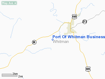
Port Of Whitman Business Air Center Airport |
Location & QuickFacts
| FAA Information Effective: | 2008-09-25 |
| Airport Identifier: | S94 |
| Airport Status: | Operational |
| Longitude/Latitude: | 117-24-50.6920W/46-51-31.3460N
-117.414081/46.858707 (Estimated) |
| Elevation: | 2181 ft / 664.77 m (Estimated) |
| Land: | 64 acres |
| From nearest city: | 3 nautical miles SW of Colfax, WA |
| Location: | Whitman County, WA |
| Magnetic Variation: | 19E (1985) |
Owner & Manager
| Ownership: | Publicly owned |
| Owner: | Port Of Whitman County |
| Address: | 302 N. Mill Street
Colfax, WA 99111 |
| Phone number: | 509-397-3791 |
| Manager: | Daryl Fender |
| Address: | Po Box 143
Colfax, WA 99111 |
| Phone number: | 509-397-2061 |
Airport Operations and Facilities
| Airport Use: | Open to public |
| Wind indicator: | Yes |
| Segmented Circle: | No |
| Control Tower: | No |
| Lighting Schedule: | DUSK-DAWN
ACTVT MIRL RY 07/25 - CTAF. |
| Beacon Color: | Clear-Green (lighted land airport) |
| Landing fee charge: | No |
| Sectional chart: | Seattle |
| Region: | ANM - Northwest Mountain |
| Traffic Pattern Alt: | 829 ft |
| Boundary ARTCC: | ZSE - Seattle |
| Tie-in FSS: | SEA - Seattle |
| FSS on Airport: | No |
| FSS Toll Free: | 1-800-WX-BRIEF |
| NOTAMs Facility: | SEA (NOTAM-d service avaliable) |
| Federal Agreements: | N1 |
Airport Communications
| CTAF: | 122.800 |
| Unicom: | 122.800 |
Airport Services
| Fuel available: | 100LL
100LL AVAILABLE FOR EMERGENCIES. CALL 509-397-3791 |
| Airframe Repair: | NONE |
| Power Plant Repair: | NONE |
| Bottled Oxygen: | NONE |
| Bulk Oxygen: | NONE |
Runway Information
Runway 07/25
| Dimension: | 3209 x 60 ft / 978.1 x 18.3 m |
| Surface: | ASPH, Good Condition |
| Weight Limit: | Single wheel: 7000 lbs. |
| Edge Lights: | Non-standard lighting system
NSTD MIRL ONLY CENTER 2240 FT LGTD. |
| |
Runway 07 |
Runway 25 |
| Longitude: | 117-25-13.7770W | 117-24-27.6070W |
| Latitude: | 46-51-31.4870N | 46-51-31.2040N |
| Traffic Pattern: | Left | Left |
| Markings: | Basic, Good Condition | Basic, Good Condition |
| Displaced threshold: | 492.00 ft | 319.00 ft |
| Obstruction: | 13 ft road, 316.0 ft from runway, 131 ft right of centerline, 8:1 slope to clear
APCH RATIO 50:1 FROM DSPLCD THLD. | 115 ft hills, 4000.0 ft from runway, 33:1 slope to clear
APCH RATIO 37:1 FROM DSPLCD THLD. |
|
Radio Navigation Aids
| ID |
Type |
Name |
Ch |
Freq |
Var |
Dist |
| SFF | NDB | Felts | | 365.00 | 19E | 49.9 nm |
| SKA | TACAN | Fairchild | 051X | | 19E | 46.3 nm |
| PUW | VOR/DME | Pullman | 027X | 109.00 | 20E | 13.6 nm |
| MQG | VOR/DME | Nez Perce | 019X | 108.20 | 20E | 36.4 nm |
| GEG | VORTAC | Spokane | 102X | 115.50 | 21E | 43.3 nm |
| GEG | VOT | Spokane Intl | | 109.60 | | 46.2 nm |
| SFF | VOT | Spokane/felts Field | | 114.00 | | 49.5 nm |
Remarks
- RY 07/25 FARM MACHINERY MAY BE OPERATING IN FIELDS OFF BOTH RY ENDS.
- ESTABD PRIOR TO 15 MAY 1959.
Images and information placed above are from
http://www.airport-data.com/airport/S94/
We thank them for the data!
| General Info
|
| Country |
United States
|
| State |
WASHINGTON
|
| FAA ID |
S94
|
| Latitude |
46-51-30.591N
|
| Longitude |
117-24-49.667W
|
| Elevation |
2171 feet
|
| Near City |
COLFAX
|
We don't guarantee the information is fresh and accurate. The data may
be wrong or outdated.
For more up-to-date information please refer to other sources.
|
|


