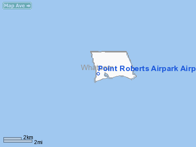
Point Roberts Airpark Airport |
| Point Roberts Airpark |
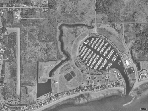 |
| The Airpark's runway (left) |
| IATA: none – ICAO: 1RL – FAA LID: 1RL |
| Summary |
| Airport type |
Public |
| Owner/Operator |
Robin Lamb |
| Serves |
Point Roberts, Washington |
| Elevation AMSL |
10 ft / 3 m |
| Coordinates |
48°58′47.0″N 123°04′44.0″W / 48.97972°N 123.07889°W / 48.97972; -123.07889 |
| Runways |
| Direction |
Length |
Surface |
| ft |
m |
| 16/34 |
2400 |
690 |
Turf |
| Statistics (2007) |
| Aircraft operations |
200 |
| Sources: FAA |
Point Roberts Airpark (FAA LID: 1RL) is a single-runway airport located in the town of Point Roberts, Washington. The airport, along with the marina, provide the only access to the rest of Washington state without first having to pass through British Columbia.
In 2000, a new five-plane hangar was built. It also features several couches and serves as a makeshift waiting room.
History
Point Roberts Airpark was originally started by Ray Young. Ray was a cartoonist at Buena Vista Studios. He had a life long interest in flying and moving to the Pacific Northwest. In 1967 he purchased a parcel of land in Point Roberts and started an air strip called Ray Young Field. He moved to Point Roberts with his wife Uvon in 1972. Later on he bought more land and extended the runway to its current length. Ray died in 1985. His wife, Uvon Young, lived in the family home for the next five years but gradually nature reclaimed the land and she closed the runway and put the land up for sale in 1990. In 1996, she sold it to the current owner, Robin Lamb.
In the 1996-1998 period, using a 1955 Galion grader and a 1956 International TD-91 bulldozer, the airstrip was made usable again. The bulldozer cleared the trees and the grader put a 3 foot crown on the runway and cleared the 8 acres of the parking/airpark area.
In November of 1998 the runway was seeded to a low maintenance turf. In the intervening years, except for mowing, the runway has needed no further maintenance and is used year round. The plans for the future include hangar homes and more hangar space. A GPS approach and customs clearance is being worked on.
The owner is a retired Air Canada Captain with 22,000 hours plus in the air.
The above content comes from Wikipedia and is published under free licenses – click here to read more.
Location & QuickFacts
| FAA Information Effective: | 2008-09-25 |
| Airport Identifier: | 1RL |
| Airport Status: | Operational |
| Longitude/Latitude: | 123-04-44.0000W/48-58-47.0000N
-123.078889/48.979722 (Estimated) |
| Elevation: | 10 ft / 3.05 m () |
| Land: | 20 acres |
| From nearest city: | 1 nautical miles SW of Point Roberts, WA |
| Location: | Whatcom County, WA |
| Magnetic Variation: | 19E (2000) |
Owner & Manager
| Ownership: | Privately owned |
| Owner: | Robin Lamb |
| Address: | 622 Marine Drive
Point Poberts, WA 98281 |
| Phone number: | 360-945-3139 |
| Manager: | Robin Lamb |
| Address: | 622 Marine Drive
Point Poberts, WA 98281 |
| Phone number: | 360-945-3139 |
Airport Operations and Facilities
| Airport Use: | Open to public |
| Wind indicator: | Yes |
| Segmented Circle: | No |
| Control Tower: | No |
| Sectional chart: | Seattle |
| Region: | ANM - Northwest Mountain |
| Boundary ARTCC: | ZSE - Seattle |
| Tie-in FSS: | SEA - Seattle |
| FSS Toll Free: | 1-800-WX-BRIEF |
| NOTAMs Facility: | SEA (NOTAM-d service avaliable) |
Airport Communications
| CTAF: | 122.800 |
| Unicom: | 122.800 |
Runway Information
Runway 16/34
| Dimension: | 2265 x 125 ft / 690.4 x 38.1 m |
| Surface: | TURF, |
| |
Runway 16 |
Runway 34 |
| Traffic Pattern: | Right | Left |
| Obstruction: | 7 ft brush | 18 ft brush, 0.0 ft from runway |
|
Radio Navigation Aids
| ID |
Type |
Name |
Ch |
Freq |
Var |
Dist |
| AP | NDB | Active Pass | | 378.00 | 21E | 10.5 nm |
| VR | NDB | Vancouver | | 266.00 | 21E | 11.6 nm |
| WC | NDB | White Rock | | 332.00 | 21E | 13.7 nm |
| V | NDB | Victor | | 368.00 | 22E | 13.9 nm |
| XX | NDB | Abbotsford | | 344.00 | 21E | 23.4 nm |
| YJ | NDB | Victoria | | 200.00 | 21E | 23.8 nm |
| MB | NDB | Mill Bay | | 293.00 | 21E | 25.9 nm |
| FHR | NDB | Friday Harbor | | 284.00 | 20E | 27.3 nm |
| OPZ | NDB | Lopez Island | | 356.00 | 21E | 30.7 nm |
| YCD | NDB | Nanaimo | | 251.00 | 21E | 32.5 nm |
| BVS | NDB | Skagit/bay View | | 240.00 | 21E | 40.4 nm |
| LU | NDB | Cultus | | 214.00 | 22E | 40.7 nm |
| NUW | TACAN | Whidbey Island | 085X | | 21E | 41.0 nm |
| YYJ | VOR/DME | Victoria | 084X | 113.70 | 21E | 22.1 nm |
| CVV | VOR/DME | Penn Cove | 119X | 117.20 | 19E | 46.4 nm |
| YVR | VORTAC | Vancouver | 44 | 115.90 | 21E | 6.5 nm |
| HUH | VORTAC | Whatcom | 077X | 113.00 | 20E | 19.8 nm |
Remarks
- TRAFFIC PATTERN WEST OF FLD OVER WATER.
- NOISE ABATEMENT PROCEDURES IN EFFECT, CONTACT AIRPORT MANAGER FOR DETAILS AT 360-945-3139.
- WHEN ABLE LAND TO THE 'N' AND DEPART TO THE 'S'.
Images and information placed above are from
http://www.airport-data.com/airport/1RL/
We thank them for the data!
| General Info
|
| Country |
United States
|
| State |
WASHINGTON
|
| FAA ID |
1RL
|
| Latitude |
48-58-47.000N
|
| Longitude |
123-04-44.000W
|
| Elevation |
10 feet
|
| Near City |
POINT ROBERTS
|
We don't guarantee the information is fresh and accurate. The data may
be wrong or outdated.
For more up-to-date information please refer to other sources.
|


