 |
|
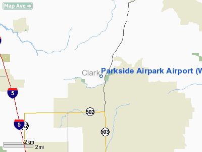
Location & QuickFacts
| FAA Information Effective: | 2008-09-25 |
| Airport Identifier: | WA87 |
| Airport Status: | Operational |
| Longitude/Latitude: | 122-33-10.3550W/45-48-57.4130N
-122.552876/45.815948 (Estimated) |
| Elevation: | 275 ft / 83.82 m (Estimated) |
| Land: | 5 acres |
| From nearest city: | 2 nautical miles N of Battle Ground, WA |
| Location: | Clark County, WA |
| Magnetic Variation: | 20E (1985) |
Owner & Manager
| Ownership: | Privately owned |
| Owner: | Parkside Airpark Owners Assoc |
| Address: | P.o. Box 352
Battle Ground, WA 98604 |
| Phone number: | 206-687-1005 |
| Manager: | Parkside Airpark Hoa |
| Address: | P.o. Box 352
Battle Ground, WA 98604 |
| Phone number: | 206-687-2356 |
Airport Operations and Facilities
| Airport Use: | Private |
| Wind indicator: | Yes |
| Segmented Circle: | No |
| Control Tower: | No |
| Landing fee charge: | No |
| Sectional chart: | Seattle |
| Region: | ANM - Northwest Mountain |
| Boundary ARTCC: | ZSE - Seattle |
| Tie-in FSS: | SEA - Seattle |
| FSS on Airport: | No |
| FSS Toll Free: | 1-800-WX-BRIEF |
Airport Services
| Airframe Repair: | NONE |
| Power Plant Repair: | NONE |
Runway Information
Runway E/W
| Dimension: | 2100 x 25 ft / 640.1 x 7.6 m
ADD'L 50' TURF ON NORTH SIDE OF RY. |
| Surface: | ASPH, |
| |
Runway E |
Runway W |
| Traffic Pattern: | Left | Right |
| Obstruction: | | 120 ft trees, 1000.0 ft from runway |
|
Radio Navigation Aids
| ID |
Type |
Name |
Ch |
Freq |
Var |
Dist |
| LBH | NDB | Laker | | 332.00 | 20E | 17.0 nm |
| PND | NDB | Banks | | 356.00 | 21E | 23.5 nm |
| LSO | NDB | Kelso | | 256.00 | 21E | 25.3 nm |
| TDO | NDB | Toledo | | 219.00 | 20E | 41.2 nm |
| PEN | NDB | Karpen | | 201.00 | 20E | 47.4 nm |
| CBU | TACAN | Columbia | 029X | | 20E | 13.9 nm |
| PDX | VOR/DME | Portland | 055X | 111.80 | 20E | 13.5 nm |
| UBG | VOR/DME | Newberg | 121X | 117.40 | 21E | 33.1 nm |
| BTG | VORTAC | Battle Ground | 113X | 116.60 | 21E | 4.4 nm |
| PDX | VOT | Portland Intl | | 111.00 | | 13.2 nm |
| HIO | VOT | Portland-hillsboro | | 115.20 | | 23.5 nm |
Images and information placed above are from
http://www.airport-data.com/airport/WA87/
We thank them for the data!
| General Info
|
| Country |
United States
|
| State |
WASHINGTON
|
| FAA ID |
WA87
|
| Latitude |
45-48-57.413N
|
| Longitude |
122-33-10.355W
|
| Elevation |
275 feet
|
| Near City |
BATTLE GROUND
|
We don't guarantee the information is fresh and accurate. The data may
be wrong or outdated.
For more up-to-date information please refer to other sources.
|
|


