|
|
| Orcas Island Airport |
| IATA: ESD – ICAO: KORS – FAA LID: ORS |
| Summary |
| Airport type |
Public |
| Owner |
Port of Orcas |
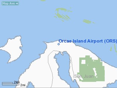
| Location |
Eastsound, Washington |
| Elevation AMSL |
31 ft / 9 m |
| Coordinates |
48°42′29″N 122°54′38″W / 48.70806°N 122.91056°W / 48.70806; -122.91056 |
| Runways |
| Direction |
Length |
Surface |
| ft |
m |
| 16/34 |
2,900 |
884 |
Asphalt |
| Statistics (2005) |
| Aircraft operations |
61,600 |
| Based aircraft |
75 |
| Source: Federal Aviation Administration |
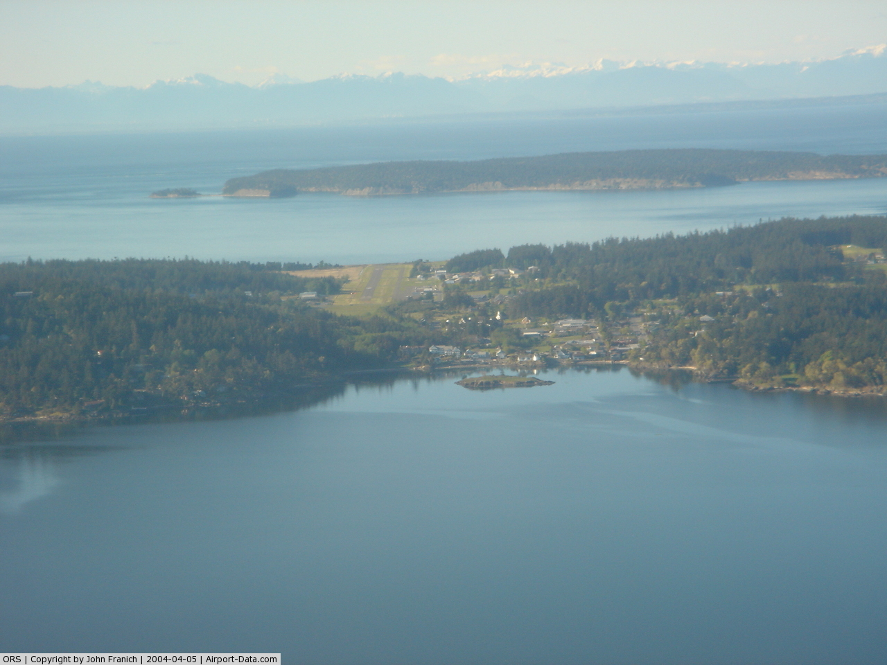
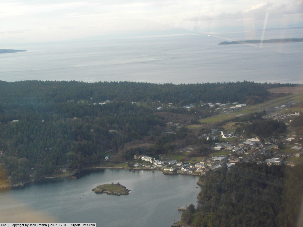
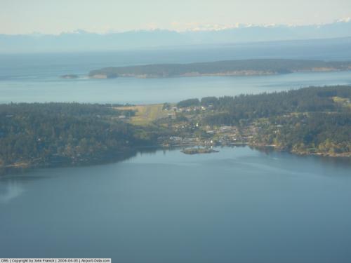
Orcas Island Airport (IATA: ESD, ICAO: KORS, FAA LID: ORS) is a public airport located one nautical mile (1.85 km) north of the central business district of Eastsound on Orcas Island in San Juan County, Washington, United States.
Although most U.S. airports use the same three-letter location identifier for the FAA and IATA, Orcas Island Airport is assigned ORS by the FAA and ESD by the IATA (which assigned ORS to Orpheus Island Resort Waterport in Queensland, Australia). Facilities and aircraft
Orcas Island Airport covers an area of 64 acres (26 ha) which contains one asphalt paved runway (16/34) measuring 2,900 x 60 ft (884 x 18 m).
For the 12-month period ending December 31, 2005, the airport had 61,600 aircraft operations, an average of 168 per day: 69% general aviation, 20% air taxi and 11% scheduled commercial. There are 75 aircraft based at this airport: 96% single engine and 4% multi-engine.
Airlines and destinations
| Airlines |
Destinations |
| Kenmore Air |
Seattle/Boeing Field |
| San Juan Airlines |
Anacortes, Bellingham, Friday Harbor |
The above content comes from Wikipedia and is published under free licenses – click here to read more.
 |
(Click on the photo to enlarge) |
 |
(Click on the photo to enlarge) |
Location & QuickFacts
| FAA Information Effective: | 2008-09-25 |
| Airport Identifier: | ORS |
| Airport Status: | Operational |
| Longitude/Latitude: | 122-54-37.6665W/48-42-29.3764N
-122.910463/48.708160 (Estimated) |
| Elevation: | 31 ft / 9.45 m (Estimated) |
| Land: | 64 acres |
| From nearest city: | 1 nautical miles N of Eastsound, WA |
| Location: | San Juan County, WA |
| Magnetic Variation: | 21E (1985) |
Owner & Manager
| Ownership: | Publicly owned |
| Owner: | Port Of Orcas |
| Address: | P.o. Box 53
Eastsound, WA 98245 |
| Phone number: | 360-376-5285 |
| Manager: | Beatrice S. Von Tobel |
| Address: | Po Box 53
Eastsound, WA 98245 |
| Phone number: | 360-376-5285 |
Airport Operations and Facilities
| Airport Use: | Open to public |
| Wind indicator: | Yes |
| Segmented Circle: | Yes |
| Control Tower: | No |
| Lighting Schedule: | DUSK-DAWN
ACTVT VASI RY 16, REIL RYS 16 & 34, &TWY LGTS - 128.25. |
| Beacon Color: | Clear-Green (lighted land airport) |
| Landing fee charge: | No |
| Sectional chart: | Seattle |
| Region: | ANM - Northwest Mountain |
| Traffic Pattern Alt: | 1000 ft |
| Boundary ARTCC: | ZSE - Seattle |
| Responsible ARTCC: | ZVR - Vancouver |
| Tie-in FSS: | SEA - Seattle |
| FSS on Airport: | No |
| FSS Toll Free: | 1-800-WX-BRIEF |
| NOTAMs Facility: | ORS (NOTAM-d service avaliable) |
| Federal Agreements: | NGY |
Airport Communications
Airport Services
| Fuel available: | 100LL
SELF SVC 24 HR FUEL AVBL WITH CREDIT CARD. |
| Airframe Repair: | MAJOR |
| Power Plant Repair: | MINOR |
| Bottled Oxygen: | NONE |
| Bulk Oxygen: | NONE |
Runway Information
Runway 16/34
| Dimension: | 2900 x 60 ft / 883.9 x 18.3 m |
| Surface: | ASPH, Good Condition |
| Surface Treatment: | Aggregate Friction Seal Coat |
| Weight Limit: | Single wheel: 12500 lbs. |
| Edge Lights: | Medium |
| |
Runway 16 |
Runway 34 |
| Longitude: | 122-54-38.0670W | 122-54-38.2560W |
| Latitude: | 48-42-44.3190N | 48-42-15.6960N |
| Elevation: | 8.00 ft | 31.00 ft |
| Traffic Pattern: | Left | Right |
| Markings: | Basic, Good Condition | Basic, Good Condition |
| Crossing Height: | 35.00 ft | 28.00 ft |
| VASI: | 4-box on left side | 2-light PAPI on left side
PAPI BAFFLED W OF CNTRLN, LATERAL COVERAGE HAS BEEN NARROWED TO AVOID OBSTACLES, DURG DECENT CLOSE ALNMT TO RY CNTRLN IS NECESSARY. |
| Visual Glide Angle: | 3.40° | 4.00° |
| Runway End Identifier: | Yes | Yes |
| Obstruction: | , 50:1 slope to clear | 162 ft trees, 2243.0 ft from runway, 267 ft left of centerline, 12:1 slope to clear |
|
Radio Navigation Aids
| ID |
Type |
Name |
Ch |
Freq |
Var |
Dist |
| FHR | NDB | Friday Harbor | | 284.00 | 20E | 11.9 nm |
| OPZ | NDB | Lopez Island | | 356.00 | 21E | 13.8 nm |
| AP | NDB | Active Pass | | 378.00 | 21E | 18.0 nm |
| WC | NDB | White Rock | | 332.00 | 21E | 19.1 nm |
| YJ | NDB | Victoria | | 200.00 | 21E | 19.8 nm |
| BVS | NDB | Skagit/bay View | | 240.00 | 21E | 24.3 nm |
| XX | NDB | Abbotsford | | 344.00 | 21E | 24.9 nm |
| MB | NDB | Mill Bay | | 293.00 | 21E | 25.0 nm |
| VR | NDB | Vancouver | | 266.00 | 21E | 28.5 nm |
| V | NDB | Victor | | 368.00 | 22E | 31.5 nm |
| LU | NDB | Cultus | | 214.00 | 22E | 38.9 nm |
| CL | NDB | Elwha | | 515.00 | 22E | 45.2 nm |
| YCD | NDB | Nanaimo | | 251.00 | 21E | 45.6 nm |
| NUW | TACAN | Whidbey Island | 085X | | 21E | 23.4 nm |
| YYJ | VOR/DME | Victoria | 084X | 113.70 | 21E | 22.8 nm |
| CVV | VOR/DME | Penn Cove | 119X | 117.20 | 19E | 28.8 nm |
| HUH | VORTAC | Whatcom | 077X | 113.00 | 20E | 19.4 nm |
| YVR | VORTAC | Vancouver | 44 | 115.90 | 21E | 24.1 nm |
Remarks
- NOISE ABATEMENT PROCEDURES IN EFFECT; CTC AMGR 360-376-5285.
- ADNL TSNT TIEDOWNS SOUTH OF SEGEMENTED CIRCLE.
- DEER ON AND INVOF RY.
- ESTABLISHED PRIOR TO 5/15/59.
Images and information placed above are from
http://www.airport-data.com/airport/ORS/
We thank them for the data!
| General Info
|
| Country |
United States
|
| State |
WASHINGTON
|
| FAA ID |
ORS
|
| Latitude |
48-42-29.376N
|
| Longitude |
122-54-37.667W
|
| Elevation |
31 feet
|
| Near City |
EASTSOUND
|
We don't guarantee the information is fresh and accurate. The data may
be wrong or outdated.
For more up-to-date information please refer to other sources.
|
|