 |
|
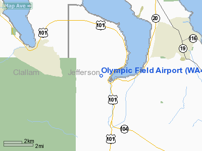
Location & QuickFacts
| FAA Information Effective: | 2008-09-25 |
| Airport Identifier: | WA45 |
| Airport Status: | Operational |
| Longitude/Latitude: | 122-53-59.0000W/47-59-43.0000N
-122.899722/47.995278 (Estimated) |
| Elevation: | 500 ft / 152.40 m (Estimated) |
| Land: | 0 acres |
| From nearest city: | 1 nautical miles W of Discovery Bay/maynard, WA |
| Location: | Jefferson County, WA |
| Magnetic Variation: | 20E (1990) |
Owner & Manager
| Ownership: | Privately owned |
| Owner: | Danae Larrance |
| Address: | 282283 Highway 101
Port Townsend, WA 98368 |
| Phone number: | 360-385-7007 |
| Manager: | Danae Larrance |
| Address: | 282283 Highway 101
Port Townsend, WA 98368 |
| Phone number: | 360-385-7007 |
Airport Operations and Facilities
| Airport Use: | Private |
| Segmented Circle: | No |
| Control Tower: | No |
| Sectional chart: | Seattle |
| Region: | ANM - Northwest Mountain |
| Boundary ARTCC: | ZSE - Seattle |
| Tie-in FSS: | SEA - Seattle |
| FSS on Airport: | No |
| FSS Toll Free: | 1-800-WX-BRIEF |
Runway Information
Runway 16/34
| Dimension: | 2500 x 120 ft / 762.0 x 36.6 m |
| Surface: | TURF, |
| |
Runway 16 |
Runway 34 |
| Traffic Pattern: | Left | Left |
|
Radio Navigation Aids
| ID |
Type |
Name |
Ch |
Freq |
Var |
Dist |
| OPZ | NDB | Lopez Island | | 356.00 | 21E | 29.1 nm |
| PWT | NDB | Kitsap | | 206.00 | 20E | 30.8 nm |
| CL | NDB | Elwha | | 515.00 | 22E | 32.3 nm |
| FHR | NDB | Friday Harbor | | 284.00 | 20E | 32.4 nm |
| BVS | NDB | Skagit/bay View | | 240.00 | 21E | 34.4 nm |
| CAN | NDB | Carney | | 274.00 | 20E | 35.2 nm |
| RNT | NDB | Renton | | 353.00 | 20E | 40.9 nm |
| YJ | NDB | Victoria | | 200.00 | 21E | 43.8 nm |
| ODD | NDB | Dondo | | 224.00 | 19E | 44.8 nm |
| MNC | NDB | Mason County | | 348.00 | 19E | 45.5 nm |
| MB | NDB | Mill Bay | | 293.00 | 21E | 47.9 nm |
| NUW | TACAN | Whidbey Island | 085X | | 21E | 23.6 nm |
| CVV | VOR/DME | Penn Cove | 119X | 117.20 | 19E | 16.6 nm |
| PAE | VOR/DME | Paine | 043X | 110.60 | 20E | 25.4 nm |
| YYJ | VOR/DME | Victoria | 084X | 113.70 | 21E | 49.8 nm |
| SEA | VORTAC | Seattle | 115X | 116.80 | 19E | 41.3 nm |
| BFI | VOT | Boeing Field | | 108.60 | | 37.0 nm |
| SEA | VOT | Seattle-tacoma | | 117.50 | | 41.0 nm |
Remarks
- 16/34 RISING TERRAIN TO THE W & NW OF RY.
Images and information placed above are from
http://www.airport-data.com/airport/WA45/
We thank them for the data!
| General Info
|
| Country |
United States
|
| State |
WASHINGTON
|
| FAA ID |
WA45
|
| Latitude |
47-59-43.000N
|
| Longitude |
122-53-59.000W
|
| Elevation |
500 feet
|
| Near City |
DISCOVERY BAY/MAYNARD
|
We don't guarantee the information is fresh and accurate. The data may
be wrong or outdated.
For more up-to-date information please refer to other sources.
|
|


