 |
|
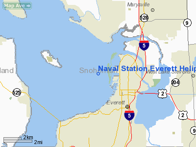
Naval Station Everett Heliport |
Location & QuickFacts
| FAA Information Effective: | 2008-09-25 |
| Airport Identifier: | 0WA9 |
| Airport Status: | Operational |
| Longitude/Latitude: | 122-14-48.0000W/47-59-54.0000N
-122.246667/47.998333 (Estimated) |
| Elevation: | 21 ft / 6.40 m (Estimated) |
| Land: | 2 acres |
| From nearest city: | 1 nautical miles E of Everett, WA |
| Location: | Snohomish County, WA |
| Magnetic Variation: | 20E (1995) |
Owner & Manager
| Ownership: | Navy owned |
| Owner: | Naval Station Everett |
| Address: | 2000 West Marine View Drive
Everett, WA 98207-5001 |
| Phone number: | 425-304-3073 |
| Manager: | Lcdr Mccabe Ops Officer |
| Address: | 2000 W Marine View Dr(30)
Everett, WA 98207-5001 |
| Phone number: | 425-304-3422 |
Airport Operations and Facilities
| Airport Use: | Private |
| Wind indicator: | Yes |
| Segmented Circle: | No |
| Control Tower: | No |
| Sectional chart: | Seattle |
| Region: | ANM - Northwest Mountain |
| Boundary ARTCC: | ZSE - Seattle |
| Tie-in FSS: | SEA - Seattle |
| FSS Toll Free: | 1-800-WX-BRIEF |
Runway Information
Helipad H1
| Dimension: | 100 x 100 ft / 30.5 x 30.5 m |
| Surface: | CONC, Good Condition |
| |
Runway H1 |
Runway |
| Traffic Pattern: | Left | Left |
| Markings: | Basic, Good Condition | , |
|
Radio Navigation Aids
| ID |
Type |
Name |
Ch |
Freq |
Var |
Dist |
| BVS | NDB | Skagit/bay View | | 240.00 | 21E | 29.1 nm |
| RNT | NDB | Renton | | 353.00 | 20E | 30.3 nm |
| PWT | NDB | Kitsap | | 206.00 | 20E | 36.7 nm |
| ODD | NDB | Dondo | | 224.00 | 19E | 38.2 nm |
| OPZ | NDB | Lopez Island | | 356.00 | 21E | 39.6 nm |
| CAN | NDB | Carney | | 274.00 | 20E | 42.7 nm |
| FHR | NDB | Friday Harbor | | 284.00 | 20E | 44.6 nm |
| NUW | TACAN | Whidbey Island | 085X | | 21E | 27.1 nm |
| PAE | VOR/DME | Paine | 043X | 110.60 | 20E | 4.9 nm |
| CVV | VOR/DME | Penn Cove | 119X | 117.20 | 19E | 24.2 nm |
| SEA | VORTAC | Seattle | 115X | 116.80 | 19E | 33.9 nm |
| BFI | VOT | Boeing Field | | 108.60 | | 28.4 nm |
| SEA | VOT | Seattle-tacoma | | 117.50 | | 33.4 nm |
Images and information placed above are from
http://www.airport-data.com/airport/0WA9/
We thank them for the data!
| General Info
|
| Country |
United States
|
| State |
WASHINGTON
|
| FAA ID |
0WA9
|
| Latitude |
47-59-54.000N
|
| Longitude |
122-14-48.000W
|
| Elevation |
21 feet
|
| Near City |
EVERETT
|
We don't guarantee the information is fresh and accurate. The data may
be wrong or outdated.
For more up-to-date information please refer to other sources.
|
|


