 |
|
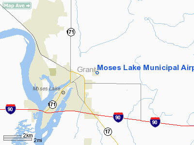
Location & QuickFacts
| FAA Information Effective: | 2008-09-25 |
| Airport Identifier: | W20 |
| Airport Status: | Operational |
| Longitude/Latitude: | 119-14-16.3750W/47-08-31.2150N
-119.237882/47.142004 (Estimated) |
| Elevation: | 1203 ft / 366.67 m (Estimated) |
| Land: | 160 acres |
| From nearest city: | 2 nautical miles NE of Moses Lake, WA |
| Location: | Grant County, WA |
| Magnetic Variation: | 19E (1985) |
Owner & Manager
| Ownership: | Publicly owned |
| Owner: | City Of Moses Lake |
| Address: | City Hall, P.o. Box 1579
Moses Lake, WA 98837 |
| Phone number: | 509-766-9201 |
| Manager: | Darel Fuller |
| Address: | 10477 Dune Lake Loop Se
Moses Lake, WA 98837 |
| Phone number: | 509-765-3200 |
Airport Operations and Facilities
| Airport Use: | Open to public |
| Wind indicator: | Yes |
| Segmented Circle: | Yes |
| Control Tower: | No |
| Lighting Schedule: | DUSK-DAWN |
| Beacon Color: | Clear-Green (lighted land airport) |
| Landing fee charge: | No |
| Sectional chart: | Seattle |
| Region: | ANM - Northwest Mountain |
| Boundary ARTCC: | ZSE - Seattle |
| Tie-in FSS: | SEA - Seattle |
| FSS on Airport: | No |
| FSS Toll Free: | 1-800-WX-BRIEF |
| NOTAMs Facility: | SEA (NOTAM-d service avaliable) |
| Federal Agreements: | 1 |
Airport Communications
| CTAF: | 123.000 |
| Unicom: | 123.000 |
Airport Services
| Fuel available: | 100LL
FUEL AVBL ONLY 0800-1700 MON-FRI. |
| Airframe Repair: | MAJOR |
| Power Plant Repair: | MAJOR |
| Bottled Oxygen: | NONE |
| Bulk Oxygen: | NONE |
Runway Information
Runway 16/34
| Dimension: | 2513 x 50 ft / 766.0 x 15.2 m |
| Surface: | ASPH, Good Condition |
| Weight Limit: | Single wheel: 8000 lbs. |
| Edge Lights: | Medium |
| |
Runway 16 |
Runway 34 |
| Longitude: | 119-14-16.2380W | 119-14-16.5110W |
| Latitude: | 47-08-43.6160N | 47-08-18.8140N |
| Elevation: | 1200.00 ft | 1203.00 ft |
| Traffic Pattern: | Left | Right |
| Markings: | Basic, Fair Condition | Basic, Fair Condition |
| Displaced threshold: | 466.00 ft | 253.00 ft |
| VASI: | 2-light PAPI on left side | 2-light PAPI on left side |
| Visual Glide Angle: | 3.00° | 3.00° |
| Obstruction: | 50 ft tree, 217.0 ft from runway, 64 ft right of centerline
APCH RATIO 13:1 FROM DSPLCD THR.
ROAD 10'; +4' FENCE 25'. | , 50:1 slope to clear
APCH RATIO 49:1 TO +16 BLDG @ 773 FT FROM DSPLCD THR, 173R.
+5' EMBANKMENT, ROAD, CANAL & RUBBLE. |
|
Radio Navigation Aids
| ID |
Type |
Name |
Ch |
Freq |
Var |
Dist |
| EAT | FAN MARKER | Malaga | | | 21E | 39.0 nm |
| MW | NDB | Pelly | | 408.00 | 18E | 2.2 nm |
| MWH | VOR/DME | Moses Lake | 097X | 115.00 | 18E | 5.2 nm |
| EAT | VOR/DME | Wenatchee | 047X | 111.00 | 19E | 42.6 nm |
| EPH | VORTAC | Ephrata | 073X | 112.60 | 21E | 16.1 nm |
Remarks
- BIRD HAZARD.
- EXTENSIVE AGRICULTURE OPR IN PROGRESS.
- EXTENSIVE ULTRALGT TFC USING 500 FT PATTERN.
- AG OPERATIONS TRAFFIC AND ULTRALIGHT TRAFFIC ON FIELD
- ULTRALIGHT OPERATORS REQUESTED TO OBTAIN AIRPORT SAFETY BRIEFING FROM AIRPORT MANAGEMENT PRIOR TO INITIAL USE OF AIRPORT.
- ESTABD PRIOR TO 15 MAY 1959.
Images and information placed above are from
http://www.airport-data.com/airport/W20/
We thank them for the data!
| General Info
|
| Country |
United States
|
| State |
WASHINGTON
|
| FAA ID |
W20
|
| Latitude |
47-08-34.511N
|
| Longitude |
119-14-29.072W
|
| Elevation |
1205 feet
|
| Near City |
MOSES LAKE
|
We don't guarantee the information is fresh and accurate. The data may
be wrong or outdated.
For more up-to-date information please refer to other sources.
|
|


