 |
|
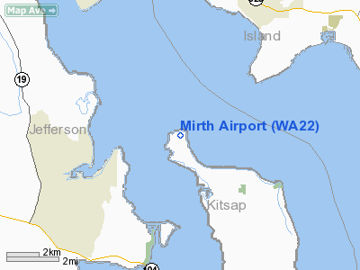
Location & QuickFacts
| FAA Information Effective: | 2008-09-25 |
| Airport Identifier: | WA22 |
| Airport Status: | Operational |
| Longitude/Latitude: | 122-36-29.0000W/47-56-19.0000N
-122.608056/47.938611 (Estimated) |
| Elevation: | 190 ft / 57.91 m (Estimated) |
| Land: | 40 acres |
| From nearest city: | 3 nautical miles NW of Hansville, WA |
| Location: | Kitsap County, WA |
| Magnetic Variation: | 19E (2000) |
Owner & Manager
| Ownership: | Privately owned |
| Owner: | Clark And Mary Crawford Trust |
| Address: | Pob 70
Hansville, WA 98340 |
| Phone number: | 360-638-2600 |
| Manager: | Clark Crawford |
| Address: | Pob 70
Hansville, WA 98340 |
| Phone number: | 360-638-2600 |
Airport Operations and Facilities
| Airport Use: | Private |
| Segmented Circle: | No |
| Control Tower: | No |
| Sectional chart: | Seattle |
| Region: | ANM - Northwest Mountain |
| Boundary ARTCC: | ZSE - Seattle |
| Tie-in FSS: | SEA - Seattle |
| FSS Toll Free: | 1-800-WX-BRIEF |
Runway Information
Runway 07/25
| Dimension: | 600 x 100 ft / 182.9 x 30.5 m |
| Surface: | TURF, |
| |
Runway 07 |
Runway 25 |
| Traffic Pattern: | Left | Right |
| Obstruction: | 60 ft trees, 300.0 ft from runway | 80 ft trees, 85.0 ft from runway |
|
Runway 17/35
| Dimension: | 800 x 60 ft / 243.8 x 18.3 m |
| Surface: | TURF, |
| |
Runway 17 |
Runway 35 |
| Traffic Pattern: | Right | Left |
| Obstruction: | 65 ft trees | 60 ft trees, 20.0 ft from runway |
|
Radio Navigation Aids
| ID |
Type |
Name |
Ch |
Freq |
Var |
Dist |
| PWT | NDB | Kitsap | | 206.00 | 20E | 27.5 nm |
| RNT | NDB | Renton | | 353.00 | 20E | 31.0 nm |
| BVS | NDB | Skagit/bay View | | 240.00 | 21E | 32.7 nm |
| CAN | NDB | Carney | | 274.00 | 20E | 33.1 nm |
| OPZ | NDB | Lopez Island | | 356.00 | 21E | 34.8 nm |
| ODD | NDB | Dondo | | 224.00 | 19E | 36.6 nm |
| FHR | NDB | Friday Harbor | | 284.00 | 20E | 39.2 nm |
| CL | NDB | Elwha | | 515.00 | 22E | 44.5 nm |
| MNC | NDB | Mason County | | 348.00 | 19E | 45.8 nm |
| GR | NDB | Graye | | 216.00 | 18E | 47.4 nm |
| NUW | TACAN | Whidbey Island | 085X | | 21E | 25.1 nm |
| PAE | VOR/DME | Paine | 043X | 110.60 | 20E | 13.3 nm |
| CVV | VOR/DME | Penn Cove | 119X | 117.20 | 19E | 19.0 nm |
| SEA | VORTAC | Seattle | 115X | 116.80 | 19E | 32.6 nm |
| TCM | VORTAC | Mcchord | 033X | 109.60 | 22E | 47.8 nm |
| BFI | VOT | Boeing Field | | 108.60 | | 27.6 nm |
| SEA | VOT | Seattle-tacoma | | 117.50 | | 32.2 nm |
Images and information placed above are from
http://www.airport-data.com/airport/WA22/
We thank them for the data!
| General Info
|
| Country |
United States
|
| State |
WASHINGTON
|
| FAA ID |
WA22
|
| Latitude |
47-56-19.000N
|
| Longitude |
122-36-29.000W
|
| Elevation |
190 feet
|
| Near City |
HANSVILLE
|
We don't guarantee the information is fresh and accurate. The data may
be wrong or outdated.
For more up-to-date information please refer to other sources.
|
|


