 |
|
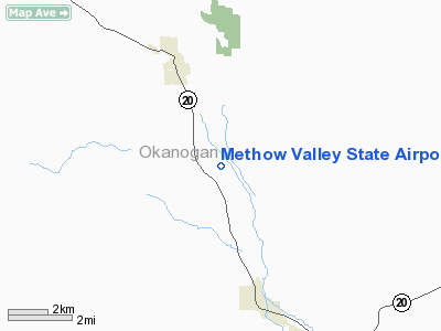
Methow Valley State Airport |
Location & QuickFacts
| FAA Information Effective: | 2008-09-25 |
| Airport Identifier: | S52 |
| Airport Status: | Operational |
| Longitude/Latitude: | 120-08-45.1880W/48-25-29.8140N
-120.145886/48.424948 (Estimated) |
| Elevation: | 1706 ft / 519.99 m (Estimated) |
| Land: | 65 acres |
| From nearest city: | 3 nautical miles SE of Winthrop, WA |
| Location: | Okanogan County, WA |
| Magnetic Variation: | 20E (1985) |
Owner & Manager
| Ownership: | Publicly owned |
| Owner: | Wsdot Aviation Division |
| Address: | 3704 172nd Street Ne, Suite K2, P.o. Box 3367
Arlington, WA 98223-6336 |
| Phone number: | 360-651-6300 |
| Manager: | Jim Scott |
| Address: | 3704 172nd Street Ne, Suite K2, P.o. Box 3367
Arlington, WA 98223-6336 |
| Phone number: | 360-651-6300 |
Airport Operations and Facilities
| Airport Use: | Open to public |
| Wind indicator: | Yes |
| Segmented Circle: | Yes |
| Control Tower: | No |
| Lighting Schedule: | RDO-CTL
ACTVT ROTG BCN - CTAF. |
| Beacon Color: | Clear-Green (lighted land airport) |
| Landing fee charge: | No |
| Sectional chart: | Seattle |
| Region: | ANM - Northwest Mountain |
| Boundary ARTCC: | ZSE - Seattle |
| Tie-in FSS: | SEA - Seattle |
| FSS on Airport: | No |
| FSS Toll Free: | 1-800-WX-BRIEF |
| NOTAMs Facility: | SEA (NOTAM-d service avaliable) |
| Federal Agreements: | NGSY |
Airport Communications
| CTAF: | 122.800 |
| Unicom: | 122.800 |
Airport Services
| Airframe Repair: | NONE |
| Power Plant Repair: | NONE |
| Bottled Oxygen: | NONE |
| Bulk Oxygen: | NONE |
Runway Information
Runway 13/31
| Dimension: | 5049 x 75 ft / 1538.9 x 22.9 m |
| Surface: | ASPH, Good Condition |
| Weight Limit: | Single wheel: 30000 lbs. |
| Edge Lights: | Medium |
| |
Runway 13 |
Runway 31 |
| Longitude: | 120-09-05.6440W | 120-08-24.7360W |
| Latitude: | 48-25-50.6750N | 48-25-08.9510N |
| Elevation: | 1694.00 ft | 0.00 ft |
| Traffic Pattern: | Left | Left |
| Markings: | Basic, Good Condition | Basic, Good Condition |
| Displaced threshold: | 129.00 ft | 231.00 ft |
| Obstruction: | 6 ft fence, 231.0 ft from runway, 46 ft right of centerline, 5:1 slope to clear
RWY 13 APCH SLOPE 0:1 TO +13' SERVICE ROAD @ 0', 92' R FROM DSPLCD THR.
+4' FENCE +10' TREES AT 50' FROM THR, ROAD AT 0'. | 12 ft road, 200.0 ft from runway
RWY 31 APCH SLOPE 34:1 TO DSPLCD +18 FT TREE 618 FT FM THLD, 33 FT LEFT.
ROAD 0' 125' L, ROAD 182', +5' STEEL POST AT 72', 80'L. |
|
Radio Navigation Aids
| ID |
Type |
Name |
Ch |
Freq |
Var |
Dist |
| OMK | NDB | Omak | | 219.00 | 19E | 25.1 nm |
Remarks
- MOUNTAINOUS TRRN SURROUNDS ARPT.
- SOME OBSTNS IN PRIMARY AND TRANSITIONAL SFCS.
- HEAVILY LOADED ACFT MAY BE MAKING STRAIGHT OUT DPTRS AND LONG FINAL APCH ALL DALGT HRS MAY-SEP.
Images and information placed above are from
http://www.airport-data.com/airport/S52/
We thank them for the data!
| General Info
|
| Country |
United States
|
| State |
WASHINGTON
|
| FAA ID |
S52
|
| Latitude |
48-25-14.400N
|
| Longitude |
120-08-49.200W
|
| Elevation |
1694 feet
|
| Near City |
WINTHROP
|
We don't guarantee the information is fresh and accurate. The data may
be wrong or outdated.
For more up-to-date information please refer to other sources.
|
|


