 |
|
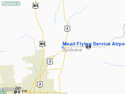
Mead Flying Service Airport |
Location & QuickFacts
| FAA Information Effective: | 2008-09-25 |
| Airport Identifier: | 70S |
| Airport Status: | Operational |
| Longitude/Latitude: | 117-21-29.4580W/47-47-13.8720N
-117.358183/47.787187 (Estimated) |
| Elevation: | 1905 ft / 580.64 m (Estimated) |
| Land: | 80 acres |
| From nearest city: | 1 nautical miles N of Mead, WA |
| Location: | Spokane County, WA |
| Magnetic Variation: | 19E (1985) |
Owner & Manager
| Ownership: | Privately owned |
| Owner: | Patricia Erickson |
| Address: | E 3507 Deer Road
Mead, WA 99021 |
| Phone number: | 509-466-3007 |
| Manager: | Patricia Erickson |
| Address: | E 3507 Deer Road
Mead, WA 99021 |
| Phone number: | 509-466-3007 |
Airport Operations and Facilities
| Airport Use: | Open to public |
| Wind indicator: | Yes |
| Segmented Circle: | Yes |
| Control Tower: | No |
| Landing fee charge: | No |
| Sectional chart: | Seattle |
| Region: | ANM - Northwest Mountain |
| Traffic Pattern Alt: | 600 ft |
| Boundary ARTCC: | ZSE - Seattle |
| Tie-in FSS: | SEA - Seattle |
| FSS on Airport: | No |
| FSS Toll Free: | 1-800-WX-BRIEF |
| NOTAMs Facility: | SEA (NOTAM-d service avaliable) |
Airport Communications
Airport Services
| Airframe Repair: | NONE |
| Power Plant Repair: | NONE |
| Bottled Oxygen: | NONE |
| Bulk Oxygen: | NONE |
Runway Information
Runway 16/34
| Dimension: | 2481 x 30 ft / 756.2 x 9.1 m |
| Surface: | ASPH, Good Condition |
| |
Runway 16 |
Runway 34 |
| Longitude: | 117-21-29.5800W | 117-21-29.3360W |
| Latitude: | 47-47-26.1140N | 47-47-01.6300N |
| Alignment: | 127 | 127 |
| Traffic Pattern: | Left | Left |
| Markings: | Basic, Good Condition | Basic, Good Condition |
| Obstruction: | 80 ft trees, 753.0 ft from runway, 175L/ ft right of centerline, 6:1 slope to clear | 69 ft trees, 546.0 ft from runway, 142 ft left of centerline, 5:1 slope to clear
+3 FT FENCE AT 69 FT, ROAD AND GATE AT 74 FT. |
|
Radio Navigation Aids
| ID |
Type |
Name |
Ch |
Freq |
Var |
Dist |
| SFF | NDB | Felts | | 365.00 | 19E | 6.4 nm |
| DPY | NDB | Deer Park | | 216.00 | 19E | 11.2 nm |
| SZT | NDB | Sandpoe | | 264.00 | 20E | 44.0 nm |
| SKA | TACAN | Fairchild | 051X | | 19E | 16.2 nm |
| COE | VOR/DME | Coeur D'alene | 025X | 108.80 | 19E | 21.7 nm |
| GEG | VORTAC | Spokane | 102X | 115.50 | 21E | 17.2 nm |
| SFF | VOT | Spokane/felts Field | | 114.00 | | 6.6 nm |
| GEG | VOT | Spokane Intl | | 109.60 | | 12.3 nm |
Remarks
- NO WINT MAINT.
- GND SOFT DURG SPRING.
- ESTABD PRIOR TO 15 MAY 1959.
Images and information placed above are from
http://www.airport-data.com/airport/70S/
We thank them for the data!
| General Info
|
| Country |
United States
|
| State |
WASHINGTON
|
| FAA ID |
70S
|
| Latitude |
47-47-29.614N
|
| Longitude |
117-21-03.780W
|
| Elevation |
1900 feet
|
| Near City |
MEAD
|
We don't guarantee the information is fresh and accurate. The data may
be wrong or outdated.
For more up-to-date information please refer to other sources.
|
|


