 |
|
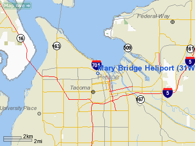
Location & QuickFacts
| FAA Information Effective: | 2008-09-25 |
| Airport Identifier: | 31WA |
| Airport Status: | Operational |
| Longitude/Latitude: | 122-27-14.0000W/47-15-42.0000N
-122.453889/47.261667 (Estimated) |
| Elevation: | 409 ft / 124.66 m (Estimated) |
| Land: | 0 acres |
| From nearest city: | 0 nautical miles N of Tacoma, WA |
| Location: | Pierce County, WA |
| Magnetic Variation: | 19E (1995) |
Owner & Manager
| Ownership: | Privately owned |
| Owner: | Multicare Health Systems |
| Address: | 315 Martin Luther King Jr Way
Tacoma, WA 98405 |
| Phone number: | 206-552-1246
OWNER ADDNL PHONE 206-552-1000. |
| Manager: | Fred Russell |
| Address: | 402 South J Street
Tacoma, WA 98405 |
| Phone number: | 206-552-1243 |
Airport Operations and Facilities
| Airport Use: | Private
MEDICAL USE. |
| Segmented Circle: | No |
| Control Tower: | No |
| Lighting Schedule: | RDO-CTL
ACTIVATE PERIMETER LGTS - UNICOM. |
| Sectional chart: | Seattle |
| Region: | ANM - Northwest Mountain |
| Boundary ARTCC: | ZSE - Seattle |
| Tie-in FSS: | SEA - Seattle |
| FSS on Airport: | No |
| FSS Toll Free: | 1-800-WX-BRIEF |
Airport Communications
Runway Information
Helipad H1
| Dimension: | 40 x 40 ft / 12.2 x 12.2 m |
| Surface: | MATS, |
| Edge Lights: | Low
PERIMETER LGTS. |
| |
Runway H1 |
Runway |
| Traffic Pattern: | Left | Left |
|
Radio Navigation Aids
| ID |
Type |
Name |
Ch |
Freq |
Var |
Dist |
| ODD | NDB | Dondo | | 224.00 | 19E | 8.5 nm |
| GR | NDB | Graye | | 216.00 | 18E | 9.1 nm |
| LAC | NDB | Lacomas | | 328.00 | 18E | 15.8 nm |
| RNT | NDB | Renton | | 353.00 | 20E | 17.1 nm |
| CAN | NDB | Carney | | 274.00 | 20E | 18.1 nm |
| PWT | NDB | Kitsap | | 206.00 | 20E | 18.5 nm |
| MNC | NDB | Mason County | | 348.00 | 19E | 25.8 nm |
| TDO | NDB | Toledo | | 219.00 | 20E | 49.5 nm |
| PAE | VOR/DME | Paine | 043X | 110.60 | 20E | 40.2 nm |
| TCM | VORTAC | Mcchord | 033X | 109.60 | 22E | 6.9 nm |
| SEA | VORTAC | Seattle | 115X | 116.80 | 19E | 12.0 nm |
| OLM | VORTAC | Olympia | 081X | 113.40 | 19E | 25.3 nm |
| SEA | VOT | Seattle-tacoma | | 117.50 | | 12.5 nm |
| BFI | VOT | Boeing Field | | 108.60 | | 17.1 nm |
Remarks
Images and information placed above are from
http://www.airport-data.com/airport/31WA/
We thank them for the data!
| General Info
|
| Country |
United States
|
| State |
WASHINGTON
|
| FAA ID |
31WA
|
| Latitude |
47-15-42.000N
|
| Longitude |
122-27-14.000W
|
| Elevation |
409 feet
|
| Near City |
TACOMA
|
We don't guarantee the information is fresh and accurate. The data may
be wrong or outdated.
For more up-to-date information please refer to other sources.
|
|


