 |
|
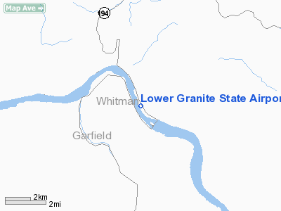
Lower Granite State Airport |
Location & QuickFacts
| FAA Information Effective: | 2008-09-25 |
| Airport Identifier: | 00W |
| Airport Status: | Operational |
| Longitude/Latitude: | 117-26-33.6620W/46-40-24.5720N
-117.442684/46.673492 (Estimated) |
| Elevation: | 719 ft / 219.15 m (Estimated) |
| Land: | 0 acres |
| From nearest city: | 12 nautical miles S of Colfax, WA |
| Location: | Whitman County, WA |
| Magnetic Variation: | 19E (1985) |
Owner & Manager
| Ownership: | Publicly owned |
| Owner: | Wsdot Aviation Division |
| Address: | 3704 172nd Street Ne, Suite K2, Box 3367
Arlington, WA 98223-3663 |
| Phone number: | 360-651-6300 |
| Manager: | Wsdot Aviation Division |
| Address: | 3704 172nd Street Ne, Suite K2, Box 3367
Arlington, WA 98223-3663 |
| Phone number: | 800-552-0666 |
Airport Operations and Facilities
| Airport Use: | Open to public |
| Wind indicator: | Yes |
| Segmented Circle: | No |
| Control Tower: | No |
| Landing fee charge: | No |
| Sectional chart: | Seattle |
| Region: | ANM - Northwest Mountain |
| Boundary ARTCC: | ZSE - Seattle |
| Tie-in FSS: | SEA - Seattle |
| FSS on Airport: | No |
| FSS Toll Free: | 1-800-WX-BRIEF |
| NOTAMs Facility: | SEA (NOTAM-d service avaliable) |
Airport Communications
Airport Services
| Airframe Repair: | NONE |
| Power Plant Repair: | NONE |
| Bottled Oxygen: | NONE |
| Bulk Oxygen: | NONE |
Runway Information
Runway 14/32
| Dimension: | 3400 x 50 ft / 1036.3 x 15.2 m |
| Surface: | GRAVEL, Fair Condition
ROCK SURFACE RWY ROUGH. |
| |
Runway 14 |
Runway 32 |
| Traffic Pattern: | Left | Left |
| Obstruction: | 50 ft trees, 845.0 ft from runway, 10 ft left of centerline, 16:1 slope to clear | 2 ft hill, 70.0 ft from runway, 50 ft right of centerline, 35:1 slope to clear |
|
Radio Navigation Aids
| ID |
Type |
Name |
Ch |
Freq |
Var |
Dist |
| PUW | VOR/DME | Pullman | 027X | 109.00 | 20E | 9.0 nm |
| MQG | VOR/DME | Nez Perce | 019X | 108.20 | 20E | 29.5 nm |
| ALW | VOR/DME | Walla Walla | 111X | 116.40 | 20E | 49.8 nm |
Remarks
- ARPT CLSD 1 OCT - 1 JUN.
- CTC WASHINGTON STATE DIVISION OF AERONAUTICS 360-651-6300 OR 800-552-0666 FOR FACILITY INFORMATION PRIOR TO USE.
- WATCH FOR PEDESTRIANS, VEHICLES, AND ANIMALS ON RY.
- STEEP CANYON WALLS BOTH SIDES OF ARPT.
- STRONG GUSTY WINDS POSSIBLE INSIDE CANYON.
- DENSITY ALT.
- PVDD ALL TFC PATS ARE ESTABLISHED ON THE NE SIDE OF THE ARPT DUE TO HIGH TERRAIN TO THE WEST.
Images and information placed above are from
http://www.airport-data.com/airport/00W/
We thank them for the data!
| General Info
|
| Country |
United States
|
| State |
WASHINGTON
|
| FAA ID |
00W
|
| Latitude |
46-40-24.572N
|
| Longitude |
117-26-33.662W
|
| Elevation |
719 feet
|
| Near City |
COLFAX
|
We don't guarantee the information is fresh and accurate. The data may
be wrong or outdated.
For more up-to-date information please refer to other sources.
|
|


